Grant Township, Vermilion County, Illinois
| Grant Township | |
|---|---|
| Township | |
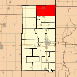 Location in Vermilion County | |
| Coordinates: 40°26′51″N 87°38′45″W / 40.44750°N 87.64583°WCoordinates: 40°26′51″N 87°38′45″W / 40.44750°N 87.64583°W | |
| Country | United States |
| State | Illinois |
| County | Vermilion |
| Created | 1862 |
| Area | |
| • Total | 86.69 sq mi (224.5 km2) |
| • Land | 86.66 sq mi (224.4 km2) |
| • Water | 0.03 sq mi (0.08 km2) 0.03% |
| Elevation | 696 ft (212 m) |
| Population (2010) | |
| • Total | 6,028 |
| • Density | 69.6/sq mi (26.9/km2) |
| Time zone | CST (UTC-6) |
| • Summer (DST) | CDT (UTC-5) |
| GNIS feature ID | 0429072 |
Grant Township is a township in Vermilion County, Illinois, USA. As of the 2010 census, its population was 6,028 and it contained 2,817 housing units.[1]
History
Grant Township was originally called Lyon Township but it was changed in 1862 to honor Ulysses S. Grant. He had just won a surrender by Confederate forces at Fort Donelson in Tennessee.[2]
Geography
According to the 2010 census, the township has a total area of 86.69 square miles (224.5 km2), of which 86.66 square miles (224.4 km2) (or 99.97%) is land and 0.03 square miles (0.078 km2) (or 0.03%) is water.[1]
Cities and towns
Unincorporated towns
Extinct towns
- Coalton
- Heaton
Adjacent townships
- Hickory Grove Township, Benton County, Indiana (northeast)
- Prairie Green Township, Iroquois County (northeast)
- Prairie Township, Warren County, Indiana (east)
- Jordan Township, Warren County, Indiana (southeast)
- Ross Township (south)
- Butler Township (west)
- Fountain Creek Township, Iroquois County (northwest)
- Lovejoy Township, Iroquois County (northwest)
Cemeteries
The township contains one cemetery, Redtop.
Major highways
Airports and landing strips
- Beckley Airfield
- Hoopeston Community Memorial Hospital Heliport
References
- 1 2 "Population, Housing Units, Area, and Density: 2010 - County -- County Subdivision and Place -- 2010 Census Summary File 1". United States Census. Retrieved 2013-05-28.
- ↑ Callary, Edmund (2009). Place Names of Illinois. Urbana: University of Illinois Press. p. 144. ISBN 978-0-252-03356-8.
External links
Municipalities and communities of Vermilion County, Illinois, United States | ||
|---|---|---|
| Cities | ||
| Villages | ||
| Townships | ||
| CDP | ||
| Other unincorporated communities | ||
| Footnotes | ‡This populated place also has portions in an adjacent county or counties | |
This article is issued from Wikipedia - version of the 12/28/2015. The text is available under the Creative Commons Attribution/Share Alike but additional terms may apply for the media files.