Great Barrier Aerodrome
| Great Barrier Aerodrome | |||||||||||||||
|---|---|---|---|---|---|---|---|---|---|---|---|---|---|---|---|
|
Aircraft at the aerodrome | |||||||||||||||
| IATA: GBZ – ICAO: NZGB | |||||||||||||||
| Summary | |||||||||||||||
| Airport type | Public | ||||||||||||||
| Operator | Auckland Council | ||||||||||||||
| Location | Claris, Great Barrier Island | ||||||||||||||
| Elevation AMSL | 21 ft / 6 m | ||||||||||||||
| Coordinates | 36°14′29″S 175°28′19″E / 36.24139°S 175.47194°ECoordinates: 36°14′29″S 175°28′19″E / 36.24139°S 175.47194°E | ||||||||||||||
| Map | |||||||||||||||
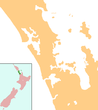 GBZ Location of the Great Barrier Aerodrome | |||||||||||||||
| Runways | |||||||||||||||
| |||||||||||||||
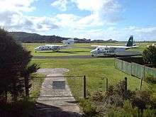

Great Barrier Airfield from the northeast.
Great Barrier Aerodrome (IATA: GBZ, ICAO: NZGB) is the major airfield of the three on Great Barrier Island. It is a small, uncontrolled aerodrome 1 nautical mile (1.9 km) north-east of Claris on Great Barrier Island in the Hauraki Gulf off the North Island of New Zealand. Fuel is not available.
The town of Claris is a short walk to the north east, and there are rental car and bicycle hire services available at the airport. Landing fees were previously payable at Council offices, but are now billed direct to aircraft operators.
Airlines and destinations
| Airlines | Destinations |
|---|---|
| Barrier Air | Auckland, North Shore, Okiwi, Tauranga, Whangarei, Whitianga[1] |
| Flight Hauraki | Ardmore, Waiheke [2] |
| Fly My Sky | Auckland, Okiwi |
| Sunair | Ardmore,[3] Hamilton, Tauranga, Whitianga |
See also
References
- ↑ Archived 3 December 2013 at the Wayback Machine.
- ↑ "Island Hopper Service". Flight Hauraki. Retrieved 24 June 2015.
- ↑ "Great Barrier Island Flights". Sunair.co.nz. 2014-12-01. Retrieved 2015-09-20.
External links
- Great Barrier Airlines
- Fly My Sky
- NZAIP Volume 4 AD
- New Zealand AIP (PDF)
Airports in the Auckland Region | ||
|---|---|---|
| Existing | ||
| Former | ||
This article is issued from Wikipedia - version of the 11/27/2016. The text is available under the Creative Commons Attribution/Share Alike but additional terms may apply for the media files.