Great Bend, North Dakota
| Great Bend, North Dakota | |
|---|---|
| City | |
|
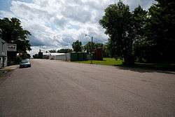
Street in Great Bend | |
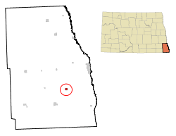 Location of Great Bend, North Dakota | |
| Coordinates: 46°9′12″N 96°48′11″W / 46.15333°N 96.80306°WCoordinates: 46°9′12″N 96°48′11″W / 46.15333°N 96.80306°W | |
| Country | United States |
| State | North Dakota |
| County | Richland |
| Founded | 1888 |
| Incorporated (village) | 1908 |
| Incorporated (city) | 1967 |
| Named for | Bend in the Wild Rice River |
| Area[1] | |
| • Total | 0.55 sq mi (1.42 km2) |
| • Land | 0.55 sq mi (1.42 km2) |
| • Water | 0 sq mi (0 km2) |
| Elevation | 974 ft (297 m) |
| Population (2010)[2] | |
| • Total | 60 |
| • Estimate (2014)[3] | 59 |
| • Density | 109.1/sq mi (42.1/km2) |
| Time zone | Central (CST) (UTC-6) |
| • Summer (DST) | CDT (UTC-5) |
| ZIP code | 58075 |
| Area code(s) | 701 |
| FIPS code | 38-32900 |
| GNIS feature ID | 1029232[4] |
Great Bend is a city in Richland County, North Dakota, United States. It sits on the banks of the Wild Rice River. The population was 60 at the 2010 census.[5] Great Bend was founded in 1888, and incorporated as a village in 1908.[6] It is part of the Wahpeton, ND–MN Micropolitan Statistical Area.
History
Great Bend was founded in 1888 on land homesteaded by George Worner (1855 – 1950).[7] He was born in Germany and moved to Brandenburg Township in 1874 when his family moved there from Wisconsin.[8] In 1875, Worner established a rural post office on his land near here, and named it Berlin in honor of the German capital.[7][9] The post office was later moved in 1882 to a site closer to Great Bend and was disbanded on July 12, 1883.[7][10] Worner was instrumental in the town's founding and development,[11] serving as one of the first station agents for the Northern Pacific Railroad, operated the first general store, and served as one of the town's first postmasters.[8] He later served in the North Dakota House of Representatives.[12]
Geography
Great Bend is located at 46°9′12″N 96°48′11″W / 46.15333°N 96.80306°W (46.153413, -96.803000).[13]
According to the United States Census Bureau, the city has a total area of 0.55 square miles (1.42 km2), all of it land.[1]
Demographics
| Historical population | |||
|---|---|---|---|
| Census | Pop. | %± | |
| 1910 | 191 | — | |
| 1920 | 142 | −25.7% | |
| 1930 | 169 | 19.0% | |
| 1940 | 198 | 17.2% | |
| 1950 | 169 | −14.6% | |
| 1960 | 164 | −3.0% | |
| 1970 | 86 | −47.6% | |
| 1980 | 113 | 31.4% | |
| 1990 | 108 | −4.4% | |
| 2000 | 118 | 9.3% | |
| 2010 | 60 | −49.2% | |
| Est. 2015 | 59 | [14] | −1.7% |
| U.S. Decennial Census[15] 2014 Estimate[3] | |||
2010 census
As of the census[2] of 2010, there were 60 people, 29 households, and 17 families residing in the city. The population density was 109.1 inhabitants per square mile (42.1/km2). There were 38 housing units at an average density of 69.1 per square mile (26.7/km2). The racial makeup of the city was 100.0% White.
There were 29 households of which 17.2% had children under the age of 18 living with them, 51.7% were married couples living together, 3.4% had a female householder with no husband present, 3.4% had a male householder with no wife present, and 41.4% were non-families. 34.5% of all households were made up of individuals and 13.7% had someone living alone who was 65 years of age or older. The average household size was 2.07 and the average family size was 2.53.
The median age in the city was 52.5 years. 18.3% of residents were under the age of 18; 1.7% were between the ages of 18 and 24; 21.6% were from 25 to 44; 38.3% were from 45 to 64; and 20% were 65 years of age or older. The gender makeup of the city was 50.0% male and 50.0% female.
2000 census
As of the 2000 Census, there were 118 people, 40 households, and 33 families residing in the city. The population density was 207.6 people per square mile (79.9/km²). There were 42 housing units at an average density of 73.9 per square mile (28.4/km²). The racial makeup of the city was 100.00% White.
There were 40 households out of which 42.5% had children under the age of 18 living with them, 72.5% were married couples living together, 5.0% had a female householder with no husband present, and 17.5% were non-families. 17.5% of all households were made up of individuals and 2.5% had someone living alone who was 65 years of age or older. The average household size was 2.95 and the average family size was 3.33.
In the city the population was spread out with 32.2% under the age of 18, 7.6% from 18 to 24, 28.0% from 25 to 44, 16.9% from 45 to 64, and 15.3% who were 65 years of age or older. The median age was 36 years. For every 100 females there were 114.5 males. For every 100 females age 18 and over, there were 122.2 males.
The median income for a household in the city was $63,333, and the median income for a family was $66,250. Males had a median income of $31,786 versus $33,750 for females. The per capita income for the city was $18,723. None of the population and none of the families were below the poverty line.
Notable people
- George Worner (1855 – 1950), town founder, state Congressman (1925 – 1932)[7][8][11]
References
- 1 2 "US Gazetteer files 2010". United States Census Bureau. Retrieved 2012-06-14.
- 1 2 "American FactFinder". United States Census Bureau. Retrieved 2012-06-14.
- 1 2 "Population Estimates". United States Census Bureau. Retrieved June 2, 2015.
- ↑ "US Board on Geographic Names". United States Geological Survey. 2007-10-25. Retrieved 2008-01-31.
- ↑ "2010 Census Redistricting Data (Public Law 94-171) Summary File". American FactFinder. United States Census Bureau. Retrieved 2 May 2011.
- ↑ North Dakota Secretary of State (1989). North Dakota Centennial Blue Book. Bismarck, ND: North Dakota Legislative Assembly. p. 506.
- 1 2 3 4 Wick, Douglas A. (1988). North Dakota Place Names. Bismarck, North Dakota: Hedemarken Collectibles. ISBN 0-9620968-0-6. OCLC 191277027.
- 1 2 3 A History of Richland County. Wahpeton, ND: Richland County Historical Society. 1977. p. 295 & 298. OCLC 3273577.
- ↑ "Berlin, North Dakota (historical)". Geographic Names Information System. United States Geological Survey.
- ↑ Patera, Alan H.; John S. Gallagher (1982). North Dakota Post Offices, 1850-1982. Burtonsville, Maryland: The Depot. pp. 117–119. OCLC 09763647.
- 1 2 Williams, Mary Ann (Barnes) (1966). Origins of North Dakota Place Names. Bismarck, North Dakota: Bismarck Tribune. OCLC 431626.
- ↑ "Dakota Lawmakers" (PDF). North Dakota Legislative Council. Retrieved 2010-08-03.
- ↑ "US Gazetteer files: 2010, 2000, and 1990". United States Census Bureau. 2011-02-12. Retrieved 2011-04-23.
- ↑ "Annual Estimates of the Resident Population for Incorporated Places: April 1, 2010 to July 1, 2015". Retrieved July 2, 2016.
- ↑ United States Census Bureau. "Census of Population and Housing". Retrieved October 31, 2013.
Municipalities and communities of Richland County, North Dakota, United States | ||
|---|---|---|
| Cities |  | |
| Townships |
| |
| Unincorporated communities |
| |
| Indian reservations | ||
| Footnotes | ‡This populated place also has portions in an adjacent county or counties | |