Greenwich, Utah
| Greenwich | |
|---|---|
| Unincorporated community | |
 Greenwich Location within the state of Utah | |
| Coordinates: 38°25′52″N 111°55′23″W / 38.43111°N 111.92306°WCoordinates: 38°25′52″N 111°55′23″W / 38.43111°N 111.92306°W | |
| Country | United States |
| State | Utah |
| County | Piute |
| Elevation | 6,854 ft (2,089 m) |
| Time zone | Mountain (MST) (UTC-7) |
| • Summer (DST) | MDT (UTC-6) |
| ZIP codes | 84732 |
| GNIS feature ID | 1437572[1] |
| Historical population | |||
|---|---|---|---|
| Census | Pop. | %± | |
| 1880 | 514 | — | |
| 1890 | 181 | −64.8% | |
| 1910 | 113 | — | |
| 1920 | 217 | 92.0% | |
| 1930 | 139 | −35.9% | |
| 1940 | 120 | −13.7% | |
| 1950 | 138 | 15.0% | |
| Source: U.S. Census Bureau[2] | |||
Greenwich is an unincorporated community in northeastern Piute County, Utah, United States, just east of the Fishlake National Forest. It lies along State Route 62 northeast of the town of Junction, the county seat of Piute County.[3] Its elevation is 6,854 feet (2,089 m).[1] Although Greenwich is unincorporated, it has a post office, with the ZIP code of 84732.[4] Greenwich is said to be an anglicized form of a Native American name.[5]
Climate
This climatic region is typified by large seasonal temperature differences, with warm to hot (and often humid) summers and cold (sometimes severely cold) winters. According to the Köppen Climate Classification system, Greenwich has a humid continental climate, abbreviated "Dfb" on climate maps.[6]
References
- 1 2 "Greenwich, Utah". Geographic Names Information System. United States Geological Survey. Retrieved 2008-04-12.
- ↑ "Census of Population and Housing". U.S. Census Bureau. Retrieved November 4, 2011.
- ↑ Rand McNally. The Road Atlas '08. Chicago: Rand McNally, 2008, p. 102.
- ↑ Zip Code Lookup
- ↑ Van Cott, John W. (1990). Utah Place Names. Salt Lake City, Utah: University of Utah Press. p. 168. ISBN 0-87480-345-4.
- ↑ Climate Summary for Greenwich, Utah
Municipalities and communities of Piute County, Utah, United States | ||
|---|---|---|
| Towns | 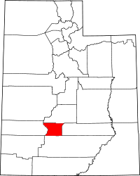 | |
| Unincorporated communities | ||
| Ghost towns | ||