Gridley, California
| City of Gridley | |
|---|---|
| City | |
|
Magnolia Street, off U.S. Route 99. | |
| Motto: "A small town that loves company"[1] | |
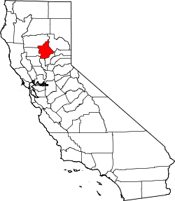
 Location in Butte County and the state of California | |
 City of Gridley Location in the United States | |
| Coordinates: 39°21′50″N 121°41′37″W / 39.36389°N 121.69361°WCoordinates: 39°21′50″N 121°41′37″W / 39.36389°N 121.69361°W | |
| Country |
|
| State |
|
| County | Butte |
| Incorporated | November 23, 1905[2] |
| Named for | George W. Gridley |
| Government | |
| • State Senator | Jim Nielsen (R)[3] |
| • CA Assembly | James Gallagher (R)[4] |
| • US Rep. | Doug LaMalfa (R)[5] |
| Area[6] | |
| • Total | 2.071 sq mi (5.364 km2) |
| • Land | 2.071 sq mi (5.364 km2) |
| • Water | 0 sq mi (0 km2) 0% |
| Elevation[7] | 95 ft (29 m) |
| Population (April 1, 2010)[8] | |
| • Total | 6,584 |
| • Estimate (2013)[8] | 6,561 |
| • Density | 3,200/sq mi (1,200/km2) |
| Time zone | Pacific (UTC-8) |
| • Summer (DST) | PDT (UTC-7) |
| ZIP code | 95948 |
| Area code | 530 |
| FIPS code | 06-31260 |
| GNIS feature IDs | 277526, 2410665 |
| Website |
www |

Gridley is a city in Butte County, California, United States. The estimated 2013 population was 6,561,[8] up from 5,382 in 2000.
History
The town of Gridley was named after its founder and earliest landowner, George W. Gridley. He was born in the state of New York and later moved with his parents to Galena, Illinois. In 1850 (1850 census shows him living in Sacramento without his family), he attempted to drive sheep and cattle across the plains to California. He lost the animals, but arrived safely himself and settled in this area.
As early as 1852, he was prospering in the stock business, and with ten thousand dollars profit, he returned to Illinois. Again he started back to California with a large herd of sheep. This time, six hundred survived. That was enough to give George Gridley his start in the sheep raising business. He prospered in this venture, and his home ranch consisted of some 960 acres (3.9 km2) located West of Gridley. He married Helen Orcutt in 1846 in Illinois, and she joined him in California in 1855. The Gridleys had ten children. Mr. Gridley died at the home ranch on 9 March 1881, Mrs. Gridley twenty years later, 1 August 1901. Descendants of the Gridley family are still living in the area today.
With the decline of mining, agriculture became a more stable and attractive business in the 1860s. The Central Pacific Railroad laid tracks from Oregon to Chico in 1865. The railroad completed its path to Gridley in 1870, and that is when the community of Gridley began to form. The principal products from the Gridley area were wool and sheep. Orchards, field crops, and cattle would soon follow. In 1896, the Libby, McNeil & Libby Cannery was established and became one of the largest peach canning operations in the world. However it stopped operation in 2001 and is still out of operation.
The first home and store in Gridley were built by L.C. Stone in 1874. Stone served as postmaster, the train depot and express agent, as well as a merchant. Wells Fargo & Co. opened its office in 1871 and soon other businesses followed suit.
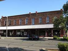
Two large fires, one in 1884 and one in 1891, destroyed much of the original business district. The district rallied and rebuilt around 1900.
Much of the historic downtown district remains. "Silk Stocking Row" the many well-preserved turn-of-the-century homes on Hazel Street, was so named because during the Depression the only women who could afford silk stockings lived in these large Hazel Street homes.
The post office at Martinsburgh was moved to Gridley in 1870.[9]
Geography
According to the United States Census Bureau, the city has a total area of 2.1 square miles (5.4 km2), all land.
Butte County geographer, Steve Herman, released the locally-popular "My Baby's Gone to Gridley," as a B-side to the 45rpm "This Is Oroville" in 1987. The tune can be downloaded:
Climate
According to the Köppen Climate Classification system, Gridley has a warm-summer Mediterranean climate, abbreviated "Csa" on climate maps.[10]
| Climate data for Gridley | |||||||||||||
|---|---|---|---|---|---|---|---|---|---|---|---|---|---|
| Month | Jan | Feb | Mar | Apr | May | Jun | Jul | Aug | Sep | Oct | Nov | Dec | Year |
| Record high °F (°C) | 70 (21) |
78 (26) |
84 (29) |
95 (35) |
106 (41) |
108 (42) |
113 (45) |
113 (45) |
112 (44) |
101 (38) |
84 (29) |
72 (22) |
113 (45) |
| Average high °F (°C) | 52 (11) |
59 (15) |
63.2 (17.3) |
73.4 (23) |
80.6 (27) |
88 (31) |
96 (36) |
93.5 (34.2) |
89.8 (32.1) |
77.5 (25.3) |
63.4 (17.4) |
54.1 (12.3) |
74.2 (23.4) |
| Average low °F (°C) | 34.8 (1.6) |
37.9 (3.3) |
41.6 (5.3) |
46.3 (7.9) |
52.4 (11.3) |
57.1 (13.9) |
60.9 (16.1) |
58.4 (14.7) |
55.7 (13.2) |
48.3 (9.1) |
40.1 (4.5) |
37.5 (3.1) |
47.6 (8.7) |
| Record low °F (°C) | 19 (−7) |
24 (−4) |
26 (−3) |
28 (−2) |
36 (2) |
42 (6) |
48 (9) |
48 (9) |
42 (6) |
28 (−2) |
20 (−7) |
22 (−6) |
19 (−7) |
| Average precipitation inches (mm) | 5.07 (128.8) |
3.05 (77.5) |
2.62 (66.5) |
1.04 (26.4) |
0.86 (21.8) |
0.26 (6.6) |
0.03 (0.8) |
0.02 (0.5) |
0.36 (9.1) |
0.89 (22.6) |
2.25 (57.2) |
3.72 (94.5) |
20.19 (512.8) |
| Average snowfall inches (cm) | 0.4 (1) |
0.1 (0.3) |
0 (0) |
0 (0) |
0 (0) |
0 (0) |
0 (0) |
0 (0) |
0 (0) |
0 (0) |
0 (0) |
0 (0) |
0.5 (1.3) |
| Average precipitation days (≥ 0.01 inch) | 12 | 9 | 9 | 4 | 4 | 2 | 0 | 0 | 1 | 4 | 6 | 10 | 61 |
| Source: [11] | |||||||||||||
Demographics
| Historical population | |||
|---|---|---|---|
| Census | Pop. | %± | |
| 1880 | 352 | — | |
| 1890 | 686 | 94.9% | |
| 1910 | 987 | — | |
| 1920 | 1,636 | 65.8% | |
| 1930 | 1,941 | 18.6% | |
| 1940 | 2,338 | 20.5% | |
| 1950 | 3,054 | 30.6% | |
| 1960 | 3,343 | 9.5% | |
| 1970 | 3,534 | 5.7% | |
| 1980 | 3,982 | 12.7% | |
| 1990 | 4,631 | 16.3% | |
| 2000 | 5,382 | 16.2% | |
| 2010 | 6,584 | 22.3% | |
| Est. 2015 | 6,582 | [12] | 0.0% |
2010
The 2010 United States Census[14] reported that Gridley had a population of 6,584. The population density was 3,179.1 people per square mile (1,227.4/km²). The racial makeup of Gridley was 4,283 (65.1%) White, 55 (0.8%) African American, 98 (1.5%) Native American, 249 (3.8%) Asian, 3 (0.0%) Pacific Islander, 1,552 (23.6%) from other races, and 344 (5.2%) from two or more races. Hispanic or Latino of any race were 3,000 persons (45.6%).
The Census reported that 6,472 people (98.3% of the population) lived in households, 16 (0.2%) lived in non-institutionalized group quarters, and 96 (1.5%) were institutionalized.
There were 2,183 households, out of which 910 (41.7%) had children under the age of 18 living in them, 1,087 (49.8%) were opposite-sex married couples living together, 338 (15.5%) had a female householder with no husband present, 134 (6.1%) had a male householder with no wife present. There were 149 (6.8%) unmarried opposite-sex partnerships, and 8 (0.4%) same-sex married couples or partnerships. 520 households (23.8%) were made up of individuals and 297 (13.6%) had someone living alone who was 65 years of age or older. The average household size was 2.96. There were 1,559 families (71.4% of all households); the average family size was 3.54.
The population was spread out with 1,892 people (28.7%) under the age of 18, 668 people (10.1%) aged 18 to 24, 1,681 people (25.5%) aged 25 to 44, 1,415 people (21.5%) aged 45 to 64, and 928 people (14.1%) who were 65 years of age or older. The median age was 33.1 years. For every 100 females there were 94.3 males. For every 100 females age 18 and over, there were 91.6 males.
There were 2,406 housing units at an average density of 1,161.7 per square mile (448.5/km²), of which 1,262 (57.8%) were owner-occupied, and 921 (42.2%) were occupied by renters. The homeowner vacancy rate was 2.6%; the rental vacancy rate was 6.5%. 3,829 people (58.2% of the population) lived in owner-occupied housing units and 2,643 people (40.1%) lived in rental housing units.
2000
As of the census[15] of 2000, there were 5,382 people, 1,841 households, and 1,266 families residing in the city. The population density was 3,427.6 people per square mile (1,323.6/km²). There were 1,963 housing units at an average density of 1,250.2 per square mile (482.8/km²). The racial makeup of the city was 66.57% White, 0.32% Black or African American, 1.54% Native American, 3.47% Asian, 0.02% Pacific Islander, 24.06% from other races, and 4.01% from two or more races. 38.63% of the population were Hispanic or Latino of any race.
There were 1,841 households out of which 36.7% had children under the age of 18 living with them, 48.0% were married couples living together, 15.3% had a female householder with no husband present, and 31.2% were non-families. 26.5% of all households were made up of individuals and 15.1% had someone living alone who was 65 years of age or older. The average household size was 2.86 and the average family size was 3.48.
In the city the population was spread out with 30.1% under the age of 18, 10.0% from 18 to 24, 25.3% from 25 to 44, 18.6% from 45 to 64, and 15.9% who were 65 years of age or older. The median age was 33 years. For every 100 females there were 91.3 males. For every 100 females age 18 and over, there were 86.2 males.
The median income for a household in the city was $24,368, and the median income for a family was $29,957. Males had a median income of $28,347 versus $24,444 for females. The per capita income for the city was $12,267. About 19.5% of families and 23.3% of the population were below the poverty line, including 34.8% of those under age 18 and 5.8% of those age 65 or over.
Infrastructure
Healthcare
The State of California, Office of Statewide Health Planning and Development defines Biggs-Gridley Memorial Hospital as a General Acute Care Hospital in Gridley with a Level IV Trauma Center and Standby emergency care as of 22 August 2006. The facility is located at (NAD83) latitude/longitude of 39°22′03″N 121°41′22″W / 39.36750°N 121.68944°W.
Notable people
- G. Vernon Bennett, Los Angeles City Council member, 1935–49
- Isaac Austin, retired NBA basketball player, 1991-2004
- Wally Westlake, MLB All-Star baseball player
References
- ↑ "Official Website of Gridley, California". Official Website of Gridley, California. Retrieved September 6, 2012.
- ↑ "California Cities by Incorporation Date" (Word). California Association of Local Agency Formation Commissions. Retrieved March 27, 2013.
- ↑ "Senators". State of California. Retrieved March 20, 2013.
- ↑ "Members Assembly". State of California. Retrieved March 20, 2013.
- ↑ "California's 1st Congressional District - Representatives & District Map". Civic Impulse, LLC. Retrieved March 1, 2013.
- ↑ "2010 Census U.S. Gazetteer Files – Places – California". United States Census Bureau.
- ↑ "Gridley". Geographic Names Information System. United States Geological Survey. Retrieved May 27, 2015.
- 1 2 3 "Gridley (city) QuickFacts". United States Census Bureau. Retrieved May 27, 2015.
- ↑ Durham, David L. (1998). California's Geographic Names: A Gazetteer of Historic and Modern Names of the State. Clovis, Calif.: Word Dancer Press. p. 244. ISBN 1-884995-14-4.
- ↑ Climate Summary for Gridley, California
- ↑ "GRIDLEY, CA (043639)". Western Regional Climate Center. Retrieved November 15, 2015.
- ↑ "Annual Estimates of the Resident Population for Incorporated Places: April 1, 2010 to July 1, 2015". Retrieved July 2, 2016.
- ↑ "Census of Population and Housing". Census.gov. Retrieved June 4, 2015.
- ↑ "2010 Census Interactive Population Search: CA - Gridley city". U.S. Census Bureau. Retrieved July 12, 2014.
- ↑ "American FactFinder". United States Census Bureau. Retrieved 2008-01-31.
External links
- Official website
- 101 Things To Do In Gridley California
- City-Data.com Comprehensive Statistical Data and more about Gridley