Halat Nuaim
| Native name: <span class="nickname" ">حالة نعيم (Arabic) | |
|---|---|
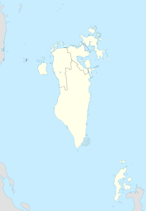 Halat Nuaim Location of Halat Nuaim Island in Bahrain | |
| Geography | |
| Location | Persian Gulf |
| Coordinates | 26°14′24″N 50°38′06″E / 26.24°N 50.635°ECoordinates: 26°14′24″N 50°38′06″E / 26.24°N 50.635°E |
| Archipelago | Bahrain |
| Adjacent bodies of water | Persian Gulf |
| Total islands | 1 |
| Major islands |
|
| Area | 0.27 km2 (0.10 sq mi) |
| Length | 0.65 km (0.404 mi) |
| Width | 0.75 km (0.466 mi) |
| Coastline | 2.58 km (1.603 mi) |
| Highest elevation | 15 m (49 ft) |
| Administration | |
| Governorate | Muharraq Governorate |
Largest settlement |
Nuaim (population 500) |
| Demographics | |
| Demonym | Bahraini |
| Population | 1000 (2014) |
| Pop. density | 3,700 /km2 (9,600 /sq mi) |
| Ethnic groups | Bahraini, non-Bahraini |
| Additional information | |
| Time zone | |
| Official website |
www |
| ISO Code = BH-14 | |
Halat Nuaim-Seltah (Arabic: حالة نعيم السلطة) is a Bahraini island. It is located off the coast of Muharraq island, near the town of Hidd. It has a distance of 5 km (3.1 mi) east of the capital, Manama, on Bahrain Island.
History
There were two islands separated by a 100 meters channel between them. Halat Nuaim which was inhabited by the Al Nuaim tribe, after whom it was named. Halat Seltah which was inhabited by the Al Sulaiti tribe, whom the island is named after. At 1998, dredging began in the canal, to create an artificial land and connect the islands.
Demography
There are two villages located on the Island:
- Nuaim
- Seltah
Administration
The island belongs to Muharraq Governorate .
Transportation
The island is today connected to Muharraq Island by a road.
Economics
The inhabitants on the island are engaged in very small scale fishing which are mainly for the island consumption.
Image gallery
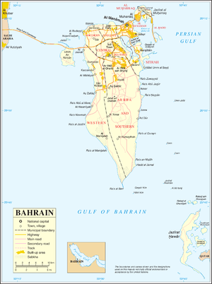 Map 1
Map 1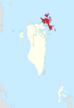 District Map
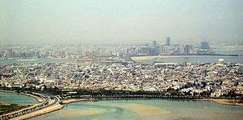 Muharraq in the foreground; Manama on Bahrain Island in the background
References
| Wikimedia Commons has media related to Halat Seltah. |