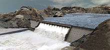
Hali Dam
| Hali Dam | |
|---|---|
 | |
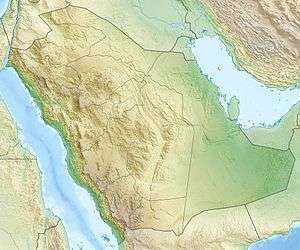 Location of Hali Dam in Saudi Arabia | |
| Country | Saudi Arabia |
| Location | Kead, Makkah Province |
| Coordinates | 18°46′4.30″N 41°34′28.29″E / 18.7678611°N 41.5745250°ECoordinates: 18°46′4.30″N 41°34′28.29″E / 18.7678611°N 41.5745250°E |
| Purpose | Flood control, irrigation, municipal water, groundwater recharge |
| Construction began | 2003 |
| Opening date | 2009 |
| Owner(s) | Ministry of Water and Electricity |
| Dam and spillways | |
| Type of dam | Gravity |
| Impounds | Wadi Hali |
| Height (foundation) | 95 m (312 ft) |
| Height (thalweg) | 57 m (187 ft) |
| Length | 384 m (1,260 ft) |
| Width (crest) | 8 m (26 ft) |
| Width (base) | 71 m (233 ft) |
| Dam volume | 690,000 m3 (900,000 cu yd) |
| Spillway type | Overflow, 12 openings |
| Spillway capacity | 7,856 m3/s (277,400 cu ft/s) |
| Reservoir | |
| Total capacity | 249,860,000 m3 (202,560 acre·ft) |
| Catchment area | 4,843 km2 (1,870 sq mi) |
| Surface area | 15 km2 (5.8 sq mi) |
The Hali Dam is a gravity dam on Wadi Hali about 14 km (8.7 mi) east of Keyad in Makkah Province of southwestern Saudi Arabia. The dam has many purposes to include flood control, irrigation, municipal water supply and groundwater recharge. The dam's reservoir has a total storage of 249,860,000 m3 (202,560 acre·ft), making it the second largest in the country after the King Fahad Dam. The dam was constructed between 2003 and 2009. It is owned and operated by the Ministry of Water and Electricity.[1][2]
References
- ↑ Alhamid, Abdulaziz A. (2004). "Achievements of the custodian of the two holy mosques in water sector, PSIPW" (PDF). King Saud University. Retrieved 27 March 2014.
- ↑ "Dams and Reservoirs". RONA. Retrieved 27 March 2014.
This article is issued from Wikipedia - version of the 5/14/2016. The text is available under the Creative Commons Attribution/Share Alike but additional terms may apply for the media files.