Halul Island
| Halul Island حالول | |
|---|---|
 Halul Island | |
| Coordinates: 25°40′30″N 52°24′41″E / 25.67500°N 52.41139°ECoordinates: 25°40′30″N 52°24′41″E / 25.67500°N 52.41139°E | |
| Country | Qatar |
|
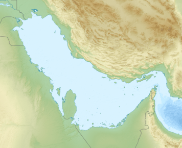
Persian Gulf | |
| Location |
Halul Island Qatar |
|---|---|
| Coordinates | 25°40′25.2″N 52°24′32.9″E / 25.673667°N 52.409139°E |
| Foundation | concrete basement |
| Construction | short concrete tower |
| Tower shape | cylindrical tower with lantern atop the hill |
| Markings / pattern | white tower, black lantern |
| Height | 5 metres (16 ft) |
| Focal height | 67 metres (220 ft) |
| Range |
white: 19 nautical miles (35 km; 22 mi) red: 9 nautical miles (17 km; 10 mi) |
| Characteristic | Fl WR 12s. |
| Admiralty number | D7378 |
| NGA number | 29816 |
| ARLHS number | QAT-003[1][2] |
Halul Island (Arabic: حالول) is one of the most important islands belonging to the State of Qatar. Lying about 80 km (50 mi) northeast of Doha, it serves as a storage area and loading terminal for oil from the surrounding offshore fields.[3] One of the main bases for the Qatari Navy is located in Halul.[4] The Coasts and Borders Security also have a base of operations on the island.[5]
It was frequented by pearling boats in the early 1900s.[6]
Geography
The island lies 72 miles southeast of Ras Rakan,[7] and around 50 miles northeast of the capital Doha.[5] It is approximately 1 mile in length.[7] The terrain is hilly and its highest peak is 202 feet.[5] The island is visible from a distance of about 15 miles, and there is a reef around it which extends up to 0.2 miles offshore. The island is susceptible to shamal winds. Located 45 miles northeast of the island is the rocky and shallow Shah Allum Shoal.[7]
Geology
Most of the island's surface lies on the Paleozoic strata. The Cambrian period Hormuz Formation is the predominant surface layer.[8] It is one of the only two territories of Qatar which lie on a Paleozoic surface.[9] Iron oxides such as hematite and ochre are found on the island, but have been left unexploited due to the high costs of extraction and transportation.[10]
Industry
Shortly after the commencement of oil activities, in the mid-1950s the government began investing resources to convert Halul into a major oil loading terminal. The significance of the island was further realized in the 1960s after the government began establishing offshore oil fields. Between 1964 and 1966, industrial infrastructure was constructed on the island. As of 2015, the island accommodates 11 external floating roof tanks with an overall capacity of 5 million barrels of crude oil.[5]
Halul produces its own electricity. It has nine turbo generators with a power capacity of 43 MW. Halul's two desalination units have a daily capacity of 400 cubic metres (110,000 US gal).[5]
See also
References
- ↑ Qatar The Lighthouse Directory. University of North Carolina at Chapel Hill. Retrieved 13 October 2016
- ↑ NGA List of Lights – Pub.112 Retrieved 13 October 2016
- ↑ "Geography". Library of Congress Country Studies. Retrieved 17 July 2015.
 This article incorporates public domain material from the Library of Congress Country Studies website http://lcweb2.loc.gov/frd/cs/.
 - ↑ RSN Singh (2008). Asian Strategic and Military Perspective. Lancer Publishers. p. 388. ISBN 978-8170622451.
- 1 2 3 4 5 "Halul Island". Qatar Petroleum. Retrieved 2 July 2015.
- ↑ "'Persian Gulf Gazetteer Part II, Geographical and Descriptive Materials, Section II Western Side of the Gulf' [53v] (109/286)". Qatar Digital Library. Retrieved 23 July 2015.
- 1 2 3 The Persian Gulf pilot: comprising the Persian Gulf, Gulf of Omán; and Makran coast. Great Britain: Hydrographic Dept. 1890. p. 127. This article incorporates text from this source, which is in the public domain.
- ↑ Sobhi Nasir, Hamad Al-Saad, Abudlrazak Alsayigh, Oliver Weidlich (25 August 2008). "Geology and petrology of the Hormuz dolomite, Infra-Cambrian: Implications for the formation of the salt-cored Halul and Shraouh islands, Offshore, State of Qatar". Journal of Asian Earth Sciences. 33 (5–6): Abstract. doi:10.1016/j.jseaes.2008.02.003. Retrieved 27 July 2015.
- ↑ Al-Kubaisi, Mohammed Ali M. (1984). Industrial development in Qatar: a geographical assessment (PDF). Durham E-Theses, Durham University. p. 12.
- ↑ Al-Kubaisi, Mohammed Ali M. (1984). Industrial development in Qatar: a geographical assessment (PDF). Durham E-Theses, Durham University. p. 11.