Hang Hau Station
Hang Hau 坑口 | |||||||||||||
|---|---|---|---|---|---|---|---|---|---|---|---|---|---|
| MTR rapid transit station | |||||||||||||
 Platform 2 | |||||||||||||
| Chinese name | |||||||||||||
| Traditional Chinese | 坑口 | ||||||||||||
| Simplified Chinese | 坑口 | ||||||||||||
| Literal meaning | Pit Mouth | ||||||||||||
| |||||||||||||
| General information | |||||||||||||
| Location |
15 Pui Shing Road, Hang Hau, Tseung Kwan O Sai Kung District, Hong Kong | ||||||||||||
| Coordinates | 22°18′56″N 114°15′52″E / 22.3156°N 114.2644°ECoordinates: 22°18′56″N 114°15′52″E / 22.3156°N 114.2644°E | ||||||||||||
| Operated by | MTR Corporation | ||||||||||||
| Line(s) | |||||||||||||
| Platforms | 2 (side platforms) | ||||||||||||
| Connections | Bus, Minibus | ||||||||||||
| Construction | |||||||||||||
| Structure type | Underground | ||||||||||||
| Platform levels | 1 | ||||||||||||
| Disabled access | Yes | ||||||||||||
| Other information | |||||||||||||
| Station code | HAH | ||||||||||||
| History | |||||||||||||
| Opened |
| ||||||||||||
| Services | |||||||||||||
| |||||||||||||
| Location | |||||||||||||
|
Hang Hau Location within the MTR system | |||||||||||||
Hang Hau (Chinese: 坑口) is an MTR station located at 15 Pui Shing Road, Hang Hau, Tseung Kwan O. It is located between Po Lam and Tseung Kwan O stations. The station is in the vicinity of many housing complexes, including Residence Oasis, East Point City, Maritime Bay, Nan Fung Plaza, La Cite Noble, and On Ning Garden.
Station layout
| - | Residential area Shopping malls |
Residence Oasis, The Lane |
| Footbridge to Nan Fung Plaza, East Point City, Maritime Bay | ||
| G | Concourse | Exits, transport interchange |
| Customer service, MTRshops, vending machines | ||
| Automatic teller machines, Octopus promotion machine | ||
| L1 Platforms |
Side platform, doors will open on the left | |
| Platform 1 | Tseung Kwan O Line towards Po Lam (Terminus) → | |
| Platform 2 | ← Tseung Kwan O Line towards North Point (Tseung Kwan O) | |
| Side platform, doors will open on the left | ||

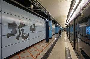
The station has two tracks and two side platforms.[1]
Entrances/exits
- A1: Residence Oasis
- A2: On Ning Garden

- B1: The Lane
- B2: Transport Interchange
Transport connections
A Transport Interchange is found by exiting through Exit B1 or A1.
Minibus routes
To Hang Hau Village:
- 11A
To Sai Kung:
- 101M
To University of Science and Technology:
- 11M
To Oscar by the Sea (via Tseung Kwan O Hospital and Fu Ning Gardens):
- 109M
Bus routes
- 98A (Circular)
To Mei Foo via Central Kowloon
- 98C
- 98D
To Hong Sing Garden via most parts of central and northern Tseung Kwan O
- 296M
To Tseung Kwan O Industrial Estate (via TVB City)
- 298E
To Diamond Hill
- 91M
To Hung Hom
- 297
References
- ↑ "Hang Hau Station layout" (PDF). MTR Corporation. Retrieved 30 October 2016.
- 1 2 "Hang Hau Station street map" (PDF). MTR Corporation. Retrieved 30 October 2016.
| Wikimedia Commons has media related to Hang Hau Station. |