Harrison County, West Virginia
| Harrison County, West Virginia | ||
|---|---|---|
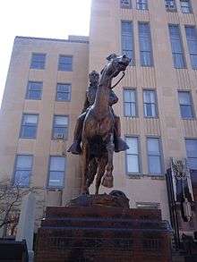
 Harrison County Courthouse | ||
| ||
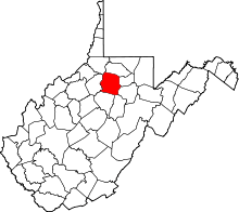 Location in the U.S. state of West Virginia | ||
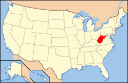 West Virginia's location in the U.S. | ||
| Founded | May 3, 1784 | |
| Seat | Clarksburg | |
| Largest city | Clarksburg | |
| Area | ||
| • Total | 417 sq mi (1,080 km2) | |
| • Land | 416 sq mi (1,077 km2) | |
| • Water | 0.5 sq mi (1 km2), 0.1% | |
| Population (est.) | ||
| • (2015) | 68,714 | |
| • Density | 165/sq mi (64/km²) | |
| Congressional district | 1st | |
| Time zone | Eastern: UTC-5/-4 | |
| Website |
www | |

Harrison County is a county in the U.S. state of West Virginia. As of the 2010 census, the population was 69,099.[1] The county seat is Clarksburg.[2] The county was founded in 1784.[3]
Harrison County is part of the Clarksburg, WV Micropolitan Statistical Area.
History
White trappers visited the area that is now Harrison County as early as the 1760s when it was still part of the vast Augusta County, Virginia. The settler Daniel Davisson claimed the land upon which present-day Clarksburg, Harrison County was formed in 1773, when the area was still part of the vast Monongalia County, Virginia.
Harrison County was created in 1784, formed from Monongalia County and named for Benjamin Harrison V,[3] who had recently retired as the Governor of Virginia. (He was the father of William Henry Harrison, 9th President of the United States and great-grandfather of Benjamin Harrison, 23rd president.) From the vast territory that was called “Harrison County” in 1784 were carved, over the next 72 years, all of eight present day West Virginia counties and parts of ten others.[4]
The first meeting of the Harrison County court was held on July 20, 1784 at home of George Jackson. One of the first orders of business was to select a permanent county seat. It was decided to move the county seat to Clarksburg. The town, named in honor of the explorer General George Rogers Clark (1752–1818), was chartered by the Virginia General Assembly in October 1785, and it was incorporated in 1795.
Clarksburg's first newspaper, The By-Stander, began publication in 1810. Clarksburg began to grow following the construction of the Northwestern Turnpike connecting Winchester and Parkersburg, which reached it in 1836. Clarksburg's economic development was also helped by the arrival of the Baltimore and Ohio Railroad in 1856. The railroad was instrumental in the development of the local coal mining industry during the late 1800s and early 1900s.
Geography
According to the U.S. Census Bureau, the county has a total area of 417 square miles (1,080 km2), of which 416 square miles (1,080 km2) is land and 0.5 square miles (1.3 km2) (0.1%) is water.[5] The county is drained by the West Fork River and its tributaries, including Tenmile Creek, Simpson Creek, Elk Creek, and Hackers Creek.[6]
Major highways
Adjacent counties
- Marion County (north)
- Taylor County (east)
- Barbour County (east)
- Upshur County (southeast)
- Lewis County (south)
- Doddridge County (west)
- Wetzel County (northwest)
Demographics
| Historical population | |||
|---|---|---|---|
| Census | Pop. | %± | |
| 1790 | 2,080 | — | |
| 1800 | 4,848 | 133.1% | |
| 1810 | 9,958 | 105.4% | |
| 1820 | 10,932 | 9.8% | |
| 1830 | 14,722 | 34.7% | |
| 1840 | 17,669 | 20.0% | |
| 1850 | 11,728 | −33.6% | |
| 1860 | 13,790 | 17.6% | |
| 1870 | 16,714 | 21.2% | |
| 1880 | 20,181 | 20.7% | |
| 1890 | 21,919 | 8.6% | |
| 1900 | 27,690 | 26.3% | |
| 1910 | 48,381 | 74.7% | |
| 1920 | 74,793 | 54.6% | |
| 1930 | 78,567 | 5.0% | |
| 1940 | 82,911 | 5.5% | |
| 1950 | 85,296 | 2.9% | |
| 1960 | 77,856 | −8.7% | |
| 1970 | 73,028 | −6.2% | |
| 1980 | 77,710 | 6.4% | |
| 1990 | 69,371 | −10.7% | |
| 2000 | 68,652 | −1.0% | |
| 2010 | 69,099 | 0.7% | |
| Est. 2015 | 68,714 | [7] | −0.6% |
| U.S. Decennial Census[8] 1790–1960[9] 1900–1990[10] 1990–2000[11] 2010–2015[1] | |||
2000 census
As of the census[12] of 2000, there were 68,652 people, 27,867 households, and 19,088 families residing in the county. The population density was 165 people per square mile (64/km²). There were 31,112 housing units at an average density of 75 per square mile (29/km²). The racial makeup of the county was 96.55% White, 1.61% Black or African American, 0.15% Native American, 0.59% Asian, 0.03% Pacific Islander, 0.21% from other races, and 0.86% from two or more races. 0.96% of the population were Hispanic or Latino of any race.
There were 27,867 households out of which 29.70% had children under the age of 18 living with them, 53.30% were married couples living together, 11.40% had a female householder with no husband present, and 31.50% were non-families. 27.70% of all households were made up of individuals and 13.20% had someone living alone who was 65 years of age or older. The average household size was 2.42 and the average family size was 2.94.
In the county, the population was spread out with 23.10% under the age of 18, 8.30% from 18 to 24, 27.50% from 25 to 44, 24.50% from 45 to 64, and 16.60% who were 65 years of age or older. The median age was 39 years. For every 100 females there were 91.80 males. For every 100 females age 18 and over, there were 88.20 males.
The median income for a household in the county was $30,562, and the median income for a family was $36,870. Males had a median income of $30,721 versus $22,110 for females. The per capita income for the county was $16,810. About 13.60% of families and 17.20% of the population were below the poverty line, including 24.10% of those under age 18 and 9.40% of those age 65 or over.
2010 census
As of the 2010 United States Census, there were 69,099 people, 28,533 households, and 18,992 families residing in the county.[13] The population density was 166.1 inhabitants per square mile (64.1/km2). There were 31,431 housing units at an average density of 75.6 per square mile (29.2/km2).[14] The racial makeup of the county was 96.0% white, 1.6% black or African American, 0.5% Asian, 0.2% American Indian, 0.2% from other races, and 1.5% from two or more races. Those of Hispanic or Latino origin made up 1.3% of the population.[13] In terms of ancestry, 19.8% were German, 19.0% were American, 18.3% were Irish, 13.2% were English, and 10.4% were Italian.[15]
Of the 28,533 households, 30.0% had children under the age of 18 living with them, 49.7% were married couples living together, 11.9% had a female householder with no husband present, 33.4% were non-families, and 28.3% of all households were made up of individuals. The average household size was 2.39 and the average family size was 2.92. The median age was 41.8 years.[13]
The median income for a household in the county was $39,191 and the median income for a family was $46,882. Males had a median income of $42,615 versus $28,867 for females. The per capita income for the county was $21,010. About 15.0% of families and 18.9% of the population were below the poverty line, including 29.0% of those under age 18 and 9.1% of those age 65 or over.[16]
Politics
| Year | Republican | Democrat |
|---|---|---|
| 2016 | 66.13% 18,687 | 27.16% 7,675 |
| 2012 | 60.43% 15,876 | 37.04% 9,732 |
| 2008 | 55.56% 17,824 | 42.34% 13,582 |
| 2004 | 55.94% 17,111 | 43.28% 13,328 |
| 2000 | 48.72% 12,948 | 48.95% 13,009 |
Communities
Cities
- Bridgeport
- Clarksburg (county seat)
- Salem
- Shinnston
- Stonewood
Towns
Census-designated places
Unincorporated communities
Charles Pointe Master-Planned Community
Harrison County is the site of a master-planned community, Charles Pointe, which is currently under construction in the city of Bridgeport, WV and comprises 1,700 acres (6.9 km2) that will combine commercial, residential, and recreational areas into one master-planned community.[18] Adjacent to Charles Pointe, the new United Hospital Center, a $278 million state-of-the-art medical facility, is also currently being constructed.[19] Directly across from the United Hospital Center site, White Oaks, a planned business community is also under way, and will support the new hospital and the FBI CJIS complex, which is also located nearby to the White Oaks site.[20][21] This area of West Virginia's Interstate 79 is considered part of a "High Tech Corridor."[22]
Historical landmarks
- Simpson Creek Covered Bridge
- Fletcher Covered Bridge
- Oak Mounds
- Kelly Miller High School
- The Waldomore
See also
- Center Branch Wildlife Management Area
- North Bend Rail Trail
- Watters Smith Memorial State Park
- National Register of Historic Places listings in Harrison County, West Virginia
References
- 1 2 "State & County QuickFacts". United States Census Bureau. Retrieved January 10, 2014.
- ↑ "Find a County". National Association of Counties. Retrieved 2011-06-07.
- 1 2 "Archived copy". Archived from the original on April 8, 2013. Retrieved January 29, 2013.
- ↑ NB: Some of these counties left “Harrison County” by way of intermediate county names. Former "Harrison County" now includes: (1) all of present day Barbour (1843; via Randolph and Lewis also), Gilmer (1845), Harrison, Lewis (1816), Randolph (1787), Ritchie (1843; parts via Lewis and Wood also), Upshur (1851; via Lewis), and Wood (1798) Counties; and (2) parts of Braxton (1836; via Lewis), Calhoun (1856; via Gilmer), Doddridge (1845; via Lewis and Ritchie also), Marion (1842), Pleasants (1851; via Wood), Pocahontas (1821; via Randolph), Tucker (1856; via Randolph), Taylor (1844; via Marion and Barbour also), Webster (1860; via Braxton and Randolph), and Wirt (1848; via Wood) Counties. ("History of County Formations in Virginia, 1617-1995")
- ↑ "2010 Census Gazetteer Files". United States Census Bureau. August 22, 2012. Retrieved July 24, 2015.
- ↑ DeLorme (1997). West Virginia Atlas & Gazetteer. Yarmouth, Maine: DeLorme. pp. 24-25, 35-36. ISBN 0-89933-246-3.
- ↑ "County Totals Dataset: Population, Population Change and Estimated Components of Population Change: April 1, 2010 to July 1, 2015". Retrieved July 2, 2016.
- ↑ "U.S. Decennial Census". United States Census Bureau. Retrieved January 10, 2014.
- ↑ "Historical Census Browser". University of Virginia Library. Retrieved January 10, 2014.
- ↑ "Population of Counties by Decennial Census: 1900 to 1990". United States Census Bureau. Retrieved January 10, 2014.
- ↑ "Census 2000 PHC-T-4. Ranking Tables for Counties: 1990 and 2000" (PDF). United States Census Bureau. Retrieved January 10, 2014.
- ↑ "American FactFinder". United States Census Bureau. Retrieved 2011-05-14.
- 1 2 3 "DP-1 Profile of General Population and Housing Characteristics: 2010 Demographic Profile Data". United States Census Bureau. Retrieved 2016-04-03.
- ↑ "Population, Housing Units, Area, and Density: 2010 - County". United States Census Bureau. Retrieved 2016-04-03.
- ↑ "DP02 SELECTED SOCIAL CHARACTERISTICS IN THE UNITED STATES – 2006-2010 American Community Survey 5-Year Estimates". United States Census Bureau. Retrieved 2016-04-03.
- ↑ "DP03 SELECTED ECONOMIC CHARACTERISTICS – 2006-2010 American Community Survey 5-Year Estimates". United States Census Bureau. Retrieved 2016-04-03.
- ↑ "Dave Leip's Atlas of U.S. Presidential Elections". Retrieved 2016-11-18.
- ↑ "Welcome to Charles Pointe". Retrieved 25 June 2016.
- ↑ uhcwv.org: New UHC
- ↑ "Echoretailproperties.com; Work.Shop.Live". Retrieved 25 June 2016.
- ↑ "Overview". Retrieved 25 June 2016.
- ↑ Wikipedia.org: I-79
External links
- Harrison County Chamber of Commerce
- Harrison County Commission
- Harrison County Development Authority
- Harrison County Genealogical Society
- Harrison County Schools
- WVGenWeb Harrison County
 |
Wetzel County | Marion County | | |
| Doddridge County | |
Taylor County and Barbour County | ||
| ||||
| | ||||
| Lewis County | Upshur County |
Municipalities and communities of Harrison County, West Virginia, United States | ||
|---|---|---|
| Cities | | |
| Towns | ||
| CDPs | ||
| Unincorporated communities |
| |
Coordinates: 39°17′N 80°23′W / 39.29°N 80.38°W