Hartenfels
| Hartenfels | ||
|---|---|---|
| ||
 Hartenfels | ||
Location of Hartenfels within Westerwaldkreis district 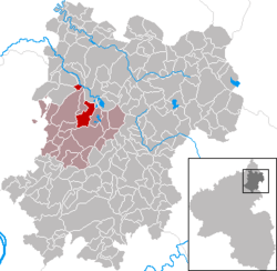 | ||
| Coordinates: 50°34′26″N 7°47′14″E / 50.57389°N 7.78722°ECoordinates: 50°34′26″N 7°47′14″E / 50.57389°N 7.78722°E | ||
| Country | Germany | |
| State | Rhineland-Palatinate | |
| District | Westerwaldkreis | |
| Municipal assoc. | Selters (Westerwald) | |
| Government | ||
| • Mayor | Arno Siry | |
| Area | ||
| • Total | 8.15 km2 (3.15 sq mi) | |
| Population (2015-12-31)[1] | ||
| • Total | 816 | |
| • Density | 100/km2 (260/sq mi) | |
| Time zone | CET/CEST (UTC+1/+2) | |
| Postal codes | 56244 | |
| Dialling codes | 02626 | |
| Vehicle registration | WW | |
| Website | www.selters-ww.de | |

Hartenfels is an Ortsgemeinde – a community belonging to a Verbandsgemeinde – in the Westerwaldkreis in Rhineland-Palatinate, Germany. The community belongs to the Verbandsgemeinde of Selters, a kind of collective municipality.
Geography

Location
Hartenfels lies 4 km from Herschbach and 8 km from Selters on the Holzbach.
History
Hartenfels Castle was first mentioned in old writings in 1249. The community is known for its castle ruins, of whose former shape only a few walls and one tower now remain. It was built in the 13th century to keep watch over the nearby trade road leading from Frankfurt to Cologne. In dialectal speech, the ruins bear the name Schmanddippe. In 1999, the community celebrated 750 years of existence. Seven years later came a chronicle.
Politics
Community council
The council is made up of 12 council members, as well as the honorary and presiding mayor (Ortsbürgermeister), who were elected in a majority vote in a municipal election on 7 June 2009.
Economy and infrastructure
Hartenfelser Kopf Windfarm
In the summer of 2006, 12 Enercon E-70 wind turbines were installed on the Hartenfelser Kopf. These supply roughly 12,500 households, making it one of the biggest windfarm projects in a forest that has ever been built in the Federal Republic. Four of the turbines stand within Hartenfels’s limits.
Regular events
In January, in honour of the community’s patron saint, Anthony, whose feast day is 17 January, two concerts are held by the community’s music club on two consecutive weekends. On the Burgberg (“Castle Mountain”), the yearly music festival Rock am Turm is held at Whitsun. At Christmas, a lit, real fir tree (Tannenbaum in German) up to 8 m tall is put up on top of the castle tower. The kermis in Hartenfels is usually held on the first weekend in July.
Choirs, clubs, etc.
The community is enriched by a music club with many members, a likewise popular volunteer fire brigade, a Möhnenverein (roughly, “Foolish Women’s Club” – it is an organization devoted to the yearly Carnival festivities) with a men’s ballet, as well as a church choir.
Transport
The community lies west of Bundesstraße 8, leading from Limburg an der Lahn to Siegburg. The nearest Autobahn interchange is Mogendorf on the A 3 (Cologne–Frankfurt). There are further Autobahn interchanges near Dierdorf and Montabaur. The nearest InterCityExpress stop is the railway station at Montabaur on the Cologne-Frankfurt high-speed rail line.
References
- ↑ "Gemeinden in Deutschland mit Bevölkerung am 31. Dezember 2015" (PDF). Statistisches Bundesamt (in German). 2016.
Further reading
On the occasion of its 750-year jubilee, the community of Hartenfels published a chronicle, written and compiled by the late Altbürgermeister und Ehrenbürger (“Old Mayor and Honorary Citizen”): Josef Marx.