Norken
| Norken | ||
|---|---|---|
| ||
 Norken | ||
Location of Norken within Westerwaldkreis district 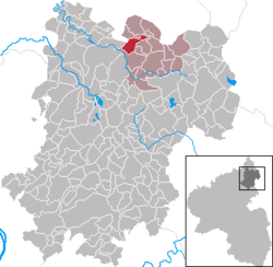 | ||
| Coordinates: 50°40′22″N 7°53′52″E / 50.67278°N 7.89778°ECoordinates: 50°40′22″N 7°53′52″E / 50.67278°N 7.89778°E | ||
| Country | Germany | |
| State | Rhineland-Palatinate | |
| District | Westerwaldkreis | |
| Municipal assoc. | Bad Marienberg (Westerwald) | |
| Government | ||
| • Mayor | Friedrich-Wilhelm Wagner | |
| Area | ||
| • Total | 5.99 km2 (2.31 sq mi) | |
| Population (2015-12-31)[1] | ||
| • Total | 968 | |
| • Density | 160/km2 (420/sq mi) | |
| Time zone | CET/CEST (UTC+1/+2) | |
| Postal codes | 57629 | |
| Dialling codes | 02661 | |
| Vehicle registration | WW | |
| Website | www.norken.de | |

Norken is an Ortsgemeinde – a community belonging to a Verbandsgemeinde – in the Westerwaldkreis in Rhineland-Palatinate, Germany.
Geography
Location
The community lies in the Westerwald between Limburg and Siegen on the boundary with North Rhine-Westphalia. The community is also between the Große Nister and Kleine Nister. Norken belongs to the Verbandsgemeinde of Bad Marienberg, a kind of collective municipality. Its seat is in the like-named town.
History
In 1262, Norken had its first documentary mention.
Politics
Community council
The council is made up of 16 council members who were elected in a majority vote in a municipal election on 13 June 2004.
Regular events
At Easter, the traditional Eierschibbeln – a kind of Easter egg roll – is celebrated.
Economy and infrastructure
Transport
Running right near the community is Bundesstraße 414, leading from Herborn to Altenkirchen. The nearest Autobahn interchanges are in Siegen and Wilnsdorf on the A 45 (Dortmund–Hanau), some 26 km away. The nearest InterCityExpress stop is the railway station at Montabaur on the Cologne-Frankfurt high-speed rail line.
References
- ↑ "Gemeinden in Deutschland mit Bevölkerung am 31. Dezember 2015" (PDF). Statistisches Bundesamt (in German). 2016.
External links
- Norken (German)
- Norken in the collective municipality’s Web pages (German)