Hartshorne, Oklahoma
| Hartshorne, Oklahoma | |
|---|---|
| City | |
 Location of Hartshorne, Oklahoma | |
| Coordinates: 34°50′43″N 95°33′33″W / 34.84528°N 95.55917°WCoordinates: 34°50′43″N 95°33′33″W / 34.84528°N 95.55917°W | |
| Country | United States |
| State | Oklahoma |
| County | Pittsburg |
| Area | |
| • Total | 3.6 sq mi (9.4 km2) |
| • Land | 3.5 sq mi (9.0 km2) |
| • Water | 0.1 sq mi (0.3 km2) |
| Elevation | 702 ft (214 m) |
| Population (2010) | |
| • Total | 2,125 |
| • Density | 590/sq mi (230/km2) |
| Time zone | Central (CST) (UTC-6) |
| • Summer (DST) | CDT (UTC-5) |
| ZIP code | 74547 |
| Area code(s) | 539/918 |
| FIPS code | 40-32850[1] |
| GNIS feature ID | 1093586[2] |
| Website |
www |
Hartshorne (pronounced "Hearts-orn") is a city in Pittsburg County, Oklahoma, United States. It is the second largest city in the county. The population was 2,125 at the 2010 census.[3]
History
The present-day city of Hartshorne began as a coal mining community about 1850. Coal mine operators in Indian Territory recruited European immigrants to work the mines. The first workers were probably English and Irish, but other ethnic groups soon joined them.These included Italians and eastern Europeans. Like many other such communities, this was a company town, built very close to the mine, with rudimentary houses and a company store. A post office opened here on March 5, 1850.[4]
The Choctaw Coal and Railway line, later acquired by the Choctaw, Oklahoma and Gulf Railroad (CO&G), built a line through Hartshorne.In 1902 the Chicago, Rock Island and Pacific Railway gained control of the CO&G. In 1904 an electric interurban began service from McAlester to Hartshorne.[4]
The Holy Rosary Church, complete with a rectory, a convent and a parochial school, was built in 1895 by Russian and other Eastern European immigrants. Other churches constructed before the 20th Century were: Baptist, Methodist, Christian, Presbyterian and Episcopal. the Saints Cyril and Methodius Russian Orthodox Church, remains a landmark. It replaced an earlier 1897 version that immigrants from Russia and other eastern European countries constructed. The community incorporated in Tobucksy County of the Choctaw Nation by order of the U.S. District Court, Central District, Indian Territory, on March 1, 1900.[4]
Geography
Hartshorne is located at 34°50′43″N 95°33′33″W / 34.84528°N 95.55917°W (34.845198, -95.559265).[5] According to the United States Census Bureau, the city has a total area of 3.6 square miles (9.3 km2), of which 3.5 square miles (9.1 km2) is land and 0.1 square miles (0.26 km2), or 3.60%, is water. The city is located approximately 15 miles (24 km) east of McAlester, Oklahoma on US. Highway 270.[4]
Demographics
| Historical population | |||
|---|---|---|---|
| Census | Pop. | %± | |
| 1900 | 2,352 | — | |
| 1910 | 2,963 | 26.0% | |
| 1920 | 3,480 | 17.4% | |
| 1930 | 3,587 | 3.1% | |
| 1940 | 2,596 | −27.6% | |
| 1950 | 2,330 | −10.2% | |
| 1960 | 1,903 | −18.3% | |
| 1970 | 2,121 | 11.5% | |
| 1980 | 2,380 | 12.2% | |
| 1990 | 2,120 | −10.9% | |
| 2000 | 2,102 | −0.8% | |
| 2010 | 2,125 | 1.1% | |
| Est. 2015 | 2,017 | [6] | −5.1% |
As of the census[1] of 2010, there were 2,125 people, 850 households, and 551 families residing in the city. The population density was 614.5 people per square mile (233.2/km²). There were 991 housing units at an average density of 291.6 per square mile (112.5/km²). The racial makeup of the city was 65.9% White, 2.5% African American, 20.3% Native American, 0.20% Asian, 0.10% Pacific Islander, 1.1% from other races, and 9.7% from two or more races. Hispanic or Latino of any race were 3.6% of the population.
There were 850 households out of which 35.8% had children under the age of 18 living with them, 43.4% were married couples living together, 14.6% had a female householder with no husband present, and 35.2% were non-families. 31.0% of all households were made up of individuals and 35.8% had someone living alone who was 65 years of age or older. The average household size was 2.47 and the average family size was 3.06.
In the city the population was spread out with 34.3% under the age of 18, 8.0% from 18 to 24, 23.7% from 25 to 44, 23.6% from 45 to 64, and 19.5% who were 65 years of age or older. The median age was 37.7 years. For every 100 females there were 89.2 males. For every 100 females age 18 and over, there were 83.7 males.
The median income for a household in the city was $21,078, and the median income for a family was $26,650. Males had a median income of $25,705 versus $18,603 for females. The per capita income for the city was $13,179. About 18.6% of families and 26.3% of the population were below the poverty line, including 33.0% of those under age 18 and 17.5% of those age 65 or over.
Education
The Hartshorne Public Schools system operates an elementary school, a junior high, and a high school. The city also has four head-start centers.
Two miles northeast of Hartshorne is Jones Academy, a public boarding school for Native Americans with proof of their tribal heritage. Many tribal students come from the Choctaw Nation, whose territory encompasses Pittsburg County. The junior high/high school students attend the Hartshorne Public Schools, while Jones Academy has their own elementary.
Hartshorne Public Library is located in downtown Hartshorne.
Notable people
- Ed Jeffers, former professional football player
- Richard Lerblance, Oklahoma state senator
- Anna Wallis Suh, the original voice of "Seoul City Sue" during the Korean War
- Warren Spahn, Hall of Fame baseball player
- Scott Mitchell, D.O, pioneering pain management physician.
References
- 1 2 "American FactFinder". United States Census Bureau. Retrieved 2008-01-31.
- ↑ "US Board on Geographic Names". United States Geological Survey. 2007-10-25. Retrieved 2008-01-31.
- ↑ "Profile of General Population and Housing Characteristics: 2010 Demographic Profile Data (DP-1): Hartshorne city, Oklahoma". U.S. Census Bureau, American Factfinder. Retrieved May 2, 2012.
- 1 2 3 4 Payne, Lorette Brown. "Hartshorne." Encyclopedia of Oklahoma History and Culture. Accessed May 3, 2016.
- ↑ "US Gazetteer files: 2010, 2000, and 1990". United States Census Bureau. 2011-02-12. Retrieved 2011-04-23.
- ↑ "Annual Estimates of the Resident Population for Incorporated Places: April 1, 2010 to July 1, 2015". Retrieved July 2, 2016.
- ↑ "Census of Population and Housing". Census.gov. Retrieved June 4, 2015.
External links
- City of Hartshorne official website
- Hartshorne Public Library
- Hartshorne Public Schools
- Jones Academy
- Encyclopedia of Oklahoma History and Culture - Hartshorne
Municipalities and communities of Pittsburg County, Oklahoma, United States | ||
|---|---|---|
| Cities | 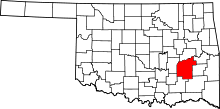 | |
| Towns | ||
| CDPs |
| |
| Unincorporated communities | ||
| Ghost town | ||