Havelock, Quebec
For other places with the same name, see Havelock (disambiguation)
| Havelock | |
|---|---|
| Township municipality | |
|
Havelock Town Hall, National Historic Site of Canada | |
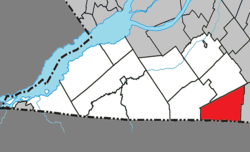 Location within Le Haut-Saint-Laurent RCM. | |
 Havelock Location in southern Quebec. | |
| Coordinates: 45°03′N 73°45′W / 45.050°N 73.750°WCoordinates: 45°03′N 73°45′W / 45.050°N 73.750°W[1] | |
| Country |
|
| Province |
|
| Region | Montérégie |
| RCM | Le Haut-Saint-Laurent |
| Constituted | April 1, 1863 |
| Named for | Henry Havelock[1] |
| Government[2][3] | |
| • Mayor | Denis Henderson |
| • Federal riding | Beauharnois—Salaberry |
| • Prov. riding | Huntingdon |
| Area[2][4] | |
| • Total | 89.40 km2 (34.52 sq mi) |
| • Land | 88.92 km2 (34.33 sq mi) |
| Population (2011)[4] | |
| • Total | 756 |
| • Density | 8.5/km2 (22/sq mi) |
| • Pop 2006-2011 |
|
| • Dwellings | 416 |
| Time zone | EST (UTC−5) |
| • Summer (DST) | EDT (UTC−4) |
| Postal code(s) | J0S 2C0 |
| Area code(s) | 450 and 579 |
| Highways |
|

Havelock is a township in Le Haut-Saint-Laurent Regional County Municipality in southern Quebec, Canada. The population as of the Canada 2011 Census was 756. Neighbouring townships include Franklin to the west, St-Chrysostome to the north and Hemmingford to the east. Havelock's southern boundary is situated along the Canada–United States border with New York State, United States.
Located within Havelock is Covey Hill, one of the northernmost hills of the Adirondack Mountains and the highest point in Le Haut-Saint-Laurent Regional County Municipality.[5]
History
Named after Major-General Sir Henry Havelock, a British general who served in India, the township was created in 1863 from the west end of Hemmingford Township.
Geography
Communities
The following locations reside within the municipality's boundaries:[1]
- Covey Hill (45°01′06″N 73°45′28″W / 45.01833°N 73.75778°W) – a hamlet located 2 kilometres (1.2 miles) north of the US border on Route 203.
- Domaine-Enchanté (45°00′59″N 73°45′58″W / 45.01639°N 73.76611°W) – a cottage community just west of Covey Hill situated on the north shore of Lac-Enchanté.
- Projet-Laplante (45°01′07″N 73°49′41″W / 45.01861°N 73.82806°W) – a hamlet located 5.5 kilometres (3.4 miles) west of Covey Hill.
- Russeltown Flats (45°04′01″N 73°45′41″W / 45.06694°N 73.76139°W) – a hamlet located in the northern portion.
- The Fort (45°02′44″N 73°41′13″W / 45.04556°N 73.68694°W) – a hamlet located in the southeast portion on Route 202.
Lakes & Rivers
The following waterways pass through or are situated within the municipality's boundaries:[1]
- Lac Enchanté (45°00′52″N 73°45′57″W / 45.01444°N 73.76583°W) – a lake situated 2 kilometres (1.2 miles) north of the US border.
- Le Gouffre (45°00′08″N 73°47′15″W / 45.00222°N 73.78750°W) – a small lake southwest of Lac Enchanté.
Topographic Features
- Covey Hill (45°00′59″N 73°47′48″W / 45.01639°N 73.79667°W) – a mountain situated west of the hamlet of Covey Hill. At 345 metres (1,132 feet), it is the highest point in Le Haut-Saint-Laurent.[1][5]
Demographics
Population
| Canada census – Havelock, Quebec community profile | |||
|---|---|---|---|
| 2011 | 2006 | 2001 | |
| Population: | 756 (-0.7% from 2006) | 761 (-4.2% from 2001) | 794 (-2.1% from 1996) |
| Land area: | 88.92 km2 (34.33 sq mi) | 88.81 km2 (34.29 sq mi) | 88.81 km2 (34.29 sq mi) |
| Population density: | 8.5/km2 (22/sq mi) | 8.6/km2 (22/sq mi) | 8.9/km2 (23/sq mi) |
| Median age: | 51.1 (M: 51.1, F: 51.2) | 50.1 (M: 50.3, F: 49.8) | 44.2 (M: 42.6, F: 46.8) |
| Total private dwellings: | 416 | 379 | 339 |
| Median household income: | $.N/A | $42,226 | $35,800 |
| Notes: 2011 income data for this area has been suppressed for data quality or confidentiality reasons. – References: 2011[4] 2006[6] 2001[7] | |||
| Historical Census Data - Havelock, Quebec[8] | ||||||||||||||||||||||||||
|---|---|---|---|---|---|---|---|---|---|---|---|---|---|---|---|---|---|---|---|---|---|---|---|---|---|---|
|
|
| ||||||||||||||||||||||||
Language
| Canada Census Mother Tongue - Havelock, Quebec[8] | ||||||||||||||||||
|---|---|---|---|---|---|---|---|---|---|---|---|---|---|---|---|---|---|---|
| Census | Total | French |
English |
French & English |
Other | |||||||||||||
| Year | Responses | Count | Trend | Pop % | Count | Trend | Pop % | Count | Trend | Pop % | Count | Trend | Pop % | |||||
| 2011 |
750 |
500 | |
66.67% | 225 | |
30.00% | 5 | |
0.66% | 20 | |
2.67% | |||||
| 2006 |
745 |
500 | |
67.11% | 220 | |
29.53% | 0 | |
0.00% | 25 | |
3.36% | |||||
| 2001 |
790 |
550 | |
69.62% | 225 | |
28.48% | 15 | |
1.90% | 0 | |
0.00% | |||||
| 1996 |
810 |
490 | n/a | 60.49% | 290 | n/a | 35.80% | 10 | n/a | 1.24% | 20 | n/a | 2.47% | |||||
Arts and culture
The town is noted for its annual agricultural fair, Havelock Fair, held every September. It showcases the best the local countryside has to offer. It was founded in 1871 and is one of the oldest fairs in Canada.[9]
See also
References
- 1 2 3 4 5 Reference number 28191 of the Commission de toponymie du Québec (French)
- 1 2 Ministère des Affaires municipales, des Régions et de l'Occupation du territoire: Havelock
- ↑ Riding history for Beauharnois—Salaberry, Quebec from the Library of Parliament
- 1 2 3 2011 Statistics Canada Census Profile: Havelock, Quebec
- 1 2 "Covey Hill, Québec". Peakbagger.com. Retrieved 24 September 2012.
- ↑ "2006 Community Profiles". Canada 2006 Census. Statistics Canada. March 30, 2011. Retrieved 2014-02-13.
- ↑ "2001 Community Profiles". Canada 2001 Census. Statistics Canada. February 17, 2012. Retrieved 2014-02-13.
- 1 2 Statistics Canada: 1996, 2001, 2006, 2011 census
- ↑ Havelock Fair Homepage , retrieved 23 September 2012
External links
| Wikimedia Commons has media related to Havelock (Québec). |
- Havelock Fair
- Havelock official website
- Chateauguay Valley
- The Russeltown Flatts Church
- Apples
- Covey Hill
 |
Saint-Chrysostome | | ||
| Franklin | |
Hemmingford (township) | ||
| ||||
| | ||||
| |
| Cities | |
|---|---|
| Municipalities | |
| Parishes | |
| Townships | |
| |