Haynesville, Maine
| Haynesville, Maine | |
|---|---|
| Town | |
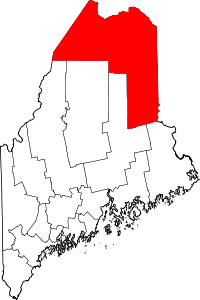
 Location of Haynesville, Maine | |
| Coordinates: 45°49′23″N 67°58′45″W / 45.82306°N 67.97917°W | |
| Country | United States |
| State | Maine |
| County | Aroostook |
| Area[1] | |
| • Total | 41.90 sq mi (108.52 km2) |
| • Land | 41.38 sq mi (107.17 km2) |
| • Water | 0.52 sq mi (1.35 km2) |
| Elevation | 371 ft (113 m) |
| Population (2010)[2] | |
| • Total | 121 |
| • Estimate (2012[3]) | 119 |
| • Density | 2.9/sq mi (1.1/km2) |
| Time zone | Eastern (EST) (UTC-5) |
| • Summer (DST) | EDT (UTC-4) |
| ZIP code | 04497 |
| Area code(s) | 207 |
| FIPS code | 23-32195 |
| GNIS feature ID | 0582515 |
Haynesville is a town in Aroostook County, Maine, United States. The population was 121 at the 2010 census.
Geography
According to the United States Census Bureau, the town has a total area of 41.90 square miles (108.52 km2), of which 41.38 square miles (107.17 km2) is land and 0.52 square miles (1.35 km2) is water.[1]
Demographics
| Historical population | |||
|---|---|---|---|
| Census | Pop. | %± | |
| 1850 | 96 | — | |
| 1860 | 169 | 76.0% | |
| 1870 | 165 | −2.4% | |
| 1880 | 224 | 35.8% | |
| 1890 | 280 | 25.0% | |
| 1900 | 316 | 12.9% | |
| 1910 | 272 | −13.9% | |
| 1920 | 349 | 28.3% | |
| 1930 | 251 | −28.1% | |
| 1940 | 235 | −6.4% | |
| 1950 | 185 | −21.3% | |
| 1960 | 187 | 1.1% | |
| 1970 | 157 | −16.0% | |
| 1980 | 169 | 7.6% | |
| 1990 | 243 | 43.8% | |
| 2000 | 122 | −49.8% | |
| 2010 | 121 | −0.8% | |
| Est. 2014 | 117 | [4] | −3.3% |
2010 census
As of the census[2] of 2010, there were 121 people, 56 households, and 38 families residing in the town. The population density was 2.9 inhabitants per square mile (1.1/km2). There were 107 housing units at an average density of 2.6 per square mile (1.0/km2). The racial makeup of the town was 98.3% White, 0.8% Native American, and 0.8% from two or more races. Hispanic or Latino of any race were 2.5% of the population.
There were 56 households of which 17.9% had children under the age of 18 living with them, 60.7% were married couples living together, 7.1% had a female householder with no husband present, and 32.1% were non-families. 32.1% of all households were made up of individuals and 10.8% had someone living alone who was 65 years of age or older. The average household size was 2.16 and the average family size was 2.66.
The median age in the town was 49.5 years. 15.7% of residents were under the age of 18; 4.9% were between the ages of 18 and 24; 19% were from 25 to 44; 45.3% were from 45 to 64; and 14.9% were 65 years of age or older. The gender makeup of the town was 55.4% male and 44.6% female.
2000 census
As of the census[6] of 2000, there were 122 people, 45 households, and 34 families residing in the town. The population density was 3.0 people per square mile (1.1/km²). There were 88 housing units at an average density of 2.1 per square mile (0.8/km²). The racial makeup of the town was 99.18% White and 0.82% Asian.
There were 45 households out of which 24.4% had children under the age of 18 living with them, 62.2% were married couples living together, 8.9% had a female householder with no husband present, and 24.4% were non-families. 20.0% of all households were made up of individuals and 8.9% had someone living alone who was 65 years of age or older. The average household size was 2.71 and the average family size was 3.12.
In the town the population was spread out with 26.2% under the age of 18, 6.6% from 18 to 24, 28.7% from 25 to 44, 23.0% from 45 to 64, and 15.6% who were 65 years of age or older. The median age was 41 years. For every 100 females there were 84.8 males. For every 100 females age 18 and over, there were 100.0 males.
The median income for a household in the town was $23,542, and the median income for a family was $23,333. Males had a median income of $22,250 versus $20,417 for females. The per capita income for the town was $11,200. There were 5.6% of families and 9.7% of the population living below the poverty line, including 6.5% of under eighteens and 10.7% of those over 64.
Cultural reference
The area of Haynesville is referenced in country music performer Dick Curless's song "A Tombstone Every Mile". The song refers to the "Haynesville Woods", an area with a stretch of road noted for many motor vehicle accidents.[7] Truck drivers used to ship potatoes to market in Boston and a dangerous hairpin turn in the route through Haynesville was the inspiration for the song.[7]
References
- 1 2 "US Gazetteer files 2010". United States Census Bureau. Retrieved 2012-12-16.
- 1 2 "American FactFinder". United States Census Bureau. Retrieved 2012-12-16.
- ↑ "Population Estimates". United States Census Bureau. Retrieved 2013-07-06.
- ↑ "Annual Estimates of the Resident Population for Incorporated Places: April 1, 2010 to July 1, 2014". Retrieved June 4, 2015.
- ↑ "Census of Population and Housing". Census.gov. Retrieved June 4, 2015.
- ↑ "American FactFinder". United States Census Bureau. Retrieved 2008-01-31.
- 1 2 Bill Russo. "Dick Curless: The Forgotten Baron of Country Music." (http://billrrrr.hubpages.com/hub/The-Forgotten-Baron-of-Country-Music-Dick-Curless) Retrieved 15 March 2014.
Coordinates: 45°49′34″N 67°59′28″W / 45.82611°N 67.99111°W