Henry County, Ohio
| Henry County, Ohio | ||
|---|---|---|
|
| ||
| ||
 Location in the U.S. state of Ohio | ||
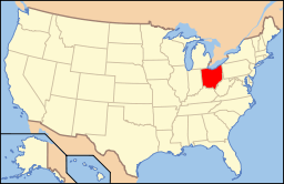 Ohio's location in the U.S. | ||
| Founded | December 26, 1834 | |
| Named for | Patrick Henry | |
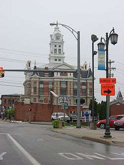
| Seat | Napoleon | |
| Largest city | Napoleon | |
| Area | ||
| • Total | 420 sq mi (1,088 km2) | |
| • Land | 416 sq mi (1,077 km2) | |
| • Water | 3.7 sq mi (10 km2), 0.9% | |
| Population | ||
| • (2010) | 28,215 | |
| • Density | 68/sq mi (26/km²) | |
| Congressional district | 5th | |
| Time zone | Eastern: UTC-5/-4 | |
| Website |
www | |

Henry County is a county located in the U.S. state of Ohio. As of the 2010 census, the population was 28,215.[1] Its county seat is Napoleon.[2] The county was created in 1820 and later organized in 1834.[3] It is named for Patrick Henry, the Virginian famous for his "give me liberty or give me death" speech.[4]
Geography
According to the U.S. Census Bureau, the county has a total area of 420 square miles (1,100 km2), of which 416 square miles (1,080 km2) is land and 3.7 square miles (9.6 km2) (0.9%) is water.[5]
Adjacent counties
- Fulton County (north)
- Lucas County (northeast)
- Wood County (east)
- Putnam County (south)
- Defiance County (west)
- Williams County (northwest)
- Hancock County (southeast)
Demographics
| Historical population | |||
|---|---|---|---|
| Census | Pop. | %± | |
| 1830 | 262 | — | |
| 1840 | 2,503 | 855.3% | |
| 1850 | 3,434 | 37.2% | |
| 1860 | 8,901 | 159.2% | |
| 1870 | 14,028 | 57.6% | |
| 1880 | 20,585 | 46.7% | |
| 1890 | 25,080 | 21.8% | |
| 1900 | 27,282 | 8.8% | |
| 1910 | 25,119 | −7.9% | |
| 1920 | 23,362 | −7.0% | |
| 1930 | 22,524 | −3.6% | |
| 1940 | 22,756 | 1.0% | |
| 1950 | 22,423 | −1.5% | |
| 1960 | 25,392 | 13.2% | |
| 1970 | 27,058 | 6.6% | |
| 1980 | 28,383 | 4.9% | |
| 1990 | 29,108 | 2.6% | |
| 2000 | 29,210 | 0.4% | |
| 2010 | 28,215 | −3.4% | |
| Est. 2015 | 27,816 | [6] | −1.4% |
| U.S. Decennial Census[7] 1790-1960[8] 1900-1990[9] 1990-2000[10] 2010-2013[1] | |||
2000 census
As of the census[11] of 2000, there were 29,210 people, 10,935 households, and 7,960 families residing in the county. The population density was 70 people per square mile (27/km²). There were 11,622 housing units at an average density of 28 per square mile (11/km²). The racial makeup of the county was 95.33% White, 0.58% Black or African American, 0.26% Native American, 0.42% Asian, 2.56% from other races, and 0.85% from two or more races. 5.40% of the population were Hispanic or Latino of any race. 94.3% spoke English, 3.7% Spanish and 1.7% German as their first language.
There were 10,935 households out of which 35.20% had children under the age of 18 living with them, 61.10% were married couples living together, 8.10% had a female householder with no husband present, and 27.20% were non-families. 23.50% of all households were made up of individuals and 10.40% had someone living alone who was 65 years of age or older. The average household size was 2.62 and the average family size was 3.10.
In the county the population was spread out with 27.60% under the age of 18, 8.20% from 18 to 24, 28.10% from 25 to 44, 22.10% from 45 to 64, and 14.00% who were 65 years of age or older. The median age was 36 years. For every 100 females there were 97.60 males. For every 100 females age 18 and over, there were 93.60 males.
The median income for a household in the county was $42,657, and the median income for a family was $49,881. Males had a median income of $35,901 versus $24,076 for females. The per capita income for the county was $18,667. About 5.30% of families and 7.00% of the population were below the poverty line, including 9.90% of those under age 18 and 4.20% of those age 65 or over.
2010 census
As of the 2010 United States Census, there were 28,215 people, 10,934 households, and 7,883 families residing in the county.[12] The population density was 67.8 inhabitants per square mile (26.2/km2). There were 11,963 housing units at an average density of 28.8 per square mile (11.1/km2).[13] The racial makeup of the county was 95.2% white, 0.4% black or African American, 0.4% Asian, 0.3% American Indian, 2.4% from other races, and 1.3% from two or more races. Those of Hispanic or Latino origin made up 6.6% of the population.[12] In terms of ancestry, 53.7% were German, 10.6% were Irish, 7.1% were English, and 6.9% were American.[14]
Of the 10,934 households, 33.3% had children under the age of 18 living with them, 58.2% were married couples living together, 9.3% had a female householder with no husband present, 27.9% were non-families, and 23.7% of all households were made up of individuals. The average household size was 2.55 and the average family size was 2.99. The median age was 39.8 years.[12]
The median income for a household in the county was $48,367 and the median income for a family was $58,587. Males had a median income of $44,953 versus $32,127 for females. The per capita income for the county was $22,638. About 8.0% of families and 10.6% of the population were below the poverty line, including 13.5% of those under age 18 and 5.9% of those age 65 or over.[15]
Politics
| Year | Republican | Democrat |
|---|---|---|
| 2016 | 66.22% 9,136 | 26.74% 3,690 |
| 2012 | 57.92% 8,257 | 39.69% 5,658 |
| 2008 | 55.47% 8,239 | 42.55% 6,320 |
| 2004 | 65.55% 9,902 | 33.84% 5,111 |
| 2000 | 64.37% 8,530 | 32.95% 4,367 |
Government
Henry County has a three-member Board of County Commissioners that oversee the various county departments, similar to 86 of the other 88 Ohio counties. Henry County's elected officials include:
- County Commissioners: Tom VonDeylen, Glenn Miller, and Robert Hastedt [17]
- County Auditor: Kevin Garringer[18]
- County Clerk of Courts: Connie Schnitkey[19]
- County Coroner: Melinda Fritz, MD[20]
- County Engineer: Timothy Schumm, PE, PS[21]
- Prosecuting attorney: John Hanna, JD[22]
- Municipal Court Judge: Amy C. Rosebrook[23]
- Common Pleas Judge - General/Probate Division: John S. Collier[24]
- Common Pleas Judge - Domestic / Juvenile: Denise McColley[25]
- County recorder: Sara L. Myles[26]
- County Treasurer: Calvin G. Spiess[27]
- County Sheriff: Michael Bodenbender[28]
Transportation
Airport
Henry County Airport is a public use airport located three nautical miles (6 km) east of the central business district of Napoleon, Ohio. It is owned by the Henry County Airport Authority.[29]
Communities
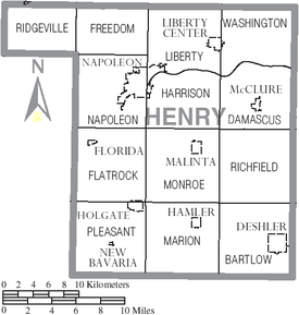
City
- Napoleon (county seat)
Villages
Townships
Unincorporated communities
- Colton
- Elery
- Gallup
- Gerald
- Grelton
- Okolona
- Pleasant Bend
- Ridgeville Corners
- Shunk
- Standley
- Texas
- Westhope
See also
References
- 1 2 "State & County QuickFacts". United States Census Bureau. Retrieved February 8, 2015.
- ↑ "Find a County". National Association of Counties. Retrieved 2011-06-07.
- ↑ "Ohio: Individual County Chronologies". Ohio Atlas of Historical County Boundaries. The Newberry Library. 2007. Retrieved February 14, 2015.
- ↑ Gannett, Henry (1905). The Origin of Certain Place Names in the United States. Govt. Print. Off. p. 155.
- ↑ "2010 Census Gazetteer Files". United States Census Bureau. August 22, 2012. Retrieved February 8, 2015.
- ↑ "County Totals Dataset: Population, Population Change and Estimated Components of Population Change: April 1, 2010 to July 1, 2015". Retrieved July 2, 2016.
- ↑ "U.S. Decennial Census". United States Census Bureau. Retrieved February 8, 2015.
- ↑ "Historical Census Browser". University of Virginia Library. Retrieved February 8, 2015.
- ↑ Forstall, Richard L., ed. (March 27, 1995). "Population of Counties by Decennial Census: 1900 to 1990". United States Census Bureau. Retrieved February 8, 2015.
- ↑ "Census 2000 PHC-T-4. Ranking Tables for Counties: 1990 and 2000" (PDF). United States Census Bureau. April 2, 2001. Retrieved February 8, 2015.
- ↑ "American FactFinder". United States Census Bureau. Retrieved 2008-01-31.
- 1 2 3 "DP-1 Profile of General Population and Housing Characteristics: 2010 Demographic Profile Data". United States Census Bureau. Retrieved 2015-12-27.
- ↑ "Population, Housing Units, Area, and Density: 2010 - County". United States Census Bureau. Retrieved 2015-12-27.
- ↑ "DP02 SELECTED SOCIAL CHARACTERISTICS IN THE UNITED STATES – 2006-2010 American Community Survey 5-Year Estimates". United States Census Bureau. Retrieved 2015-12-27.
- ↑ "DP03 SELECTED ECONOMIC CHARACTERISTICS – 2006-2010 American Community Survey 5-Year Estimates". United States Census Bureau. Retrieved 2015-12-27.
- ↑ "Dave Leip's Atlas of U.S. Presidential Elections". Retrieved 2016-03-26.
- ↑ "Board of County Commissioners". Henry County Ohio Homepage. Retrieved January 3, 2013.
- ↑ "Auditor". www.henrycountyohio.com. Retrieved 2015-11-04.
- ↑ "Clerk of Courts". www.henrycountyohio.com. Retrieved 2015-11-04.
- ↑ "Coroner". www.henrycountyohio.com. Retrieved 2015-11-04.
- ↑ "Engineer". www.henrycountyohio.com. Retrieved 2015-11-04.
- ↑ "Prosecuting Attorney". www.henrycountyohio.com. Retrieved 2015-11-04.
- ↑ "Municipal Court Judge". www.henrycountyohio.com. Retrieved 2015-11-04.
- ↑ "Common Pleas Judge (Probate/General)". www.henrycountyohio.com. Retrieved 2015-11-04.
- ↑ "Common Pleas Judge (Domestic/Juvenile)". www.henrycountyohio.com. Retrieved 2015-11-04.
- ↑ "Recorder". www.henrycountyohio.com. Retrieved 2015-11-04.
- ↑ "Treasurer". www.henrycountyohio.com. Retrieved 2015-11-04.
- ↑ "Sheriff". www.henrycountyohio.com. Retrieved 2015-11-04.
- ↑ FAA Airport Master Record for 7W5 (Form 5010 PDF). Federal Aviation Administration. Effective May 31, 2012.
External links
 |
Williams County | Fulton County | Lucas County | |
| Defiance County | |
Wood County | ||
| ||||
| | ||||
| Putnam County | Hancock County |
Municipalities and communities of Henry County, Ohio, United States | ||
|---|---|---|
| City | | |
| Villages | ||
| Townships | ||
| CDP | ||
| Unincorporated communities | ||
| Footnotes | ‡This populated place also has portions in an adjacent county or counties | |
Coordinates: 41°20′N 84°04′W / 41.33°N 84.07°W