Highmore, South Dakota
| Highmore, South Dakota | |
|---|---|
| City | |
| Motto: "A Great Place To Live, Work, And Play" | |
 Location in Hyde County and the state of South Dakota | |
| Coordinates: 44°31′7″N 99°26′28″W / 44.51861°N 99.44111°WCoordinates: 44°31′7″N 99°26′28″W / 44.51861°N 99.44111°W | |
| Country | United States |
| State | South Dakota |
| County | Hyde |
| Incorporated | 1882[1] |
| Government | |
| • Mayor | Vikki Day |
| Area[2] | |
| • Total | 1.89 sq mi (4.90 km2) |
| • Land | 1.89 sq mi (4.90 km2) |
| • Water | 0 sq mi (0 km2) |
| Elevation | 1,886 ft (575 m) |
| Population (2010)[3] | |
| • Total | 795 |
| • Estimate (2015)[4] | 779 |
| • Density | 420.6/sq mi (162.4/km2) |
| Time zone | Central (CST) (UTC-6) |
| • Summer (DST) | CDT (UTC-5) |
| ZIP code | 57345 |
| Area code(s) | 605 |
| FIPS code | 46-28980[5] |
| GNIS feature ID | 1255553[6] |
| Website | http://highmoresd.govoffice3.com/ |
Highmore is a city in Hyde County, South Dakota, United States. The population was 795 at the 2010 census. It is the county seat of Hyde County.[7]
History
A post office called Highmore has been in operation since 1882.[8] The city was named from its lofty elevation.[9]
Geography
Highmore is located at 44°31′7″N 99°26′28″W / 44.51861°N 99.44111°W (44.518700, -99.441106).[10]
According to the United States Census Bureau, the city has a total area of 1.89 square miles (4.90 km2), all of it land.[2]
Highmore has been assigned the ZIP code 57345 and the FIPS place code 28960.
Demographics
| Historical population | |||
|---|---|---|---|
| Census | Pop. | %± | |
| 1890 | 435 | — | |
| 1900 | 376 | −13.6% | |
| 1910 | 1,084 | 188.3% | |
| 1920 | 1,022 | −5.7% | |
| 1930 | 1,034 | 1.2% | |
| 1940 | 1,136 | 9.9% | |
| 1950 | 1,158 | 1.9% | |
| 1960 | 1,078 | −6.9% | |
| 1970 | 1,173 | 8.8% | |
| 1980 | 1,055 | −10.1% | |
| 1990 | 835 | −20.9% | |
| 2000 | 851 | 1.9% | |
| 2010 | 795 | −6.6% | |
| Est. 2015 | 779 | [11] | −2.0% |
| U.S. Decennial Census[12] 2015 Estimate[4] | |||
2010 census
As of the census[3] of 2010, there were 795 people, 347 households, and 201 families residing in the city. The population density was 420.6 inhabitants per square mile (162.4/km2). There were 393 housing units at an average density of 207.9 per square mile (80.3/km2). The racial makeup of the city was 91.7% White, 6.5% Native American, 0.1% Asian, 0.4% from other races, and 1.3% from two or more races. Hispanic or Latino of any race were 1.9% of the population.
There were 347 households of which 24.8% had children under the age of 18 living with them, 47.3% were married couples living together, 6.9% had a female householder with no husband present, 3.7% had a male householder with no wife present, and 42.1% were non-families. 39.8% of all households were made up of individuals and 20.5% had someone living alone who was 65 years of age or older. The average household size was 2.18 and the average family size was 2.94.
The median age in the city was 47.4 years. 23.1% of residents were under the age of 18; 5.6% were between the ages of 18 and 24; 18.4% were from 25 to 44; 26.2% were from 45 to 64; and 26.8% were 65 years of age or older. The gender makeup of the city was 47.5% male and 52.5% female.
2000 census
As of the census[5] of 2000, there were 851 people, 378 households, and 210 families residing in the city. The population density was 445.3 people per square mile (172.0/km²). There were 432 housing units at an average density of 226.0 per square mile (87.3/km²). The racial makeup of the city was 95.89% White, 3.41% Native American, 0.24% Pacific Islander, and 0.47% from two or more races. Hispanic or Latino of any race were 0.12% of the population.
There were 378 households out of which 26.2% had children under the age of 18 living with them, 45.8% were married couples living together, 6.3% had a female householder with no husband present, and 44.2% were non-families. 41.8% of all households were made up of individuals and 25.1% had someone living alone who was 65 years of age or older. The average household size was 2.15 and the average family size was 2.99.
In the city the population was spread out with 23.1% under the age of 18, 5.6% from 18 to 24, 22.1% from 25 to 44, 21.4% from 45 to 64, and 27.7% who were 65 years of age or older. The median age was 45 years. For every 100 females there were 83.8 males. For every 100 females age 18 and over, there were 79.7 males.
The median income for a household in the city was $29,135, and the median income for a family was $45,469. Males had a median income of $30,227 versus $20,000 for females. The per capita income for the city was $17,309. About 3.3% of families and 8.2% of the population were below the poverty line, including 4.2% of those under age 18 and 18.5% of those age 65 or over.
References
- ↑ "SD Towns" (PDF). South Dakota State Historical Society. Retrieved 2010-02-13.
- 1 2 "US Gazetteer files 2010". United States Census Bureau. Archived from the original on January 24, 2012. Retrieved 2012-06-21.
- 1 2 "American FactFinder". United States Census Bureau. Retrieved 2012-06-21.
- 1 2 "Population Estimates". United States Census Bureau. Retrieved June 12, 2016.
- 1 2 "American FactFinder". United States Census Bureau. Retrieved 2008-01-31.
- ↑ "US Board on Geographic Names". United States Geological Survey. 2007-10-25. Retrieved 2008-01-31.
- ↑ "Find a County". National Association of Counties. Archived from the original on May 10, 2015. Retrieved 2011-06-07.
- ↑ "Hyde County". Jim Forte Postal History. Retrieved 19 March 2015.
- ↑ Chicago and North Western Railway Company (1908). A History of the Origin of the Place Names Connected with the Chicago & North Western and Chicago, St. Paul, Minneapolis & Omaha Railways. p. 84.
- ↑ "US Gazetteer files: 2010, 2000, and 1990". United States Census Bureau. 2011-02-12. Retrieved 2011-04-23.
- ↑ "Annual Estimates of the Resident Population for Incorporated Places: April 1, 2010 to July 1, 2015". Retrieved July 2, 2016.
- ↑ United States Census Bureau. "Census of Population and Housing". Archived from the original on May 11, 2015. Retrieved June 12, 2016.
External links
Municipalities and communities of Hyde County, South Dakota, United States | ||
|---|---|---|
| City | 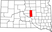 | |
| Unincorporated communities | ||
| Indian reservation | ||
| Footnotes | ‡This populated place also has portions in an adjacent county or counties | |