Hillsview, South Dakota
| Hillsview, South Dakota | |
|---|---|
| Town | |
 Location in McPherson County and the state of South Dakota | |
| Coordinates: 45°40′4″N 99°33′38″W / 45.66778°N 99.56056°WCoordinates: 45°40′4″N 99°33′38″W / 45.66778°N 99.56056°W | |
| Country | United States |
| State | South Dakota |
| County | McPherson |
| Founded | 1887[1] |
| Area[2] | |
| • Total | 0.65 sq mi (1.68 km2) |
| • Land | 0.64 sq mi (1.66 km2) |
| • Water | 0.01 sq mi (0.03 km2) |
| Elevation | 1,850 ft (564 m) |
| Population (2010)[3] | |
| • Total | 3 |
| • Estimate (2013)[4] | 3 |
| • Density | 4.7/sq mi (1.8/km2) |
| Time zone | Central (CST) (UTC-6) |
| • Summer (DST) | CDT (UTC-5) |
| ZIP code | 57437 |
| Area code(s) | 605 |
| FIPS code | 46-29340 |
| GNIS feature ID | 1261018[5] |
Hillsview is a town in McPherson County, South Dakota, United States. The population was 3 at the 2010 census.
The town was so named on account of its lofty elevation.[6]
Geography
According to the United States Census Bureau, the town has a total area of 0.65 square miles (1.68 km2), of which, 0.64 square miles (1.66 km2) of it is land and 0.01 square miles (0.03 km2) is water.[2]
Demographics
| Historical population | |||
|---|---|---|---|
| Census | Pop. | %± | |
| 1930 | 101 | — | |
| 1940 | 160 | 58.4% | |
| 1950 | 68 | −57.5% | |
| 1960 | 44 | −35.3% | |
| 1970 | 19 | −56.8% | |
| 1980 | 9 | −52.6% | |
| 1990 | 4 | −55.6% | |
| 2000 | 3 | −25.0% | |
| 2010 | 3 | 0.0% | |
| Est. 2015 | 3 | [7] | 0.0% |
| U.S. Decennial Census[8] 2013 Estimate[4] | |||
2010 census
As of the census[3] of 2010, there were 3 people, 1 households, and 1 families residing in the town. The population density was 4.7 inhabitants per square mile (1.8/km2). There were 2 housing units at an average density of 3.1 per square mile (1.2/km2). The racial makeup of the town was 100.0% White.
There were 1 households of which 100.0% were married couples living together. 0.0% of all households were made up of individuals. The average household size was 3.00 and the average family size was 3.00.
The median age in the town was 53.5 years. 0.0% of residents were under the age of 18; 33.3% were between the ages of 18 and 24; 0.0% were from 25 to 44; 66.7% were from 45 to 64; and 0.0% were 65 years of age or older. The gender makeup of the town was 33.3% male and 66.7% female.
2000 census
As of the census of 2000, there were 3 people, 1 household, and 1 family residing in the town. The population density was 4.7 people per square mile (1.8/km²). There were 2 housing units at an average density of 3.1 per square mile (1.2/km²). The racial makeup of the town was 100% White.
There was 1 household, a married couple living together. The household size was 3 and the family size was 3.
In the town the population was spread out with 33.3% from 25 to 44, 33.3% from 45 to 64, and 33.3% who were 65 years of age or older. The median age was 64 years. There were 2 men and 1 woman.
References
- ↑ "SD Towns" (PDF). South Dakota State Historical Society. Retrieved 2010-02-13.
- 1 2 "US Gazetteer files 2010". United States Census Bureau. Archived from the original on January 24, 2012. Retrieved 2012-06-21.
- 1 2 "American FactFinder". United States Census Bureau. Retrieved 2012-06-21.
- 1 2 "Population Estimates". United States Census Bureau. Retrieved 2014-07-20.
- ↑ "US Board on Geographic Names". United States Geological Survey. 2007-10-25. Retrieved 2008-01-31.
- ↑ Federal Writers' Project (1940). South Dakota place-names, v.1-3. University of South Dakota. p. 43.
- ↑ "Annual Estimates of the Resident Population for Incorporated Places: April 1, 2010 to July 1, 2015". Retrieved July 2, 2016.
- ↑ United States Census Bureau. "Census of Population and Housing". Archived from the original on May 11, 2015. Retrieved September 21, 2013.
Municipalities and communities of McPherson County, South Dakota, United States | ||
|---|---|---|
| Cities | 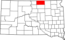 | |
| Towns | ||
| Townships | ||
| Unincorporated community | ||