Hilltop, Texas
| Hilltop, Texas | |
|---|---|
| Census-designated place | |
 | |
| Coordinates: 28°41′34″N 99°10′25″W / 28.69278°N 99.17361°WCoordinates: 28°41′34″N 99°10′25″W / 28.69278°N 99.17361°W | |
| Country | United States |
| State | Texas |
| County | Frio |
| Area | |
| • Total | 1.25 sq mi (3.25 km2) |
| • Land | 1.25 sq mi (3.25 km2) |
| • Water | 0.0 sq mi (0.0 km2) |
| Elevation | 522 ft (159 m) |
| Population (2010) | |
| • Total | 287 |
| • Density | 229/sq mi (88.3/km2) |
| Time zone | Central (CST) (UTC-6) |
| • Summer (DST) | CDT (UTC-5) |
| FIPS code | 48-34130[1] |
| GNIS feature ID | 1852711[2] |
Hilltop is an unincorporated community and census-designated place (CDP) in Frio County, Texas, United States. The population was 287 at the 2010 census.[3]
Geography
Hilltop is located in southern Frio County at 28°41′34″N 99°10′25″W / 28.69278°N 99.17361°W (28.692830, -99.173601).[4] It is bordered to the south by the city of Dilley. Interstate 35 forms the southeastern edge of the CDP, with access from Exits 85 and 86. I-35 leads north 15 miles (24 km) to Pearsall, the Frio County seat, and south past Dilley 18 miles (29 km) to Cotulla.
According to the United States Census Bureau, the Hilltop CDP has a total area of 1.25 square miles (3.25 km2), all of it land.[3]
Demographics
As of the census[1] of 2000, there were 300 people, 83 households, and 75 families residing in the CDP. The population density was 251.5 people per square mile (97.3/km²). There were 101 housing units at an average density of 84.7/sq mi (32.8/km²). The racial makeup of the CDP was 77.00% White, 21.67% from other races, and 1.33% from two or more races. Hispanic or Latino of any race were 90.00% of the population.
There were 83 households out of which 57.8% had children under the age of 18 living with them, 68.7% were married couples living together, 15.7% had a female householder with no husband present, and 9.6% were non-families. 8.4% of all households were made up of individuals and 3.6% had someone living alone who was 65 years of age or older. The average household size was 3.61 and the average family size was 3.81.
In the CDP the population was spread out with 36.7% under the age of 18, 11.3% from 18 to 24, 29.7% from 25 to 44, 15.0% from 45 to 64, and 7.3% who were 65 years of age or older. The median age was 27 years. For every 100 females there were 106.9 males. For every 100 females age 18 and over, there were 118.4 males.
The median income for a household in the CDP was $23,229, and the median income for a family was $23,229. Males had a median income of $16,250 versus $7,045 for females. The per capita income for the CDP was $7,269. About 37.1% of families and 50.0% of the population were below the poverty line, including 73.0% of those under the age of eighteen and 60.0% of those sixty five or over.
Education
Hilltop is served by the Dilley Independent School District.
References
- 1 2 "American FactFinder". United States Census Bureau. Retrieved 2008-01-31.
- ↑ "US Board on Geographic Names". United States Geological Survey. 2007-10-25. Retrieved 2008-01-31.
- 1 2 "Geographic Identifiers: 2010 Demographic Profile Data (G001): Hilltop CDP (Frio County), Texas". U.S. Census Bureau, American Factfinder. Retrieved September 7, 2016.
- ↑ "US Gazetteer files: 2010, 2000, and 1990". United States Census Bureau. 2011-02-12. Retrieved 2011-04-23.
Municipalities and communities of Frio County, Texas, United States | ||
|---|---|---|
| Cities | 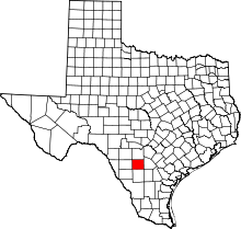 | |
| CDPs | ||
| Ghost towns | ||