Hladaw
| Hladaw လှတော Hla Daw | |
|---|---|
| Town | |
 Hladaw Location in Burma | |
| Coordinates: 22°23′N 95°41′E / 22.383°N 95.683°ECoordinates: 22°23′N 95°41′E / 22.383°N 95.683°E | |
| Country |
|
| Region | Sagaing Region |
| District | Shwebo District |
| Township | Wetlet Township |
| Elevation | 76 m (252 ft) |
| Time zone | MST (UTC+6.30) |
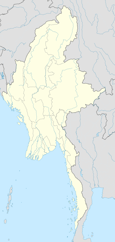
Hladaw (sometimes Hladaw Model Village[1]) is a crossroads village in Wetlet Township of Shwebo District in the Sagaing Region of Burma (Myanmar). It is located on the plains between the Mu River and the Irrawaddy. Hladaw is at the cross roads of the Shwebo–Sagaing road and the Wetlet–Monywa road.[2] Access to the railroad is via Wetlet.[2]
Further reading
- Khin Myo Chit, Daw (1995) Gift of Laughter Parami Books, Rangoon, Burma, OCLC 45076177 (on the picturesque speech of the people of Hladaw, selections of which have been published in the Pyinsa Rupa Magazine.[3])
Notes
- ↑ "Shwebo District hails Union Day, supports National Convention" Myanmar News: The New Light of Myanmar 27 January 2005, last accessed 1 October 2010
- 1 2 "Map of Sagaing Division" Myanmars.net
- ↑ "Daw Khin Myo Chit"
External links
Capital: Sagaing | ||
| Hkamti District |  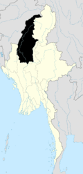 | |
| Kale District | ||
| Katha District | ||
| Mawlaik District | ||
| Monywa District | ||
| Sagaing District | ||
| Shwebo District | ||
| Tamu District | ||
| Yinmabin District | ||
| Naga Self-Administered Zone | ||
This article is issued from Wikipedia - version of the 2/4/2011. The text is available under the Creative Commons Attribution/Share Alike but additional terms may apply for the media files.