Holland, Massachusetts
| Holland, Massachusetts | ||
|---|---|---|
| Town | ||
|
Library | ||
| ||
 Location in Hampden County in Massachusetts | ||
| Coordinates: 42°03′50″N 72°09′28″W / 42.06389°N 72.15778°WCoordinates: 42°03′50″N 72°09′28″W / 42.06389°N 72.15778°W | ||
| Country | United States | |
| State | Massachusetts | |
| County | Hampden | |
| Settled | 1725 | |
| Incorporated | 1783 | |
| Government | ||
| • Type | Open town meeting | |
| Area | ||
| • Total | 13.1 sq mi (33.9 km2) | |
| • Land | 12.4 sq mi (32.1 km2) | |
| • Water | 0.7 sq mi (1.8 km2) | |
| Elevation | 743 ft (226 m) | |
| Population (2000) | ||
| • Total | 2,407 | |
| • Density | 194.2/sq mi (75.0/km2) | |
| Time zone | Eastern (UTC-5) | |
| • Summer (DST) | Eastern (UTC-4) | |
| ZIP code | 01521 | |
| Area code(s) | 413 | |
| FIPS code | 25-30665 | |
| GNIS feature ID | 0618185 | |
| Website | http://town.holland.ma.us | |


Holland is a town in Hampden County, Massachusetts, United States. The population was 2,481 at the 2010 census. It is part of the Springfield, Massachusetts Metropolitan Statistical Area.
Part of the town comprises the census-designated place of Holland.
History
In 1730 the Town of Holland was settled by Joseph Blodgett, whose descendants still live in the town today. The Town was named after Lord Holland, an English statesman who lobbied for independence for the American colonies. The town was incorporated on July 5, 1783, and is rich with history. It separated from Wales which in part, separated from Brimfield back a few years earlier in 1775. The town separated because the town center of Wales was up through a mountain which made it hard to get through.
Holland is located in the southeast corner of Hampden County in Western Massachusetts. The town is twelve point four square miles in area. It contains the Quinnebaug River and the Hamilton Reservoir, one of the largest reservoirs in southern New England. It is nestled amongst two hill ranges, where elevations reach up to 1,100 feet.
Throughout the years, Holland has remained an example of the charm and beauty of the traditional New England village. At different times, it has sustained industries such as farming, the manufacturing of cloth, and brick making. To this day, Holland is known most for its recreational opportunities. There are extensive recreational facilities at the Hamilton Reservoir, which is stocked with trout each year by the state of Massachusetts. There is also a park and a swimming area at the very picturesque Lake Siog.
Unfortunately, the 200-year-old town hall was destroyed in a horrendous fire in December 1995. The new Town Hall was dedicated on July 11, 1998 by Richard Neal, Holland's U.S. Congressman from Springfield.
Geography
According to the United States Census Bureau, the town has a total area of 13.1 square miles (34 km2), of which 12.4 square miles (32 km2) is land and 0.7 square miles (1.8 km2) (5.34%) is water. Holland is bounded on the east by Sturbridge; on the south by Union, Connecticut; on the west by Wales; and on the north by Brimfield. Holland is equidistant between Springfield and Worcester, a distance of approximately 30 miles (48 km). Holland is also within commuting distance (approximately 35 miles) from Hartford, Connecticut, as it is located along the Interstate 84 corridor on the Massachusetts-Connecticut border.
Demographics
| Historical population | ||
|---|---|---|
| Year | Pop. | ±% |
| 1850 | 449 | — |
| 1860 | 419 | −6.7% |
| 1870 | 344 | −17.9% |
| 1880 | 302 | −12.2% |
| 1890 | 201 | −33.4% |
| 1900 | 169 | −15.9% |
| 1910 | 145 | −14.2% |
| 1920 | 153 | +5.5% |
| 1930 | 137 | −10.5% |
| 1940 | 247 | +80.3% |
| 1950 | 377 | +52.6% |
| 1960 | 561 | +48.8% |
| 1970 | 931 | +66.0% |
| 1980 | 1,589 | +70.7% |
| 1990 | 2,185 | +37.5% |
| 2000 | 2,407 | +10.2% |
| 2010 | 2,481 | +3.1% |
| * = population estimate. Source: United States Census records and Population Estimates Program data.[1][2][3][4][5][6][7][8][9][10] | ||
At the 2000 census,[11] there were 2,407 people, 898 households and 668 families residing in the town. The population density was 194.2 per square mile (75.0/km²). There were 1,317 housing units at an average density of 106.3 per square mile (41.0/km²). The racial makeup of the town was 96.97% White, 0.08% Black or African American, 0.83% Native American, 0.25% Asian, 0.04% Pacific Islander, 0.75% from other races, and 1.08% from two or more races. Hispanic or Latino of any race were 1.41% of the population.
There were 898 households of which 37.5% had children under the age of 18 living with them, 62.5% were married couples living together, 7.3% had a female householder with no husband present, and 25.6% were non-families. 18.0% of all households were made up of individuals and 4.9% had someone living alone who was 65 years of age or older. The average household size was 2.68 and the average family size was 3.06.
27.9% of the population were under the age of 18, 5.7% from 18 to 24, 33.1% from 25 to 44, 24.8% from 45 to 64, and 8.6% who were 65 years of age or older. The median age was 37 years. For every 100 females there were 103.5 males. For every 100 females age 18 and over, there were 102.3 males.
The median household income was $52,073 and the median family income was $57,024. Males had a median income of $40,636 and females $29,010. The per capita income was $21,770. About 6.5% of families and 7.3% of the population were below the poverty line, including 9.2% of those under age 18 and 5.3% of those age 65 or over.
Education
Holland Elementary School, serving grades preschool-6, has its own school committee, part of School Union 61. Holland students attend Tantasqua Regional Junior High School (grades 7-8) and Tantasqua Regional High School in Sturbridge. Union 61 and the Tantasqua district share administrators, including the superintendent, and both include Brimfield, Brookfield, Holland, Sturbridge and Wales.
Notable people
- Carl Beane (1952-2012), announcer at Fenway Park from 2003 until his death.
- Joel Crouse (1992– ), American country music singer
- Dick and Rick Hoyt, a father-and-son marathon/triathlon team
- Sean Kennedy (1987- ), two time and current Guinness world record holder, highest trampoline bounce (team) (2012, Atlantic City, and 2014 New York, on NBC Today Show)[12]
- T.J. Kennedy (1991- ), current Guinness world record holder highest trampoline bounce (team) (2014)[12]
- Eric Kennedy (1993- ), current Guinness world record holder highest trampoline bounce (team) (2014)[13]
References
| Wikimedia Commons has media related to Holland, Massachusetts. |
- ↑ "TOTAL POPULATION (P1), 2010 Census Summary File 1". American FactFinder, All County Subdivisions within Massachusetts. United States Census Bureau. 2010.
- ↑ "Massachusetts by Place and County Subdivision - GCT-T1. Population Estimates". United States Census Bureau. Retrieved July 12, 2011.
- ↑ "1990 Census of Population, General Population Characteristics: Massachusetts" (PDF). US Census Bureau. December 1990. Table 76: General Characteristics of Persons, Households, and Families: 1990. 1990 CP-1-23. Retrieved July 12, 2011.
- ↑ "1980 Census of the Population, Number of Inhabitants: Massachusetts" (PDF). US Census Bureau. December 1981. Table 4. Populations of County Subdivisions: 1960 to 1980. PC80-1-A23. Retrieved July 12, 2011.
- ↑ "1950 Census of Population" (PDF). Bureau of the Census. 1952. Section 6, Pages 21-10 and 21-11, Massachusetts Table 6. Population of Counties by Minor Civil Divisions: 1930 to 1950. Retrieved July 12, 2011.
- ↑ "1920 Census of Population" (PDF). Bureau of the Census. Number of Inhabitants, by Counties and Minor Civil Divisions. Pages 21-5 through 21-7. Massachusetts Table 2. Population of Counties by Minor Civil Divisions: 1920, 1910, and 1920. Retrieved July 12, 2011.
- ↑ "1890 Census of the Population" (PDF). Department of the Interior, Census Office. Pages 179 through 182. Massachusetts Table 5. Population of States and Territories by Minor Civil Divisions: 1880 and 1890. Retrieved July 12, 2011.
- ↑ "1870 Census of the Population" (PDF). Department of the Interior, Census Office. 1872. Pages 217 through 220. Table IX. Population of Minor Civil Divisions, &c. Massachusetts. Retrieved July 12, 2011.
- ↑ "1860 Census" (PDF). Department of the Interior, Census Office. 1864. Pages 220 through 226. State of Massachusetts Table No. 3. Populations of Cities, Towns, &c. Retrieved July 12, 2011.
- ↑ "1850 Census" (PDF). Department of the Interior, Census Office. 1854. Pages 338 through 393. Populations of Cities, Towns, &c. Retrieved July 12, 2011.
- ↑ "American FactFinder". United States Census Bureau. Retrieved January 31, 2008.
- 1 2 http://www.today.com/news/brothers-set-guinness-world-record-trampoline-bounce-2D79499940
http://www.guinnessworldrecords.com/world-records/highest-trampoline-bounce-%28team%29 - ↑ http://www.today.com/news/brothers-set-guinness-world-record-trampoline-bounce-2D79499940
External links
Municipalities and communities of Hampden County, Massachusetts, United States | ||
|---|---|---|
| Cities | 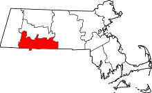 | |
| Towns | ||
| CDPs | ||
| Other villages | ||
| Footnotes | ‡This populated place also has portions in an adjacent county or counties | |