Hornersville, Missouri
| Hornersville | |
| City | |
| Country | United States |
|---|---|
| State | Missouri |
| Region | Dunklin County |
| Coordinates | 36°2′29″N 90°6′48″W / 36.04139°N 90.11333°WCoordinates: 36°2′29″N 90°6′48″W / 36.04139°N 90.11333°W |
| Area | 2.0 km2 (1 sq mi) |
| Population | 663 (2010) |
| Density | 335.3/km2 (868/sq mi) |
| Timezone | CST |
| Postal code | 63855 |
| Area code | 573 |
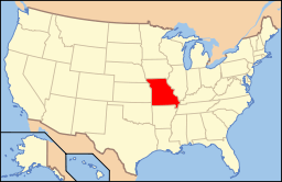 Location of Hornersville in the USA | |
 Location of Hornersville in Dunklin County | |
Hornersville is a city in Dunklin County, Missouri, United States founded in 1840. The population was 663 at the 2010 census.
History
Hornersville was platted in 1842.[1] The city was named for its founder, Dr. William H. Horner, who had settled there in 1832.[2][3] A post office called Hornersville has been in operation since 1875.[4]
Geography
Hornersville is located at 36°2′29″N 90°6′48″W / 36.04139°N 90.11333°W (36.041365, -90.113360).[5] It is the southernmost municipality in the Midwestern United States.
According to the United States Census Bureau, the city has a total area of 0.78 square miles (2.02 km2), all of it land.[6]
Demographics
| Historical population | |||
|---|---|---|---|
| Census | Pop. | %± | |
| 1900 | 240 | — | |
| 1910 | 390 | 62.5% | |
| 1920 | 647 | 65.9% | |
| 1930 | 877 | 35.5% | |
| 1940 | 964 | 9.9% | |
| 1950 | 875 | −9.2% | |
| 1960 | 752 | −14.1% | |
| 1970 | 693 | −7.8% | |
| 1980 | 704 | 1.6% | |
| 1990 | 629 | −10.7% | |
| 2000 | 686 | 9.1% | |
| 2010 | 663 | −3.4% | |
| Est. 2015 | 635 | [7] | −4.2% |
2010 census
As of the census[9] of 2010, there were 663 people, 275 households, and 178 families residing in the city. The population density was 850.0 inhabitants per square mile (328.2/km2). There were 302 housing units at an average density of 387.2 per square mile (149.5/km2). The racial makeup of the city was 97.0% White, 1.2% Native American, 0.3% from other races, and 1.5% from two or more races. Hispanic or Latino of any race were 5.4% of the population.
There were 275 households of which 31.3% had children under the age of 18 living with them, 44.7% were married couples living together, 13.1% had a female householder with no husband present, 6.9% had a male householder with no wife present, and 35.3% were non-families. 33.1% of all households were made up of individuals and 16.4% had someone living alone who was 65 years of age or older. The average household size was 2.41 and the average family size was 3.01.
The median age in the city was 36.4 years. 24% of residents were under the age of 18; 10.7% were between the ages of 18 and 24; 25% were from 25 to 44; 27% were from 45 to 64; and 13.1% were 65 years of age or older. The gender makeup of the city was 50.1% male and 49.9% female.
2000 census
As of the census[10] of 2000, there were 686 people, 296 households, and 182 families residing in the city. The population density was 865.8 people per square mile (335.3/km²). There were 324 housing units at an average density of 408.9/sq mi (158.4/km²). The racial makeup of the city was 97.23% White, 0.58% African American, 0.58% Asian, 1.31% from other races, and 0.29% from two or more races. Hispanic or Latino of any race were 4.23% of the population.
There were 296 households out of which 28.7% had children under the age of 18 living with them, 46.3% were married couples living together, 11.8% had a female householder with no husband present, and 38.2% were non-families. 33.8% of all households were made up of individuals and 17.6% had someone living alone who was 65 years of age or older. The average household size was 2.32 and the average family size was 3.00.
In the city the population was spread out with 26.2% under the age of 18, 7.3% from 18 to 24, 25.2% from 25 to 44, 21.6% from 45 to 64, and 19.7% who were 65 years of age or older. The median age was 40 years. For every 100 females there were 99.4 males. For every 100 females age 18 and over, there were 87.4 males.
The median income for a household in the city was $22,000, and the median income for a family was $26,354. Males had a median income of $28,500 versus $16,875 for females. The per capita income for the city was $11,589. About 22.5% of families and 28.9% of the population were below the poverty line, including 38.1% of those under age 18 and 28.6% of those age 65 or over.
References
- ↑ "Dunklin County Place Names, 1928–1945 (archived)". The State Historical Society of Missouri. Retrieved 29 September 2016.
- ↑ Eaton, David Wolfe (1916). How Missouri Counties, Towns and Streams Were Named. The State Historical Society of Missouri. p. 166.
- ↑ Gannett, Henry (1905). The Origin of Certain Place Names in the United States. Govt. Print. Off. p. 161.
- ↑ "Post Offices". Jim Forte Postal History. Retrieved 29 September 2016.
- ↑ "US Gazetteer files: 2010, 2000, and 1990". United States Census Bureau. 2011-02-12. Retrieved 2011-04-23.
- ↑ "US Gazetteer files 2010". United States Census Bureau. Retrieved 2012-07-08.
- ↑ "Annual Estimates of the Resident Population for Incorporated Places: April 1, 2010 to July 1, 2015". Retrieved July 2, 2016.
- ↑ "Census of Population and Housing". Census.gov. Retrieved June 4, 2015.
- ↑ "American FactFinder". United States Census Bureau. Retrieved 2012-07-08.
- ↑ "American FactFinder". United States Census Bureau. Retrieved 2008-01-31.
Municipalities and communities of Dunklin County, Missouri, United States | ||
|---|---|---|
| Cities | 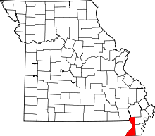 | |
| Village | ||
| Townships | ||
| Unincorporated communities | ||
| Ghost towns | ||
| Footnotes | ‡This populated place also has portions in an adjacent county or counties | |