Houghton, Iowa
| Houghton, Iowa | |
|---|---|
| City | |
 Location of Houghton, Iowa | |
| Coordinates: 40°46′59″N 91°36′45″W / 40.78306°N 91.61250°WCoordinates: 40°46′59″N 91°36′45″W / 40.78306°N 91.61250°W | |
| Country |
|
| State |
|
| County | Lee |
| Area[1] | |
| • Total | 0.31 sq mi (0.80 km2) |
| • Land | 0.31 sq mi (0.80 km2) |
| • Water | 0 sq mi (0 km2) |
| Elevation | 715 ft (218 m) |
| Population (2010)[2] | |
| • Total | 146 |
| • Estimate (2012[3]) | 145 |
| • Density | 471.0/sq mi (181.9/km2) |
| Time zone | Central (CST) (UTC-6) |
| • Summer (DST) | CDT (UTC-5) |
| ZIP code | 52631 |
| Area code(s) | 319 |
| FIPS code | 19-37335 |
| GNIS feature ID | 0457683 |
Houghton is a city in Lee County, Iowa, United States. The population was 146 at the 2010 census. It is part of the Fort Madison–Keokuk, IA-MO Micropolitan Statistical Area.
Geography
Houghton is located at 40°46′59″N 91°36′45″W / 40.78306°N 91.61250°W (40.783009, -91.612605).[4]
According to the United States Census Bureau, the city has a total area of 0.31 square miles (0.80 km2), all of it land.[1]
Economy
The town has more manufacturing jobs than population, which is rare—doubly rare because there are no other towns nearby to supply additional labor. There are a half-dozen plants that account for this, making plastic products, grain storage bins and ready-mix concrete.[5][6] Houghton was once the junction of two rail lines, both now abandoned, which may have something to do with the origin of its industry. Nevertheless, St. Johns Catholic Church is the most substantial building in town.[7]
Demographics
| Historical populations | ||
|---|---|---|
| Year | Pop. | ±% |
| 1970 | 119 | — |
| 1980 | 124 | +4.2% |
| 1990 | 127 | +2.4% |
| 2000 | 130 | +2.4% |
| 2010 | 146 | +12.3% |
| 2014 | 145 | −0.7% |
| 2015 | 144 | −0.7% |
| Source:"American FactFinder". United States Census Bureau. and Iowa Data Center Source: | ||
2010 census
As of the census[2] of 2010, there were 146 people, 62 households, and 47 families residing in the city. The population density was 471.0 inhabitants per square mile (181.9/km2). There were 64 housing units at an average density of 206.5 per square mile (79.7/km2). The racial makeup of the city was 100.0% White.
There were 62 households of which 27.4% had children under the age of 18 living with them, 71.0% were married couples living together, 3.2% had a female householder with no husband present, 1.6% had a male householder with no wife present, and 24.2% were non-families. 21.0% of all households were made up of individuals and 9.7% had someone living alone who was 65 years of age or older. The average household size was 2.35 and the average family size was 2.74.
The median age in the city was 48 years. 19.9% of residents were under the age of 18; 4.8% were between the ages of 18 and 24; 21.2% were from 25 to 44; 33.5% were from 45 to 64; and 20.5% were 65 years of age or older. The gender makeup of the city was 46.6% male and 53.4% female.
2000 census
As of the census[9] of 2000, there were 130 people, 54 households, and 42 families residing in the city. The population density was 431.1 people per square mile (167.3/km²). There were 61 housing units at an average density of 202.3 per square mile (78.5/km²). The racial makeup of the city was 100.00% White, and no people in the city were Hispanic or Latino of any race.
There were 54 households out of which 33.3% had children under the age of 18 living with them, 70.4% were married couples living together, 3.7% had a female householder with no husband present, and 22.2% were non-families. 22.2% of all households were made up of individuals and 13.0% had someone living alone who was 65 years of age or older. The average household size was 2.39 and the average family size was 2.79.
Population spread: 24.6% under the age of 18, 2.3% from 18 to 24, 23.1% from 25 to 44, 29.2% from 45 to 64, and 20.8% who were 65 years of age or older. The median age was 44 years. For every 100 females there were 91.2 males. For every 100 females age 18 and over, there were 96.0 males.
The median income for a household in the city was $47,500, and the median income for a family was $54,375. Males had a median income of $31,042 versus $16,750 for females. The per capita income for the city was $19,203. There were no families and 3.1% of the population living below the poverty line, including no under eighteens and none of those over 64.
References
- 1 2 "US Gazetteer files 2010". United States Census Bureau. Retrieved 2012-05-11.
- 1 2 "American FactFinder". United States Census Bureau. Retrieved 2012-05-11.
- ↑ "Population Estimates". United States Census Bureau. Retrieved 2013-05-23.
- ↑ "US Gazetteer files: 2010, 2000, and 1990". United States Census Bureau. 2011-02-12. Retrieved 2011-04-23.
- ↑
- ↑
- ↑
- ↑ "Census of Population and Housing". Census.gov. Retrieved June 4, 2015.
- ↑ "American FactFinder". United States Census Bureau. Retrieved 2008-01-31.
External links
Municipalities and communities of Lee County, Iowa, United States | ||
|---|---|---|
| Cities | 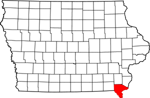 | |
| Townships | ||
| CDP | ||
| Other unincorporated communities | ||