Hrib–Loški Potok
| Hrib–Loški Potok Hrib (until 1953) | |
|---|---|
|
Postcard of Hrib–Loški Potok | |
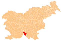
 Hrib–Loški Potok Location in Slovenia | |
| Coordinates: 45°42′5.49″N 14°35′24.26″E / 45.7015250°N 14.5900722°ECoordinates: 45°42′5.49″N 14°35′24.26″E / 45.7015250°N 14.5900722°E | |
| Country |
|
| Traditional region | Lower Carniola |
| Statistical region | Southeast Slovenia |
| Municipality | Loški Potok |
| Area | |
| • Total | 9.56 km2 (3.69 sq mi) |
| Elevation | 771.5 m (2,531.2 ft) |
| Population (2002) | |
| • Total | 353 |
| [1] | |

Hrib–Loški Potok (pronounced [ˈxɾiːb ˈloːʃki ˈpɔːtɔk]; Slovene: Hrib - Loški potok) is a village in the Municipality of Loški Potok in southern Slovenia. It is also the administrative centre of the municipality. The area is part of the traditional region of Lower Carniola and is now included in the Southeast Slovenia Statistical Region.[2]
Name
The name of the settlement was changed from Hrib to Hrib - Loški potok in 1953.[3]
Church
The parish church in the settlement is dedicated to Saint Leonard and belongs to the Roman Catholic Archdiocese of Ljubljana. It was built in 1670 on the site of a 14th-century building. It has an octagonal floor plan and a large belfry.[4] A second church in the settlement is dedicated to Saint Barbara and dates to the 17th century.[5]
References
- ↑ Statistical Office of the Republic of Slovenia
- ↑ Loški Potok municipal site
- ↑ Spremembe naselij 1948–95. 1996. Database. Ljubljana: Geografski inštitut ZRC SAZU, DZS.
- ↑ Slovenian Ministry of Culture register of national heritage reference number ešd 2009
- ↑ Slovenian Ministry of Culture register of national heritage reference number ešd 2010
External links
| Settlements | Administrative centre: Hrib–Loški Potok
|  | ||||||
|---|---|---|---|---|---|---|---|---|