Hudson, Michigan
| Hudson, Michigan | |
|---|---|
| City | |
|
Main Street, facing east. | |
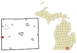 Location of Hudson, Michigan | |
| Coordinates: 41°51′23″N 84°21′4″W / 41.85639°N 84.35111°W | |
| Country | United States |
| State | Michigan |
| County | Lenawee |
| Area[1] | |
| • Total | 2.20 sq mi (5.70 km2) |
| • Land | 2.19 sq mi (5.67 km2) |
| • Water | 0.01 sq mi (0.03 km2) |
| Elevation | 915 ft (279 m) |
| Population (2010)[2] | |
| • Total | 2,307 |
| • Estimate (2012[3]) | 2,273 |
| • Density | 1,053.4/sq mi (406.7/km2) |
| Time zone | Eastern (EST) (UTC-5) |
| • Summer (DST) | EDT (UTC-4) |
| ZIP code | 49247 |
| Area code(s) | 517 |
| FIPS code | 26-39720[4] |
| GNIS feature ID | 0628761[5] |

Hudson is a city in Lenawee County in the U.S. state of Michigan. The population was 2,307 at the 2010 census. The city is located within Hudson Township, but is politically independent.
History
Hudson was named for Dr. Daniel Hudson, an original landowner.[6]
Geography
According to the United States Census Bureau, the city has a total area of 2.20 square miles (5.70 km2), of which 2.19 square miles (5.67 km2) is land and 0.01 square miles (0.03 km2) is water.[1]
Demographics
| Historical population | |||
|---|---|---|---|
| Census | Pop. | %± | |
| 1860 | 1,489 | — | |
| 1870 | 2,450 | 64.5% | |
| 1880 | 2,254 | −8.0% | |
| 1890 | 2,178 | −3.4% | |
| 1900 | 2,403 | 10.3% | |
| 1910 | 2,178 | −9.4% | |
| 1920 | 2,464 | 13.1% | |
| 1930 | 2,361 | −4.2% | |
| 1940 | 2,426 | 2.8% | |
| 1950 | 2,773 | 14.3% | |
| 1960 | 2,546 | −8.2% | |
| 1970 | 2,618 | 2.8% | |
| 1980 | 2,545 | −2.8% | |
| 1990 | 2,580 | 1.4% | |
| 2000 | 2,499 | −3.1% | |
| 2010 | 2,307 | −7.7% | |
| Est. 2015 | 2,241 | [7] | −2.9% |
2010 census
As of the census[2] of 2010, there were 2,307 people, 861 households, and 599 families residing in the city. The population density was 1,053.4 inhabitants per square mile (406.7/km2). There were 1,019 housing units at an average density of 465.3 per square mile (179.7/km2). The racial makeup of the city was 96.2% White, 0.7% African American, 0.5% Native American, 0.3% Asian, 0.3% from other races, and 1.9% from two or more races. Hispanic or Latino of any race were 4.2% of the population.
There were 861 households of which 40.3% had children under the age of 18 living with them, 48.7% were married couples living together, 15.6% had a female householder with no husband present, 5.3% had a male householder with no wife present, and 30.4% were non-families. 27.1% of all households were made up of individuals and 9.2% had someone living alone who was 65 years of age or older. The average household size was 2.63 and the average family size was 3.16.
The median age in the city was 33.4 years. 29.5% of residents were under the age of 18; 9.2% were between the ages of 18 and 24; 25.7% were from 25 to 44; 25% were from 45 to 64; and 10.7% were 65 years of age or older. The gender makeup of the city was 49.0% male and 51.0% female.
2000 census
In 2000 the population density was 1,155.4 per square mile (446.7/km²). There were 1,019 housing units at an average density of 471.1 per square mile (182.1/km²). The racial makeup of the city was 96.28% White, 0.32% African American, 0.20% Native American, 0.64% Asian, 0.84% from other races, and 1.72% from two or more races. Hispanic or Latino of any race were 2.16% of the population.
There were 929 households out of which 38.9% had children under the age of 18 living with them, 52.6% were married couples living together, 14.1% had a female householder with no husband present, and 29.9% were non-families. 24.1% of all households were made up of individuals and 10.1% had someone living alone who was 65 years of age or older. The average household size was 2.65 and the average family size was 3.15.
In the city the population was spread out with 29.7% under the age of 18, 9.4% from 18 to 24, 30.8% from 25 to 44, 19.2% from 45 to 64, and 10.9% who were 65 years of age or older. The median age was 32 years. For every 100 females there were 91.9 males. For every 100 females age 18 and over, there were 84.4 males.
The median income for a household in the city was $41,122, and the median income for a family was $43,011. Males had a median income of $32,946 versus $23,679 for females. The per capita income for the city was $16,340. About 4.9% of families and 8.0% of the population were below the poverty line, including 8.2% of those under age 18 and 7.2% of those age 65 or over.
Media
Newspaper
- Hudson Post-Gazette
Radio
- WBZV 102.5FM
Transportation
References
- 1 2 "US Gazetteer files 2010". United States Census Bureau. Retrieved 2012-11-25.
- 1 2 "American FactFinder". United States Census Bureau. Retrieved 2012-11-25.
- ↑ "Population Estimates". United States Census Bureau. Retrieved 2013-06-03.
- ↑ "American FactFinder". United States Census Bureau. Retrieved 2008-01-31.
- ↑ "US Board on Geographic Names". United States Geological Survey. 2007-10-25. Retrieved 2008-01-31.
- ↑ Gannett, Henry (1905). The Origin of Certain Place Names in the United States. Govt. Print. Off. p. 162.
- ↑ "Annual Estimates of the Resident Population for Incorporated Places: April 1, 2010 to July 1, 2015". Retrieved July 2, 2016.
- ↑ "Census of Population and Housing". Census.gov. Retrieved June 4, 2015.
External links
- Official site
- Lenawee County government site
- Lenawee County Visitors Bureau
- The Daily Telegram
- Complete text of History of Lenawee County published in 1909 by the Western Historical Society
Municipalities and communities of Lenawee County, Michigan, United States | ||
|---|---|---|
| Cities | 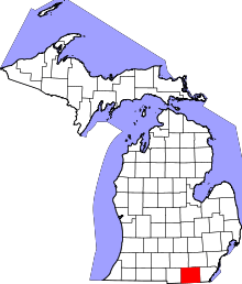 | |
| Villages | ||
| Charter townships | ||
| General law townships | ||
| CDPs | ||
| Other unincorporated communities | ||
| Footnotes | ‡This populated place also has portions in an adjacent county or counties | |
Coordinates: 41°51′18″N 84°21′14″W / 41.85500°N 84.35389°W