Hunnewell, Missouri
| Hunnewell, Missouri | |
|---|---|
| City | |
 Location of Hunnewell, Missouri | |
| Coordinates: 39°40′1″N 91°51′34″W / 39.66694°N 91.85944°WCoordinates: 39°40′1″N 91°51′34″W / 39.66694°N 91.85944°W | |
| Country | United States |
| State | Missouri |
| County | Shelby |
| Area[1] | |
| • Total | 0.62 sq mi (1.61 km2) |
| • Land | 0.62 sq mi (1.61 km2) |
| • Water | 0 sq mi (0 km2) |
| Elevation | 751 ft (229 m) |
| Population (2010)[2] | |
| • Total | 184 |
| • Estimate (2012[3]) | 181 |
| • Density | 296.8/sq mi (114.6/km2) |
| Time zone | Central (CST) (UTC-6) |
| • Summer (DST) | CDT (UTC-5) |
| ZIP code | 63443 |
| Area code(s) | 573 |
| FIPS code | 29-33760[4] |
| GNIS feature ID | 0719996[5] |
Hunnewell is a city in Shelby County, Missouri, United States. The population was 184 at the 2010 census.
History
Hunnewell was platted in 1857.[6] It was named for Boston financer and railroad promoter H. H. Hunnewell.[7]
Geography
Hunnewell is located at 39°40′1″N 91°51′34″W / 39.66694°N 91.85944°W (39.666976, -91.859330).[8]
According to the United States Census Bureau, the city has a total area of 0.62 square miles (1.61 km2), all of it land.[1]
Demographics
| Historical population | |||
|---|---|---|---|
| Census | Pop. | %± | |
| 1870 | 327 | — | |
| 1880 | 424 | 29.7% | |
| 1890 | 427 | 0.7% | |
| 1900 | 473 | 10.8% | |
| 1910 | 406 | −14.2% | |
| 1920 | 348 | −14.3% | |
| 1930 | 342 | −1.7% | |
| 1940 | 312 | −8.8% | |
| 1950 | 293 | −6.1% | |
| 1960 | 284 | −3.1% | |
| 1970 | 304 | 7.0% | |
| 1980 | 235 | −22.7% | |
| 1990 | 219 | −6.8% | |
| 2000 | 227 | 3.7% | |
| 2010 | 184 | −18.9% | |
| Est. 2015 | 179 | [9] | −2.7% |
2010 census
As of the census[2] of 2010, there were 184 people, 82 households, and 59 families residing in the city. The population density was 296.8 inhabitants per square mile (114.6/km2). There were 97 housing units at an average density of 156.5 per square mile (60.4/km2). The racial makeup of the city was 98.9% White, 0.5% Native American, and 0.5% from two or more races. Hispanic or Latino of any race were 2.2% of the population.
There were 82 households of which 31.7% had children under the age of 18 living with them, 48.8% were married couples living together, 12.2% had a female householder with no husband present, 11.0% had a male householder with no wife present, and 28.0% were non-families. 23.2% of all households were made up of individuals and 11% had someone living alone who was 65 years of age or older. The average household size was 2.24 and the average family size was 2.59.
The median age in the city was 41 years. 19.6% of residents were under the age of 18; 10.3% were between the ages of 18 and 24; 24.4% were from 25 to 44; 27.7% were from 45 to 64; and 17.9% were 65 years of age or older. The gender makeup of the city was 53.3% male and 46.7% female.
2000 census
As of the census[4] of 2000, there were 227 people, 95 households, and 62 families residing in the city. The population density was 358.3 people per square mile (139.1/km²). There were 112 housing units at an average density of 176.8 per square mile (68.6/km²). The racial makeup of the city was 90.31% White, 8.37% African American, and 1.32% from two or more races. Hispanic or Latino of any race were 0.44% of the population.
There were 95 households out of which 31.6% had children under the age of 18 living with them, 49.5% were married couples living together, 12.6% had a female householder with no husband present, and 33.7% were non-families. 30.5% of all households were made up of individuals and 8.4% had someone living alone who was 65 years of age or older. The average household size was 2.39 and the average family size was 3.03.
In the city the population was spread out with 26.4% under the age of 18, 6.2% from 18 to 24, 30.0% from 25 to 44, 20.3% from 45 to 64, and 17.2% who were 65 years of age or older. The median age was 38 years. For every 100 females there were 110.2 males. For every 100 females age 18 and over, there were 106.2 males.
The median income for a household in the city was $24,861, and the median income for a family was $31,429. Males had a median income of $28,750 versus $22,500 for females. The per capita income for the city was $12,985. About 13.2% of families and 15.9% of the population were below the poverty line, including 23.9% of those under the age of eighteen and 10.0% of those sixty five or over.
References
- 1 2 "US Gazetteer files 2010". United States Census Bureau. Archived from the original on January 24, 2012. Retrieved 2012-07-08.
- 1 2 "American FactFinder". United States Census Bureau. Retrieved 2012-07-08.
- ↑ "Population Estimates". United States Census Bureau. Archived from the original on June 17, 2013. Retrieved 2013-05-30.
- 1 2 "American FactFinder". United States Census Bureau. Archived from the original on September 11, 2013. Retrieved 2008-01-31.
- ↑ "US Board on Geographic Names". United States Geological Survey. 2007-10-25. Retrieved 2008-01-31.
- ↑ Eaton, David Wolfe (1918). How Missouri Counties, Towns and Streams Were Named. The State Historical Society of Missouri. p. 365.
- ↑ Gannett, Henry (1905). The Origin of Certain Place Names in the United States. Govt. Print. Off. p. 163.
- ↑ "US Gazetteer files: 2010, 2000, and 1990". United States Census Bureau. 2011-02-12. Retrieved 2011-04-23.
- ↑ "Annual Estimates of the Resident Population for Incorporated Places: April 1, 2010 to July 1, 2015". Retrieved July 2, 2016.
- ↑ "Census of Population and Housing". Census.gov. Archived from the original on May 11, 2015. Retrieved June 4, 2015.
External links
- Historic maps of Hunnewell in the Sanborn Maps of Missouri Collection at the University of Missouri
Municipalities and communities of Shelby County, Missouri, United States | ||
|---|---|---|
| Cities | 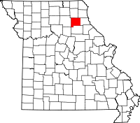 | |
| Villages | ||
| Unincorporated communities | ||