Indian Point Township, Knox County, Illinois
| Indian Point Township | |
|---|---|
| Township | |
 Location in Knox County | |
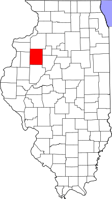 Knox County's location in Illinois | |
| Coordinates: 40°45′31″N 90°23′34″W / 40.75861°N 90.39278°WCoordinates: 40°45′31″N 90°23′34″W / 40.75861°N 90.39278°W | |
| Country |
|
| State |
|
| County | Knox |
| Established | November 2, 1852 |
| Area | |
| • Total | 36.09 sq mi (93.5 km2) |
| • Land | 36.08 sq mi (93.4 km2) |
| • Water | 0.01 sq mi (0.03 km2) 0.03% |
| Elevation | 712 ft (217 m) |
| Population (2010) | |
| • Total | 1,554 |
| • Density | 43.1/sq mi (16.6/km2) |
| Time zone | CST (UTC-6) |
| • Summer (DST) | CDT (UTC-5) |
| ZIP codes | 61410, 61458, 61474 |
| GNIS feature ID | 0429167 |
Indian Point Township is one of twenty-one townships in Knox County, Illinois, USA. As of the 2010 census, its population was 1,554 and it contained 716 housing units.[1]
Geography
According to the 2010 census, the township has a total area of 36.09 square miles (93.5 km2), of which 36.08 square miles (93.4 km2) (or 99.97%) is land and 0.01 square miles (0.026 km2) (or 0.03%) is water.[1]
Cities, towns, villages
- Abingdon (south third)
- St. Augustine
Cemeteries
The township contains these two cemeteries: Boydston-Dawdy and Hunt.
Airports and landing strips
- Murks Strip
- Wolfords Airport
School districts
- Abingdon Community Unit School District 217
- Avon Community Unit School District 176
Political districts
- Illinois's 17th congressional district
- State House District 74
- State Senate District 37
References
- "Indian Point Township, Knox County, Illinois". Geographic Names Information System. United States Geological Survey. Retrieved 2010-02-25.
- United States Census Bureau 2009 TIGER/Line Shapefiles
- United States National Atlas
- 1 2 "Population, Housing Units, Area, and Density: 2010 - County -- County Subdivision and Place -- 2010 Census Summary File 1". United States Census. Retrieved 2013-05-28.
External links
 |
Floyd Township, Warren County | Cedar Township | Orange Township | |
| Berwick Township, Warren County | |
Chestnut Township | ||
| ||||
| | ||||
| Greenbush Township, Warren County | Union Township, Fulton County |
Municipalities and communities of Knox County, Illinois, United States | ||
|---|---|---|
| Cities | ||
| Villages | ||
| Townships | ||
| CDPs | ||
| Other unincorporated communities | ||
| Ghost towns | ||
| Footnotes | ‡This populated place also has portions in an adjacent county or counties | |
This article is issued from Wikipedia - version of the 9/9/2016. The text is available under the Creative Commons Attribution/Share Alike but additional terms may apply for the media files.