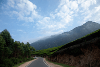
Indian road network
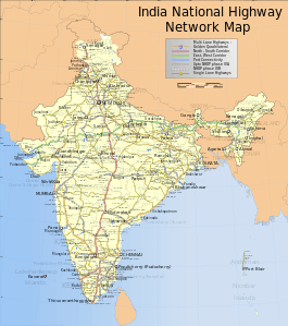
India has a road network of over 5,472,144 kilometres (3,400,233 mi) as on 31 March 2015, the second largest road network in the world. At 1.66 km of roads per square kilometre of land, the quantitative density of India's road network is higher than that of Japan (0.91) and the United States (0.67), and far higher than that of China (0.46), Brazil (0.18) or Russia (0.08).[1] However, qualitatively India's roads are a mix of modern highways and narrow, unpaved roads, and are being improved.[2] As on 31 March 2015, 61.05% of Indian roads were paved.[1]
Adjusted for its large population, India has less than 3.8 kilometres of roads per 1000 people, including all its paved and unpaved roads. In terms of quality, all season, 4 or more lane highways, India has less than 0.07 kilometres of highways per 1000 people, as of 2010. These are some of the lowest road and highway densities in the world. For context, United States has 21 kilometres of roads per 1000 people, while France about 15 kilometres per 1000 people – predominantly paved and high quality in both cases. In terms of all season, 4 or more lane highways, developed countries such as United States and France have a highway density per 1000 people that is over 15 times as India.
India in its past did not allocate enough resources to build or maintain its road network.[2] This has changed since 1995, with major efforts currently underway to modernize the country's road infrastructure.[3]

As of April 2015, India had completed and placed in use over 24,000 kilometres of recently built 4 or 6-lane highways connecting many of its major manufacturing centres, commercial and cultural centres.[4][5] The rate of new highway construction across India accelerated after 1999, but has slowed in recent years. Policy delays and regulatory blocks reduced the rate of highway construction awards to just 500 kilometers of new road projects in 2013.[6] Major projects are being implemented under the National Highways Development Project, a government initiative. Private builders and highway operators are also implementing major projects - for example, the Yamuna Expressway between Delhi and Agra was completed ahead of schedule and within budget,[7] while the KMP Expressway started in 2006 is far behind schedule, over budget and incomplete.[8]
According to 2009 estimates by Goldman Sachs, India will need to invest US$1.7 trillion on infrastructure projects before 2020 to meet its economic needs, a part of which would be in upgrading India's road network.[9] The Government of India is attempting to promote foreign investment in road projects.[9][10][11] Foreign participation in Indian road network construction has attracted 45 international contractors and 40 design/engineering consultants, with Malaysia, South Korea, United Kingdom and United States being the largest players.[12]
History
The first evidence of road development in the Indian subcontinent can be traced back to approximately 2800 BC from the ancient cities of Harrapa and Mohenjodaro of the Indus Valley Civilization. Ruling emperors and monarchs of ancient India had constructed roads to connect the cities. Archaeological excavations give us fresh information about road connectivity in ancient India. The Grand Trunk Road was built by Sher Shah Suri in 1540-45 connecting Sonargaon near Dhaka in Bangladesh with Peshawar in modern-day Pakistan linking several cities from in India.[15]
India inherited a poor road network infrastructure at the time of its independence in 1947. Beyond that, between 1947 and 1988, India witnessed no new major projects, and the roads were poorly maintained. Predominantly all roads were single lane, and most were unpaved. India had no expressways, and less than 200 kilometers of 4-lane highways. In 1988, an autonomous entity called the National Highways Authority of India was established in India by an Act of Parliament, and came into existence on 15 June 1989. The Act empowered this entity to develop, maintain and manage India's road network through National Highways. However, even though the Authority was created in 1988, not much happened till India introduced widespread economic liberalization in the early 1990s. Since 1995, the authority has privatized road network development in India, and by May 2014 delivered a state wise lengths of over 92,851 kilometers of National Highways, of which 22,757 kilometers are 4-lane or 6-lane modern highways.[5][16][17]
Overview

Road transport is vital to India's economy. It enables the country's transportation sector to contribute 4.7 percent towards India’s gross domestic product, in comparison to railways that contributed 1 percent, in 2009–2010. Road transport has gained in importance over the years despite significant barriers and inefficiencies in inter-state freight and passenger movement compared to railways and air. The government of India considers road network as critical to the country's development, social integration and security needs of the country.[18] India's road network carries over 65 percent of its freight and about 85 percent of passenger traffic.[19]
Indian road network is administered by various government authorities, given India's federal form of government. The following table shows the total length of India's road network by type of road as on 31 March 2015.[1]
| Road classification | Authority responsible | Length (km) | Share of network length |
|---|---|---|---|
| National Highways | Ministry of Road Transport and Highways | 97,991 | 1.79 % |
| State Highways | Public Works Department of State/Union Territory | 167,109 | 3.05 % |
| Other PWD roads | Public Works Department of State/Union Territory | 1,101,178 | 20.12 % |
| Rural roads | Panchayats, JRY and PMGSY | 3,337,255 | 61 % |
| Urban roads | Local governments and municipalities | 467,106 | 8.54 % |
| Project roads | Various State/Union territory government departments, and SAIL, NMDC and BRO | 301,505 | 5.50 % |
| Total | N/A | 5,472,144 | 100 % |
Statistics

In general, roads in India are primarily bitumen-based macadamised roads. However, a few of the National Highways have concrete roads too. In some locations, such as in Kanpur, British-built concrete roads are still in use. Concrete roads were less popular prior to 1990s because of low availability of cement then. However, with large supplies of cement in the country and the virtues of concrete roads, they are gaining popularity. Concrete roads are durable, weather-proof and require lower maintenance compared to bituminous roads. Moreover, new concrete pavement technology has developed such as cool pavement, quiet pavement and permeable pavement, which has rendered it more attractive and eco-friendly.
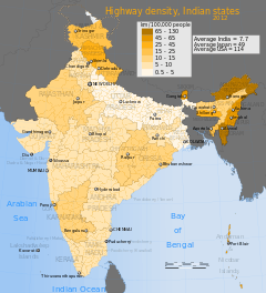
The National Highways are the backbone of the road infrastructure and the major roads in India. They carry most of India's freight and passenger traffic. State highways and major district roads constitute the secondary and interconnecting roads in India. The sortable table below lists national highway density in India per state or union territory.[20][21] Included for context and comparison are major road density of several developed economies.[22][23]
| State / Union Territory | National Highway Length, kilometres | Kilometers per 1000 people | National Highway Numbers |
|---|---|---|---|
| Andaman and Nicobar Islands | 300 | 0.843 | 223 |
| Andhra Pradesh | 4,537 | 0.06 | 4, 5, 7, 9, 16, 18, 18A, 43, 63, 202, 205, 214, 214A, 219, 221, 222 & 234 |
| Arunachal Pradesh | 1,992 | 1.816 | 52, 52A, 153, 229, 52B Ext. & 37 Ext. |
| Assam | 2,836 | 0.106 | 31, 31B, 31C, 36, 37, 37A, 38, 39, 44, 51, 52, 52A, 52B, 53, 54, 61, 62,151,152,153 &154 |
| Bihar | 3,642 | 0.044 | 2, 2C, 19, 28, 28A, 28B, 30, 30A, 31, 57, 57A, 77, 80, 81, 82, 83, 84, 85, 98, 99, 101, 102, 103, 104, 105, 106, 107 & 110 |
| Chandigarh | 24 | 0.027 | 21 |
| Chhattisgarh | 2,184 | 0.105 | 6, 12A, 16, 43, 78, 200,202, 216, 217, 111, & 221 |
| Dadra and Nagar Haveli | 0 | 0 | |
| Daman and Diu | 0 | 0 | |
| Delhi | 72 | 0.005 | 1, 2, 8, 10 & 24 |
| Goa | 269 | 0.2 | 4A, 17, 17A & 17B |
| Gujarat | 3,245 | 0.064 | NE-I, 6, 8, 8A, 8B, 8C, 8D, 8E, 14, 15, 59, 113 & 228 |
| Haryana | 1,512 | 0.072 | 1, 2, 8, 10, 21A, 22, 64, 65, 71, 71A, 72, 73, 73A, 71B & NE-II |
| Himachal Pradesh | 1,409 | 0.232 | 1A, 20, 20A, 21, 21A, 22, 70, 72, 72B, 88 & 73A |
| Jammu & Kashmir | 1,245 | 0.123 | 1A, 1B, 1C & 1D |
| Jharkhand | 1,805 | 0.067 | 2, 6, 23, 31, 32, 33, 75, 78, 80, 98, 99 & 100 |
| Karnataka | 4,396 | 0.083 | 4, 4A, 7, 9, 13, 17, 48, 63, 67, 206, 207,209, 212, 218 & 234 |
| Kerala | 1,457 | 0.046 | 17, 47, 47A, 47C, 49, 208, 212, 213, & 220 |
| Lakshadweep | 0 | 0 | |
| Madhya Pradesh | 4,670 | 0.077 | 3, 7, 12, 12A, 25, 26, 26A, 27, 59, 59A, 69, 75, 76, 78, 86 & 92 |
| Maharashtra | 4,176 | 0.043 | 3, 4, 4B, 4C, 6, 7, 8, 9, 13, 16, 17, 50, 69, 204, 211 & 222 |
| Manipur | 959 | 0.418 | 39, 53, 150 & 155 |
| Meghalaya | 810 | 0.349 | 40, 44, 51 & 62 |
| Mizoram | 927 | 1.044 | 44A, 54, 54A, 54B, 150 & 154 |
| Nagaland | 494 | 0.248 | 36, 39, 61, 150 & 155 |
| Orissa | 3,704 | 0.101 | 5, 5A, 6, 23, 42, 43, 60, 75, 200, 201, 203, 203A, 215, 217 & 224 |
| Puducherry | 53 | 0.054 | 45A & 66 |
| Punjab | 1,557 | 0.064 | 1, 1A, 10, 15, 20, 21, 22, 64, 70, 71, 72 & 95 |
| Rajasthan | 5,585 | 0.099 | 3, 8, 11, 11A, 11B, 11C, 12, 14, 15, 65, 71B, 76, 79, 79A, 89, 90, 113, 112, 114, 116, 148D, 458, 758 & 58 |
| Sikkim | 62 | 0.115 | 31A |
| Tamil Nadu | 4,832 | 0.077 | 4, 5, 44, 7A, 45, 45A, 45B, 45C, 46, 47, 47B, 49, 66, 67, 68, 205, 207, 208, 209, 210, 219, 220, 226, 226E, 227, 230 & 234 |
| Tripura | 400 | 0.125 | 44 & 44A |
| Uttarakhand | 2,042 | 0.241 | 58, 72, 72A, 72B,73, 74, 87, 94, 108, 109, 123, 119, 121, 87 Ext. & 125 |
| Uttar Pradesh | 6,774 | 0.041 | 2, 2A, 3, 7, 11, 12A, 19, 24, 24A, 24B, 25, 25A, 26, 27, 28, 28B, 28C, 29, 56, 56A, 56B, 58, 72A, 73, 74, 75, 76, 86, 87, 91, 91A, 92, 93, 96, 97, 119, 231, 232, 232A 233, 235 & NE-II |
| West Bengal | 2,578 | 0.032 | 2, 2B, 2B Ext., 6, 31, 31A, 31C, 31D. 32, 34, 35, 41, 55, 60, 60A, 80, 81 & 117 |
| India | 70,548 | 0.069 | |
Roads
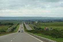
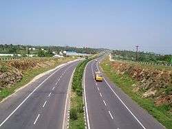
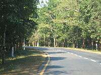
Expressways

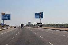
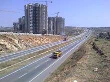
Expressways make up approximately 1,208 km (751 mi) of India's road network, as of 2013.[24][25] These high-speed roads are four-lane or six-lane, predominantly access controlled. The 165 kilometer Yamuna Expressway, India's longest six-laned controlled-access opened on 9 August 2012.[26]
While the start of several expressway projects such as the Ganga Expressway have been delayed for 3 or more years, because of litigation and bureaucratic procedures, India expects another 3,530 kilometres of expressways to come up by 2014 from the projects under construction. The government has drawn up a target to lay 18,637 kilometre network of brand new expressways by 2022.[27] Most of the existing expressways in India are toll roads.[25]
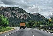
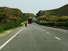
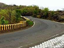
National Highways
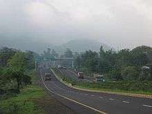
The main highways running through the length and breadth of the country connecting major ports, state capitals, large industrial and tourist centres, etc. National Highways in India are designated as NH followed by the highway number. Indian national highways are further classified based on the width of carriageway of the highway. As of March 2012, India had completed and placed in use the following newly built highways:[4]
- 5,846 kilometers of its 4-lane Golden Quadrilateral highway,
- 6,310 kilometres of its 4-lane North–South and East–West Corridor highway,
- 353 kilometres of 4-lane port connectivity highways,
- 4,553 kilometres of 4-lane inter-capital highways,
- 961 kilometres of 4-lane bypass and other national highways.
The above 17,700 kilometres of highways connect most of the major manufacturing centers, commercial and cultural cities of India.[28] The National Highways Authority of India (NHAI) is the authority responsible for the development, maintenance and management of National Highways entrusted to it. The NHAI is undertaking the developmental activities under National Highways Development Project (NHDP) in 5 phases. The NHAI is also responsible for implementing other projects on National Highways, primarily road connectivity to major ports in India.
As of June 2012, under Phase I, II, III and V of India's national effort has already finished and put in use about 18,000 kilometers of 4/6 lane highways. The country is in process of building an additional 33,441 kilometers of 4 to 6 lanes, international quality highways throughout India. Of this target, about 13,700 kilometers of modern highways were under implementation in June 2012, and about 18,000 kilometers of highways have been identified for contract award.[5] India road building rate has accelerated in recent years and averaged about 11 kilometers per day in second half of 2011. The country targets to build 600 kilometers of modern roads every month through 2014.
| Lanes | Length (km) | Percentage |
|---|---|---|
| Single Lane / Intermediate lane | 18,350 | 26% |
| Double lane | 36031 | 51% |
| Four Lane/Six lane/Eight Lane | 16,553 | 23% |
| Total | 70,934 | 100% |
State Highways
State Governments have the authority and responsibility to build road networks and state highways. Independent of the NHDP program, state governments have been implementing a number of state highway projects since 2000. By 2010, state highway projects worth $1.7 billion had been completed, and an additional $11.4 billion worth of projects were under implementation.[30] The State Highways provide linkages with the National Highways, district headquarters, important towns, tourist centers and minor ports and carry the traffic along major centers within the state. Their total length is about 137,712 km.[31]
Major District Roads
These are important roads within a district connecting areas of production with markets and connecting these with each other or with the State Highways & National Highways. It also connects Taluka headquarters and rural areas to District headquarters within the state.
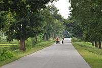
Rural Roads
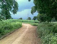
The rural roads in India forms a substantial portion of the Indian road network. These roads are in poor shape, affecting the rural population's quality of life and Indian farmer's ability to transfer produce to market post-harvest. Over 30 percent of Indian farmer's harvest spoils post-harvest because of the poor infrastructure. Many rural roads are of poor quality, potholed, and unable to withstand the loads of heavy farm equipment. These roads are also far from all season, good quality 2-lane or 4-lane highways, making economic resource flow slow, and logistical costs between different parts of India one of the highest in the world. For the development of these rural roads, Pradhan Mantri Gram Sadak Yojana (or "Prime Minister Rural Roads Scheme"), was launched in December 2000 by the Indian government to provide connectivity to unconnected rural habitations. The scheme envisions that these roads will be constructed and maintained by the village panchayats. In some parts of India, where the government has attempted to manage it directly as a local social spending program, this program has produced limited results and no lasting change over 10 years, in either the quality or quantity of rural road network.[33]
In other parts of India, the Pradhan Mantri Gram Sadak Yojana and a sister program named Bharat Nirman (or Build India) have privatized the rural road construction projects and deployed contractors. The effort has aimed to build all-season, single lane, paved asphalted roads that connect India's rural and remote areas. A significant portion of funding for these projects has come from the World Bank and Asian Development Bank.[34] This has produced results, which are presented in the table below.
| Kilometers in 2001 | Kilometers as of May 2011 | Kilometers under construction in 2011 | |
|---|---|---|---|
| Total rural roads | 2.7 million | 3.1 million | 0.1 million |
| Paved, not maintained rural roads | 0.5 million | ||
| Unpaved rural roads | 2.2 million | 1.9 million | |
| Paved, maintained rural roads | 728,871 | 53,634 | |
| New rural roads | 322,900 | 82,743 |
In a 2011 report, The Economist noted the rural road scheme and Mahatma Gandhi National Rural Employment Guarantee to be India's biggest single welfare project, costing over $8 billion a year. Alone, it eats up over 3% of all public spending in India. The report claims Jairam Ramesh, the minister in charge of the central government department administering the program, criticises uneven, patchy implementation of the scheme. He describes wasteful construction of items such as roads that quickly crumble away. The results, in many areas, fall short of the huge sums spent. The funds aimed to employ local villagers through their panchayats is not changing the quality of rural roads, rather ending up in wasteful spending and corrupt government officials’ pockets. The gloomiest estimates suggest two-thirds of allocated scheme funds is being squandered. A review published by the Ministry in September 2011 found that skilled technicians were unavailable at almost every site. There were rules banning the use of machinery or contractors, labour is usually by shovel, resulting in patchy construction of roads, drains, ponds, dams and other assets that are of very poor quality. The government scheme has failed to improve India's awful rural infrastructure. These rural roads get washed away each monsoon, only to be rebuilt, badly, the following year.[35]
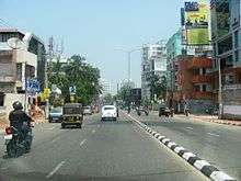
Issues
The main roads in India are under huge pressure and in great need of modernisation in order to handle the increased requirements of the Indian economy. In addition to maintenance, the expansion of the network and widening of existing roads is becoming increasingly important. This would then enable the roads to handle increased traffic, and also allow for a corresponding increase in the average movement speed on India's roads.
In 2009, lane capacity was low and only about 16% of India's roads were four lanes or above.[10] A 2007 study found that the congestion on India's highways reduced average truck and bus speeds to 30–40 km/h (19–25 mph); road maintenance was under-funded, and some 40 percent of villages in India lacked access to all-weather roads.[2] While the PMGSY rural road program mentioned above has, by 2011, connected 90 percent of villages identified in 2005 as without access,[32] many remote villages in India were still without access to a single lane, paved road as of May 2011.
The World Health Organization compilation of road network safety data for major economies found India to have the highest number of road fatalities in the World, with 105,000 road-accident caused deaths in 2006.[36] However, adjusted for India's larger population, the accident and fatalities rates are similar to major economies. Over 2004–2007, India had a road fatality rate of 132 deaths per million citizens, compared to 131 deaths per million citizens in the United States. Non-fatal accident rates reported on Indian roads was 429 accidents per million citizens, compared to 412 accidents per million citizens in China, and 1101 accidents per million citizens in the United States. The report notes that not all accidents in India and China are reported and recorded.
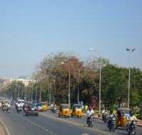
The low road densities per 1000 people has created significant congestion and slow speeds on existing roads inside cities. Because of the congestion, the fuel efficiency of the vehicles in India is very low. This increases the overall fuel consumption per equivalent kilometer travelled, besides resulting in heavy pollution since the engines run very inefficiently at such low speeds.[37] Pollutants from poor road network and resultant poor fuel efficiencies include hydrocarbons, NOx, SOx, methane, carbon monoxide and carbon dioxide – all of which cause health problems, adverse climate effects and related environmental damage.
Due to rising prices of petroleum, a non-renewable resource, some have urged the Indian government to focus instead on improving public transport like the Indian Railways and rapid transit systems.[38] Many cities have proposed, or are implementing metros and mass transit systems.
Efforts in India to address issues related to road network

India's recent efforts to build modern highways and improve its road network has made a significant difference in trucking logistics. According to DHL, a global logistics company, the average time to truck shipments from New Delhi to Bengaluru (Bangalore), a 2000+ kilometre journey, had dropped in 2008, to about five days.[39] By 2010, the average time to complete a road trip from New Delhi to Mumbai, a 1400+ kilometer journey, had dropped to about 35 hours. In contrast, a similar journey takes about half the time in China, and one third in European Union countries. In a 2010 report, KPMG – one of the world's largest audit and advisory services company – noted marked improvements in Indian road network and logistics efficiencies in recent years.[40] The report also identified the competitive challenges faced by India. Some findings of this report include:
- The average road speed in India has increased to 30–40 kilometers per hour. The worldwide average road speed, which includes China, ranges between 60–80 kilometers per hour.
- Four lane road network in India has increased to 7,000 kilometers.
- Average surface freight costs have dropped to US$0.07 per kilometer. Japan, in comparison, has average surface freight costs of US$0.037 per kilometer.
The KPMG report also notes that India's road network logistics and transportation bottlenecks hinder its GDP growth by one to two percent (US$16 billion – US$32 billion). In India's 2010 per capita income basis, this is equivalent to a loss of about 10 million new jobs every year. Poor rural roads and traffic congestion inside the cities remains a challenge in India. The planned addition of over 12,000 kilometers of expressways in the next 10 years may help address some of such issues. The constraints and issues with Indian road network differ from one state to another. Some states, such as Tamil Nadu, Gujarat, have remarkably better road network than others.
See also
- List of National Highways in India
- List of National Highways in India by highway number
- Border Roads Organisation
- Transport in India
References
- 1 2 3 "Basic Road Statistics of India 2013-14 and 2014-15". Ministry of Road Transport & Highways. Retrieved 2016-11-12.
- 1 2 3 "India Transport Sector". World Bank.
- ↑ "India en route for grand highways". BBC News.
- 1 2 "National Highways Development Project Maps, click NHDP tab, then click maps, NDHP Project Phase – I, II & III". Ministry of Road Transport and Highways, Government of India. September 2011.
- 1 2 3 4 "National Highway Development Project NHDP)". NHAI, Ministry of Roads Transport, Govt of India. January 2012.
- ↑ Highway developers face policy speed breakers Business Standard (3 February 2014)
- ↑ Yamuna Expressway to open in April, trial runs on The Times of India
- ↑ The seemingly unending road The Hindu (11 August 2013)
- 1 2 Shobana Chandra. "U.S. Pension Funds May Invest in India Road Projects, Nath Says". Bloomberg.
- 1 2 RN Bhaskar. "Crossing the Chasm". Forbes India.
- ↑ Suman Guha Mozumder. "Kamal Nath on what dogs Indian road projects". Rediff.
- ↑ Indian Highways - Emerging Opportunities Govt of India, Page 15
- ↑ Average lane kilometers per 100,000 equals average kilometers of road per 100,000 multiplied by average number of lanes per road for a country
- ↑ Table - Distribution of density of road network, Ministry of Roads Transport and Highways, Government of India (2013)
- ↑ Taylor (1995). A Star Shall Fall. Collins. ISBN 978-81-7223-066-1.
- ↑ "National Highway Annual Report, 1989–1995" (PDF). NHAI, Govt of India. 1996.
- ↑ "National Highways, Statewise Lengths". NHAI, Govt of India. January 2012.
- ↑ "Report of Working Group on Road Transport" (PDF). Ministry of Road Transport, Government of India. 2011.
- ↑ "An Overview: Road Network of India". Ministry of Road Transport, Government of India. 2010.
- ↑ "Distribution of Density of National Highways Lengths". Ministry of Road Transport & Highways, Government of India. 2010.
- ↑ "List of State-Wise National Highways in the Country". Ministry of Road Transport & Highways, Government of India. 2010.
- ↑ Department of Transportation, Govt of the United States (2009). "Highway statistics 2008, United States".
- ↑ Department of Transportation, Govt of the United States (2009). "Road System Measures for Selected Countries" (PDF).
- ↑ "India Roads – November 2010" (PDF). IBEF. November 2010.
- 1 2 "Check out India's 13 super expressways". Rediff. July 2011.
- ↑ "Yamuna Expressway from Delhi to Agra opens: 10 facts".
- ↑ "Project Report on Indian National Expressway Network". Ministry of Road Transport and Highways, Government of India. October 2011.
- ↑ "National Highways of India". Government of India. September 2011.
- ↑ "Statewise distribution of National Highways". NHAI, MoRTH India. 2011.
- ↑ "Compendium of PPP Projects in State Highways" (PDF). Secretariat for Infrastructure, Govt of India. June 2010.
- ↑ Basic Road Statistics of India 2014 (Report). Ministry of Road Transport & Highways. 23 May 2014. Retrieved 21 June 2014.
- 1 2 3 "Pradhan Mantri Gram Sadak Yojana (PMGSY) including Bharat Nirman (Rural Connectivity) Program Review". Ministry of Rural Development, Government of India. July 2011.
- ↑ "India's boom bypasses the poor". The Wall Street Journal. 29 April 2011.
- ↑ "New all weather roads boost rural incomes, India". The World Bank. 2009.
- ↑ "Indian rural welfare: Digging holes". The Economist. 5 November 2011.
- ↑ "Global Status Report on Road Safety" (PDF). World Health Organization. 2009.
- ↑ John Pucher; Nisha Korattyswaropam; Neha Mittal; Neenu Ittyerah. "Urban transport crisis in India" (PDF).
- ↑ Minister of Road Transport and Highways for India
- ↑ "Logistics in India". DHL. 2008.
- ↑ "Logistics in India, part 1 (A 3 part series)" (PDF). KPMG. 2010.
External links
| Wikimedia Commons has media related to Roads in India. |