Quadrant roadway intersection

A quadrant roadway intersection adds an additional "quadrant roadway" between two legs of the intersection. This roadway adds two three-way intersections in addition to the original four-way intersection moving all left turns (in right-hand traffic countries) or right turns (in left-hand traffic countries) from the main intersection. The design is intended to improve traffic flow by reducing signal timing phases from four to two in the main intersection. The design is intended for intersections where large artery routes meet in an area of dense development and high pedestrian volume.[1][2]
Proponents also point to a reduction in places where accidents could occur from vehicles potentially crossing paths as well as a low development cost compared to roundabouts or the more complex single-point urban interchange designs.[1][3][4] Opponents point to the increase in points where accidents could occur with merging traffic as well as the non-traditional nature of the design which has the potential to confuse drivers. Opponents also refute low cost claims pointing to right-of-way and construction costs of the quadrant road.[1][3]
Variants
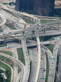
Single quadrant intersections (pictured above) feature a single quadrant road. Double quadrant intersections add an additional quadrant road placed opposite of the other quadrant road. Another variant links grade-separated roads via the quadrant road, typically to bring together a faster road with denser traffic with an overpass (or flyover) over a less traveled, slower road. This design is also referred to as a single-loop intersection.[4]
A One Quadrant Interchange uses an overpass and two T-intersections.[5] This is the only and very common one quadrant variant in Germany, where it is called a "Partial At-grade Intersection" (German: Teilplangleicher Verkehrsknoten).[6]
Examples
Canada
The single-loop variant is used frequently in the Thornhill area, in the Greater Toronto Area in Ontario, Canada, examples include:
- Dundas Street and Cawthra Road, Mississauga, Ontario
- Highway 7, Langstaff Road, and Dufferin Street, Vaughan, Ontario
- Highway 7 and Bathurst Street, also in Vaughan, Ontario
- Highway 7 and Yonge Street, Markham, Ontario
- Highway 7 and Bayview Street, Markham, Ontario
- Bloor Street and Stevenson Road, Oshawa, Ontario
United States
- Exchange St. and Wolf Ledges Pkwy., Akron, Ohio (The quadrant roadway has its own name, Arc Dr., but has no driveways or addresses and serves solely as the quadrant roadway.)
- Maryland Route 140 and Owings Mills Blvd. in Owings Mills, Maryland
- New York Route 130 Broadway St. and New York Route 277 Union Rd. in Depew, New York
- Meridian St. and 146 St. via Greyhound Pass in Carmel, Indiana
- Illinois Route 21 and Illinois Route 132 in Gurnee, Illinois
- Fairfield, Ohio - State Route 4 at State Route 4 Bypass (4B) and Ross Road. Diversion Road is used as the quadrant road.
- Birmingham, Michigan – Woodward Ave & Maple Rd. Peadbody Street is used as the quadrant road.
- Ann Arbor, Michigan - Washtenaw Ave & Huron Pkwy. Platt Road is the quadrant road.
- Golden Triangle, New Jersey – Kaighns Ave and Chapel Ave
- Wallingford, Connecticut – Colony Rd & Church St
- Lansing, Michigan - Martin Luther King Ave. at Grand River Ave.
- Cary, North Carolina, High House Road and Cary Parkway (proposed)[7]
- Billings, Montana, Hilltop Road and Lake Elmo Drive.
- Smyrna, TN: Lee Victory Parkway (TN Route 102) and Old Nashville Pike.
- Mill Creek, Washington: Washington State Route 527 and Washington State Route 96 via 16th Avenue SE (partial)
Germany
References
- 1 2 3 Turner-Fairbank Highway Research Center (August 2004). "Signalized Intersections: Informational Guide". ALTERNATIVE INTERSECTION TREATMENTS. United States Department of Transportation. Retrieved 3 January 2010.
- ↑ Cooke, Jordan (Mar 24, 2009). "Left turns left out of road redesign". Cary News. Archived from the original on April 10, 2009. Retrieved 3 January 2010.
- 1 2 Hummer, Joseph E. (May 14, 2003). "Moving More Cars Through the Same Space Using Unconventional Intersection Designs" (PDF). NCDOT Traffic Engineering Conference. North Carolina State University. Retrieved 3 January 2010.
- 1 2 "Quadrant Roadway Intersection vs. Traditional Intersection" (PDF). Community Planning Assn. of Southwest Idaho. Retrieved 3 January 2010.
- ↑ "Archived copy" (PDF). Archived from the original (PDF) on April 12, 2015. Retrieved December 23, 2014.
- ↑ Institut für Straßen- und Eisenbahnwesen am KIT: Entwurf und Bau von Straßen – Teil: Straßenentwurf. (PDF; 8,44 MB) Abgerufen am 7. September 2013.
- ↑ "Cary Parkway and High House Road Intersection". Town of Cary, North Carolina. Retrieved 3 January 2010.