Indiana State Road 234
| ||||
|---|---|---|---|---|
 | ||||
| Route information | ||||
| Maintained by INDOT | ||||
| Existed: | 1931[1] – present | |||
| Western segment | ||||
| West end: | Illinois state line | |||
| Major junctions: |
| |||
| East end: |
| |||
| Eastern segment | ||||
| West end: |
| |||
| East end: |
| |||
| Location | ||||
| Counties: | Boone, Fountain, Hancock, Henry, Montgomery, Parke, Vermillion | |||
| Highway system | ||||
| ||||

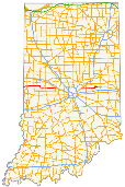
State Road 234 exists in two sections in Indiana. The western portion begins at the Illinois border from a Vermilion County, Illinois, county road. It runs east from there to U.S. Route 136 (US 136) near Jamestown. Much of the route is a scenic, two-lane road with very tight turns. The primary access to Shades State Park is located along SR 234.
Its eastern portion goes from the U.S. Route 36/State Road 67 concurrency in McCordsville, Indiana. Then eastern terminus is at an intersection with State Road 38.
Route description
Western section
From the western terminus SR 234 heads east towards Cayuga. SR 234 passes through Cayuga and heads east towards Kingman. East of Kingman SR 234 has an intersection with U.S. Route 41. SR 234 heads east then southeast towards Ladoga, passing through intersections with State Road 341, State Road 47, and U.S. Route 231. SR 234 heads east towards Jamestown, where SR 234 has a concurrency with State Road 75. The concurrency end at the eastern terminus of the western section.[2]
Eastern section
From US 36/SR 67, SR 234 heads due east towards Kennard, passing through intersection with State Road 9 and State Road 109. SR 234 heads north out of Kennard, 2 miles (3.2 km) north of Kennard SR 234 turns east. The eastern terminus is soon after at SR 38.[3]
History
A middle section of SR 234 existed in Hamilton County, Indiana, between U.S. Route 31 in Carmel and State Road 37 in Noblesville. The designation in this area has not existed since the late 1970s, but some modern maps still show it running along 131st Street and River Road in Carmel and 146th Street into Fishers and Noblesville.
Major intersections
| County | Location | mi[4] | km | Destinations | Notes | |||
|---|---|---|---|---|---|---|---|---|
| Vermillion | Eugene Township | 0.00 | 0.00 | Illinois state line | Western terminus of SR 234 | |||
| Cayuga | 4.67 | 7.52 | ||||||
| Parke |
No major junctions | |||||||
| Fountain | Millcreek Township | 16.58 | 26.68 | |||||
| Jackson Township | 21.57 | 34.71 | Southern terminus of SR 341 | |||||
| Montgomery | Brown Township | 34.24 | 55.10 | |||||
| Scott Township | 38.04 | 61.22 | ||||||
| Boone | Jamestown | 53.03 | 85.34 | Western end of SR 75 concurrency | ||||
| 53.77 | 86.53 | eastern end of SR 75 concurrency; eastern terminus of the western section of SR 234 | ||||||
| Gap in route | ||||||||
| Hancock | Vernon Township | 53.77 | 86.53 | Western terminus of the eastern section of SR 234 | ||||
| Eden | 61.41 | 98.83 | ||||||
| Warrington | 68.96 | 110.98 | ||||||
| Henry | Westwood | 80.03 | 128.80 | Eastern terminus of SR 234 | ||||
1.000 mi = 1.609 km; 1.000 km = 0.621 mi
| ||||||||
References
- ↑ "Roads Added to State System". The Daily Reporter. Greenfield. May 15, 1931. Retrieved October 20, 2016 – via Newspapers.com.

- ↑ Google (2010-04-17). "overview map of the western section of SR 234" (Map). Google Maps. Google. Retrieved 2010-04-17.
- ↑ Google (2010-04-17). "overview map of the eastern section of SR 234" (Map). Google Maps. Google. Retrieved 2010-04-17.
- ↑ "INDOT Roadway Referencing System" (PDF). Indiana Department of Transportation. Retrieved 2011-04-07.