Inger, Minnesota
| Inger, Minnesota Chi-achaabaaning | |
|---|---|
| Census-designated place (CDP) and Unincorporated community | |
 Inger, Minnesota Location of the community of Inger | |
| Coordinates: 47°33′15″N 93°59′7″W / 47.55417°N 93.98528°WCoordinates: 47°33′15″N 93°59′7″W / 47.55417°N 93.98528°W | |
| Country |
|
| State |
|
| County | Itasca |
| Area[1] | |
| • Total | 1.909 sq mi (4.94 km2) |
| • Land | 1.877 sq mi (4.86 km2) |
| • Water | 0.032 sq mi (0.08 km2) |
| Elevation | 1,332 ft (406 m) |
| Population (2010)[2] | |
| • Total | 212 |
| • Density | 110/sq mi (43/km2) |
| Time zone | CST (UTC-6) |
| • Summer (DST) | CDT (UTC-5) |
| ZIP code | 56636 |
| Area Code | 218 |
| GNIS ID | 656702[3] |
Inger is an unincorporated community and census-designated place (CDP) in Itasca County, Minnesota, United States, along the Bowstring River of the Leech Lake Indian Reservation. As of the 2010 census, its population was 212.[2]
The center of Inger is generally considered at the junction of Itasca County Roads 35 and 146. State Highway 46 (MN 46) is also in the vicinity. Inger is located 22 miles northwest of Deer River.
In Ojibwe, the community is called Chi-achaabaaning, meaning "by the Big Bowstring" due to its location along the Bowstring River. The village is located in the former Inger Township, which reverted to being unorganized. Named for one of its pioneer settlers,[4] a post office was in operation from 1912 until 1955.[5]
Located 9 miles south of Inger is the Winnibigoshish Lake Dam, which is listed on the National Register of Historic Places.
References
- ↑ "US Gazetteer files: 2010, 2000, and 1990". United States Census Bureau. 2011-02-12. Retrieved 2011-04-23.
- 1 2 "American FactFinder". United States Census Bureau. Retrieved 2011-05-14.
- ↑ "Inger, Minnesota". Geographic Names Information System. United States Geological Survey.
- ↑ Upham, Warren (1920). Minnesota Geographic Names: Their Origin and Historic Significance. Minnesota Historical Society. p. 255.
- ↑ "Itasca County". Jim Forte Postal History. Retrieved 12 July 2015.
- Rand McNally Road Atlas – 2007 edition – Minnesota entry
- Official State of Minnesota Highway Map – 2011/2012 edition
- Mn/DOT map of Itasca County – Sheet 2 – 2011 edition
Municipalities and communities of Itasca County, Minnesota, United States | ||
|---|---|---|
| Cities | 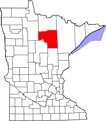 | |
| Townships |
| |
| Unorganized territories | ||
| CDPs | ||
| Unincorporated communities | ||
| Indian reservations | ||
| Footnotes | ‡This populated place also has portions in an adjacent county or counties | |