Inglewood, South Australia
| Inglewood South Australia | |||||||||||||
|---|---|---|---|---|---|---|---|---|---|---|---|---|---|
 Inglewood Inn | |||||||||||||
 Inglewood | |||||||||||||
| Coordinates | 34°49′0″S 138°46′0″E / 34.81667°S 138.76667°ECoordinates: 34°49′0″S 138°46′0″E / 34.81667°S 138.76667°E | ||||||||||||
| Population |
| ||||||||||||
| Postcode(s) | 5133 | ||||||||||||
| Location | 24 km (15 mi) from Adelaide | ||||||||||||
| LGA(s) | Adelaide Hills Council | ||||||||||||
| State electorate(s) | Kavel | ||||||||||||
| Federal Division(s) | Mayo | ||||||||||||
| |||||||||||||
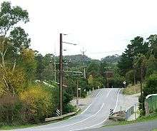
Inglewood is a small town near Adelaide, South Australia. It is located in the Adelaide Hills Council local government area, and is adjacent to Houghton, Paracombe and the rural districts of Upper Hermitage and Chain of Ponds. At the 2006 census, Inglewood had a population of 264.[2]
Inglewood began as a private subdivision, and was named after a town in Cumberland, England.[3][4] The historic Inglewood Inn on North East Road was built by Thomas Deacon in 1858, and played a significant role in the development of the area. It survives today and is listed on the South Australian Heritage Register and the former Register of the National Estate.[5][6] Inglewood Post Office opened in July 1865.[7] The town also has a general store, located on North East Road.[8]
The modern boundaries of Inglewood were established in October 2001 for the long established name. Its boundaries with Lower Hermitage were altered in October 2005 and it gained an area from Millbrook in August 2015.[4]
Transport
The area is not serviced by Adelaide public transport. A coach is operated from Tea Tree Plaza Interchange to Gumeracha and Mount Pleasant by Link SA.[9]
References
- ↑ Australian Bureau of Statistics (31 October 2012). "Inglewood (State Suburb)". 2011 Census QuickStats. Retrieved 3 February 2016.
- 1 2 Australian Bureau of Statistics (25 October 2007). "Inglewood (State Suburb)". 2006 Census QuickStats. Retrieved 2 August 2011.
- ↑ Placenames SA - Inglewood accessed 16 June 2006
- 1 2 "Search result(s) for Inglewood, 5133". Property Location Browser. Government of South Australia. Retrieved 17 February 2016.
- ↑ "Inglewood Inn". South Australian Heritage Register. Department of Environment, Water and Natural Resources. Retrieved 30 March 2016.
- ↑ "Inglewood Inn, North East Rd, Inglewood, SA, Australia". Register of the National Estate. Department of the Environment. Retrieved 30 March 2016.
- ↑ "Inglewood". Post Office Reference. Premier Postal. Retrieved 30 March 2016.
- ↑ "School Context Statement" (PDF). Paracombe Primary School. Retrieved 30 March 2016.
- ↑ "Tea Tree Plaza - Mt Pleasant - Mt Torrens" (PDF). Link SA. Retrieved 30 March 2016.