Itararé, Santa Maria
| Itararé | |
|---|---|
| Bairro | |
 The bairro in District of Sede | |
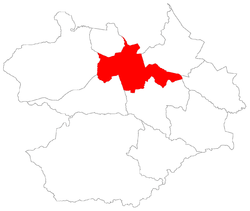 District of Sede, in Santa Maria City, Rio Grande do Sul, Brazil | |
| Coordinates: 29°40′27.66″S 53°47′45.92″W / 29.6743500°S 53.7960889°WCoordinates: 29°40′27.66″S 53°47′45.92″W / 29.6743500°S 53.7960889°W | |
| Country | Brazil |
| State | Rio Grande do Sul |
| Municipality/City | Santa Maria |
| District | District of Sede |
| Area | |
| • Total | 2.3133 km2 (0.8932 sq mi) |
| Population [1] | |
| • Total | 7,300 |
| • Density | 3,200/km2 (8,200/sq mi) |
| Adjacent bairros | Campestre do Menino Deus, Centro, Menino Jesus, Nossa Senhora do Perpétuo Socorro, Presidente João Goulart. |
| Website | Official site of Santa Maria |
Itararé[2] (Portuguese pronunciation: [????], "indian word for excavated stone") is a bairro in the District of Sede in the municipality of Santa Maria, in the Brazilian state of Rio Grande do Sul. It is located in northeast Santa Maria.
Villages
The bairro contains the following villages: Canário, Itararé, Loteamento Link, Possadas, Vila Bela Vista, Vila Bürger, Vila Felipe Menna Barreto, Vila Kruel, Vila Montanha Russa, Vila Nossa Senhora Aparecida, Vila Pércio Reis, Vila Popular Leste, Vila Popular Oeste.
Gallery of photos


References
| Districts | |
|---|---|
| Bairros |
|
This article is issued from Wikipedia - version of the 12/28/2014. The text is available under the Creative Commons Attribution/Share Alike but additional terms may apply for the media files.