Ivey, Georgia
| Ivey, Georgia | |
|---|---|
| Town | |
 Location in Wilkinson County and the state of Georgia | |
| Coordinates: 32°54′33″N 83°18′3″W / 32.90917°N 83.30083°WCoordinates: 32°54′33″N 83°18′3″W / 32.90917°N 83.30083°W | |
| Country | United States |
| State | Georgia |
| County | Wilkinson |
| Area | |
| • Total | 3 sq mi (7.7 km2) |
| • Land | 2.6 sq mi (6.6 km2) |
| • Water | 0.4 sq mi (1.1 km2) |
| Elevation | 358 ft (109 m) |
| Population (2000) | |
| • Total | 1,100 |
| • Density | 366.7/sq mi (142.9/km2) |
| Time zone | Eastern (EST) (UTC-5) |
| • Summer (DST) | EDT (UTC-4) |
| ZIP code | 31031 |
| Area code(s) | 478 |
| FIPS code | 13-41540[1] |
| GNIS feature ID | 0332071[2] |
Ivey is a town in Wilkinson County, Georgia, United States. The population was 1,100 at the 2000 census.
Geography
Ivey is located at 32°54′33″N 83°18′3″W / 32.90917°N 83.30083°W (32.909078, -83.300808).[3]
According to the United States Census Bureau, the town has a total area of 3.0 square miles (7.8 km2), of which, 2.6 square miles (6.7 km2) of it is land and 0.4 square miles (1.0 km2) of it (14.09%) is water.
Demographics
| Historical population | |||
|---|---|---|---|
| Census | Pop. | %± | |
| 1950 | 46 | — | |
| 1960 | 48 | 4.3% | |
| 1970 | 245 | 410.4% | |
| 1980 | 455 | 85.7% | |
| 1990 | 1,053 | 131.4% | |
| 2000 | 1,100 | 4.5% | |
| 2010 | 981 | −10.8% | |
| Est. 2015 | 926 | [4] | −5.6% |
As of the census[1] of 2000, there were 1,100 people, 434 households, and 314 families residing in the town. The population density was 430.2 people per square mile (165.9/km²). There were 529 housing units at an average density of 206.9 per square mile (79.8/km²). The racial makeup of the town was 97.55% White, 1.09% African American, 0.27% Native American, 0.09% from other races, and 1.00% from two or more races. Hispanic or Latino of any race were 0.73% of the population.
There were 434 households out of which 33.6% had children under the age of 18 living with them, 58.5% were married couples living together, 11.1% had a female householder with no husband present, and 27.6% were non-families. 23.7% of all households were made up of individuals and 8.1% had someone living alone who was 65 years of age or older. The average household size was 2.53 and the average family size was 3.03.
In the town the population was spread out with 27.0% under the age of 18, 8.9% from 18 to 24, 29.9% from 25 to 44, 22.5% from 45 to 64, and 11.6% who were 65 years of age or older. The median age was 36 years. For every 100 females there were 87.7 males. For every 100 females age 18 and over, there were 93.5 males.
The median income for a household in the town was $38,750, and the median income for a family was $41,071. Males had a median income of $31,083 versus $21,953 for females. The per capita income for the town was $16,710. About 7.4% of families and 8.5% of the population were below the poverty line, including 12.1% of those under age 18 and 3.1% of those age 65 or over.
The town is the home of Lee Amerson who is a recording artist with his unique blend of calypso music and hip hop.
References
- 1 2 "American FactFinder". United States Census Bureau. Retrieved 2008-01-31.
- ↑ "US Board on Geographic Names". United States Geological Survey. 2007-10-25. Retrieved 2008-01-31.
- ↑ "US Gazetteer files: 2010, 2000, and 1990". United States Census Bureau. 2011-02-12. Retrieved 2011-04-23.
- ↑ "Annual Estimates of the Resident Population for Incorporated Places: April 1, 2010 to July 1, 2015". Retrieved July 2, 2016.
- ↑ "Census of Population and Housing". Census.gov. Retrieved June 4, 2015.
Municipalities and communities of Wilkinson County, Georgia, United States | ||
|---|---|---|
| Cities | 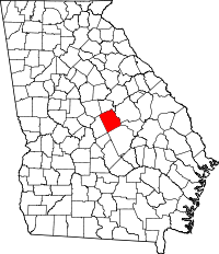 | |
| Towns | ||
| Footnotes | ‡This populated place also has portions in an adjacent county or counties | |