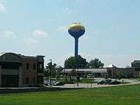
Johnson Creek, Wisconsin
| Johnson Creek, Wisconsin | |
|---|---|
| Village | |
 | |
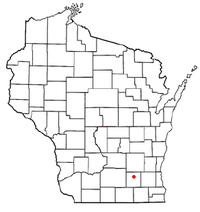 Location of Johnson Creek, Wisconsin | |
| Coordinates: 43°4′45″N 88°46′16″W / 43.07917°N 88.77111°WCoordinates: 43°4′45″N 88°46′16″W / 43.07917°N 88.77111°W | |
| Country | United States |
| State | Wisconsin |
| County | Jefferson |
| Government | |
| • Type | Village Board (President - Trustees) |
| • President | Greg Schopp |
| Area[1] | |
| • Total | 3.03 sq mi (7.85 km2) |
| • Land | 3.02 sq mi (7.82 km2) |
| • Water | 0.01 sq mi (0.03 km2) |
| Elevation[2] | 830 ft (253 m) |
| Population (2010)[3] | |
| • Total | 2,738 |
| • Estimate (2012[4]) | 2,840 |
| • Density | 906.6/sq mi (350.0/km2) |
| Time zone | Central (CST) (UTC-6) |
| • Summer (DST) | CDT (UTC-5) |
| Area code(s) | 920 |
| FIPS code | 55-38350[5] |
| GNIS feature ID | 1567212[2] |
| Website |
www |
Johnson Creek is a village in Jefferson County, Wisconsin, United States. The population was 2,738 at the 2010 census.[6] The village is located approximately halfway between Milwaukee and Madison, at the intersection of Wisconsin Highway 26 and Interstate 94.
History
The first two settlers were Charles Goodhue and Timothy Johnson, the latter of whom also founded nearby Watertown.[7] While sometimes called Belleville, this caused it to be confused with another Belleville, Wisconsin, and the post office has always been named Johnson Creek. The village took its name from its location on Johnson Creek.[8]
Johnson Creek was founded where the Union Pacific railroad crosses Johnson Creek just above where the stream empties into the Rock River. The Union Pacific spur currently runs from Fort Atkinson to Clyman Junction.[9] The economy is now more dependent on Interstate 94. A large outlet mall shopping complex was built in 1998 to capitalize on this traffic. The once famous hotel and supper club, The Gobbler, was in Johnson Creek.
Geography
Johnson Creek is located at 43°4′45″N 88°46′16″W / 43.07917°N 88.77111°W (43.079147, -88.771030).[10]
According to the United States Census Bureau, the village has a total area of 3.03 square miles (7.85 km2), of which 3.02 square miles (7.82 km2) is land and 0.01 square miles (0.03 km2) is water.[1]
Demographics
| Historical population | |||
|---|---|---|---|
| Census | Pop. | %± | |
| 1880 | 208 | — | |
| 1890 | 176 | −15.4% | |
| 1910 | 425 | — | |
| 1920 | 493 | 16.0% | |
| 1930 | 457 | −7.3% | |
| 1940 | 511 | 11.8% | |
| 1950 | 575 | 12.5% | |
| 1960 | 686 | 19.3% | |
| 1970 | 790 | 15.2% | |
| 1980 | 1,136 | 43.8% | |
| 1990 | 1,259 | 10.8% | |
| 2000 | 1,581 | 25.6% | |
| 2010 | 2,738 | 73.2% | |
| Est. 2015 | 2,913 | [11] | 6.4% |
2010 census
As of the census[3] of 2010, there were 2,738 people, 1,049 households, and 736 families residing in the village. The population density was 906.6 inhabitants per square mile (350.0/km2). There were 1,118 housing units at an average density of 370.2 per square mile (142.9/km2). The racial makeup of the village was 93.2% White, 0.9% African American, 0.3% Native American, 1.2% Asian, 2.8% from other races, and 1.5% from two or more races. Hispanic or Latino of any race were 7.5% of the population.
There were 1,049 households of which 36.5% had children under the age of 18 living with them, 58.5% were married couples living together, 7.4% had a female householder with no husband present, 4.2% had a male householder with no wife present, and 29.8% were non-families. 21.7% of all households were made up of individuals and 5.2% had someone living alone who was 65 years of age or older. The average household size was 2.60 and the average family size was 3.06.
The median age in the village was 32.4 years. 27% of residents were under the age of 18; 7% were between the ages of 18 and 24; 35.5% were from 25 to 44; 22% were from 45 to 64; and 8.4% were 65 years of age or older. The gender makeup of the village was 48.8% male and 51.2% female.
2000 census
As of the census[5] of 2000, there were 1,581 people, 624 households, and 423 families residing in the village. The population density was 735.2 people per square mile (283.9/km²). There were 659 housing units at an average density of 306.4 per square mile (118.3/km²). The racial makeup of the village was 95.19% White, 0.19% African American, 0.82% Native American, 0.25% Asian, 2.21% from other races, and 1.33% from two or more races. Hispanic or Latino of any race were 3.98% of the population.
There were 624 households out of which 35.4% had children under the age of 18 living with them, 52.7% were married couples living together, 9.5% had a female householder with no husband present, and 32.2% were non-families. 23.7% of all households were made up of individuals and 9.8% had someone living alone who was 65 years of age or older. The average household size was 2.53 and the average family size was 3.01.
In the village the population was spread out with 26.6% under the age of 18, 9.8% from 18 to 24, 34.7% from 25 to 44, 19.4% from 45 to 64, and 9.5% who were 65 years of age or older. The median age was 32 years. For every 100 females there were 97.9 males. For every 100 females age 18 and over, there were 97.3 males.
The median income for a household in the village was $45,694, and the median income for a family was $49,348. Males had a median income of $35,540 versus $25,927 for females. The per capita income for the village was $19,671. About 3.0% of families and 4.3% of the population were below the poverty line, including 4.3% of those under age 18 and 8.7% of those age 65 or over.
Education
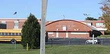
The Johnson Creek School District operates a K-12 campus on the eastern side of the village, along Wisconsin Highway 26. It serves about 572 students.[13] Johnson Creek High School won the 2007 Wisconsin State Baseball Championship in WIAA Division 4.[14] The baseball team was WIAA Division 4 State Runner's Up in 2012.[15]
In 2014 voters passed a referendum allowing the district to increase taxes and begin construction of a new school to be constructed from several modular domes.[16][17]
Notable people
- Henry C. Christians, Wisconsin State Assemblyman and businessman, was the postmaster of Johnson Creek.[18]
- H. J. Grell, Wisconsin State Assemblyman and businessman, was born in and served as President and a member of the school board of Johnson Creek.[19]
References
- 1 2 "US Gazetteer files 2010". United States Census Bureau. Retrieved 2012-11-18.
- 1 2 "US Board on Geographic Names". United States Geological Survey. 2007-10-25. Retrieved 2008-01-31.
- 1 2 "American FactFinder". United States Census Bureau. Retrieved 2012-11-18.
- ↑ "Population Estimates". United States Census Bureau. Retrieved 2013-06-24.
- 1 2 "American FactFinder". United States Census Bureau. Retrieved 2008-01-31.
- ↑ "Profile of General Population and Housing Characteristics: 2010 Demographic Profile Data (DP-1): Johnson Creek village, Wisconsin". U.S. Census Bureau, American Factfinder. Retrieved October 5, 2012.
- ↑ Johnson Creek [origin of place name]
- ↑ Chicago and North Western Railway Company (1908). A History of the Origin of the Place Names Connected with the Chicago & North Western and Chicago, St. Paul, Minneapolis & Omaha Railways. p. 88.
- ↑ http://www.dot.wisconsin.gov/localgov/docs/railmap.pdf
- ↑ "US Gazetteer files: 2010, 2000, and 1990". United States Census Bureau. 2011-02-12. Retrieved 2011-04-23.
- ↑ "Annual Estimates of the Resident Population for Incorporated Places: April 1, 2010 to July 1, 2015". Retrieved July 2, 2016.
- ↑ "Census of Population and Housing". Census.gov. Retrieved June 4, 2015.
- ↑ Johnson Creek School District
- ↑ http://www.maxpreps.com/news/qyb273V1ekqZy-00qwTl6Q/2007-baseball-state-champs-%E2%80%93-nebraska-to-wisconsin.htm
- ↑ http://www.wiaawi.org/Portals/0/PDF/Results/Baseball_Spring/2012/d4game3.htm
- ↑ Anderson, Andrea (23 March 2013). "Johnson Creek residents to vote on state's first monolithic dome school". Milwaukee Journal Sentinel. Retrieved 28 May 2014.
- ↑ Hicks, Todd (2 Apr 2014). "Johnson Creek passes domed school referendum on 5th try". WTMJ (Radio). Retrieved 28 May 2014.
- ↑ 'Wisconsin Blue Book 1895,' Biographical Sketch of Henry C. Christians, pg. 681
- ↑ THE WISCONSIN BLUE BOOK. Madison. 1917. p. 531.
External links
| Wikivoyage has a travel guide for Johnson Creek. |
 |
Watertown | | ||
| Lake Mills | |
Concord | ||
| ||||
| | ||||
| Jefferson |
Municipalities and communities of Jefferson County, Wisconsin, United States | ||
|---|---|---|
| Cities |  | |
| Villages | ||
| Towns | ||
| CDPs | ||
| Unincorporated communities |
| |
| Footnotes | ‡This populated place also has portions in an adjacent county or counties | |