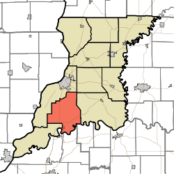
Johnson Township, Knox County, Indiana
| Johnson Township | |
|---|---|
| Township | |
 | |
| Coordinates: 38°34′08″N 87°30′37″W / 38.56889°N 87.51028°WCoordinates: 38°34′08″N 87°30′37″W / 38.56889°N 87.51028°W | |
| Country | United States |
| State | Indiana |
| County | Knox |
| Government | |
| • Type | Indiana township |
| Area | |
| • Total | 50.98 sq mi (132.0 km2) |
| • Land | 50.51 sq mi (130.8 km2) |
| • Water | 0.47 sq mi (1.2 km2) |
| Elevation[1] | 502 ft (153 m) |
| Population (2010) | |
| • Total | 1,382 |
| • Density | 27.4/sq mi (10.6/km2) |
| FIPS code | 18-38700[2] |
| GNIS feature ID | 453513 |
Johnson Township is one of ten townships in Knox County, Indiana. As of the 2010 census, its population was 1,382 and it contained 581 housing units.[3]
History
Johnson Township is named for Thomas Johnson, an early pioneer settler who arrived in 1800, settling on land that later became the Purcell Station area. His son Thomas Johnson Jr. expanded the property and married into the Catt family. [4]
Geography
According to the 2010 census, the township has a total area of 50.98 square miles (132.0 km2), of which 50.51 square miles (130.8 km2) (or 99.08%) is land and 0.47 square miles (1.2 km2) (or 0.92%) is water.[3]
References
- ↑ "US Board on Geographic Names". United States Geological Survey. 2007-10-25. Retrieved 2008-01-31.
- ↑ "American FactFinder". United States Census Bureau. Retrieved 2008-01-31.
- 1 2 "Population, Housing Units, Area, and Density: 2010 - County -- County Subdivision and Place -- 2010 Census Summary File 1". United States Census. Retrieved 2013-05-10.
- ↑ History of Knox and Daviess County, Indiana: From the Earliest Time to the Present. Goodspeed. 1886. p. 81.
External links
Municipalities and communities of Knox County, Indiana, United States | ||
|---|---|---|
| Cities | ||
| Towns | ||
| Townships | ||
| CDPs | ||
| Other unincorporated communities |
| |
This article is issued from Wikipedia - version of the 10/15/2016. The text is available under the Creative Commons Attribution/Share Alike but additional terms may apply for the media files.