Jordan, Oregon
| Jordan | |
|---|---|
| Unincorporated community | |
 | |
 Jordan  Jordan Location within the state of Oregon | |
| Coordinates: 44°43′38″N 122°41′55″W / 44.72722°N 122.69861°WCoordinates: 44°43′38″N 122°41′55″W / 44.72722°N 122.69861°W | |
| Country | United States |
| State | Oregon |
| County | Linn |
| Time zone | Pacific (PST) (UTC-8) |
| • Summer (DST) | PDT (UTC-7) |
| ZIP code | 97374 |
| Area code(s) | 503 and 971 |
Jordan is an unincorporated community in Linn County, in the U.S. state of Oregon. It lies along Oregon Route 226, southeast of Stayton and about halfway between Scio and Lyons.[1]
Thomas Creek flows through Jordan.[1] A covered bridge, the Jordan Bridge, built in 1937, was a 90-foot (27 m) Howe truss span that crossed the creek here. Dismantled in 1985, its timbers were moved to Stayton and reassembled in that city's Pioneer Park.[2]
The community was once the site of Monastery of Our Lady of Jordan, Oregon.
References
External links
Municipalities and communities of Linn County, Oregon, United States | ||
|---|---|---|
| Cities | 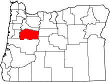 | |
| CDPs | ||
| Other unincorporated communities | ||
| Ghost towns | ||
| Footnotes | ‡This populated place also has portions in an adjacent county or counties | |
This article is issued from Wikipedia - version of the 7/30/2016. The text is available under the Creative Commons Attribution/Share Alike but additional terms may apply for the media files.