Juodkrantė Lighthouse
|
Juodkrantė Lighthouse | |
 Lithuania | |
| Location |
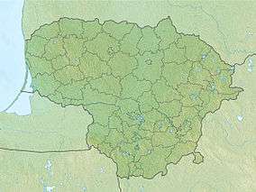
Neringa Klaipėda County Lithuania |
|---|---|
| Coordinates | 55°33′23.7″N 21°06′56.9″E / 55.556583°N 21.115806°ECoordinates: 55°33′23.7″N 21°06′56.9″E / 55.556583°N 21.115806°E |
| Year first constructed | 1950 |
| Construction | skeletal tower |
| Tower shape | square pyramidal tower with gallery and daymark |
| Markings / pattern | white tower, red lantern |
| Height | 20 metres (66 ft) |
| Focal height | 68 metres (223 ft) |
| Range | 17 nautical miles (31 km; 20 mi) |
| Characteristic | white light, 3 s on, 5 s off |
| Admiralty number | C3334 |
| NGA number | 11996 |
| ARLHS number | LIT-001 |
| Lithuania number | LT-0049 |
| Managing agent | Klaipeda Port Authority[1] |

Juodkrantė Lighthouse (Lithuanian: Juodkrantė švyturys) - a lighthouse on the Curonian Spit,[2] on the Lithuanian coast of the Baltic Sea. The lighthouse was constructed in 1950; 900 metres away from the coastline.[3] The lighthouse is a square pyramidal skeletal tower - with a white daymark and red gallery - making the lighthouse appear enclosed from far away.[4]
See also
References
- ↑ Rowlett, Russ. "Lighthouses of Lithuania". The Lighthouse Directory. University of North Carolina at Chapel Hill. Retrieved February 19, 2016.
- ↑ "Main Page". Nerija. Retrieved 11 May 2015.
- ↑ "Juodkrante Lighthouse". Lighthouse Digest. Retrieved 11 May 2015.
- ↑ "Lighthouses Of Lithuania". UNC. Retrieved 11 May 2015.
This article is issued from Wikipedia - version of the 9/4/2016. The text is available under the Creative Commons Attribution/Share Alike but additional terms may apply for the media files.