Kaptai Upazila
| Kaptai Sub-District কাপ্তাই | |
|---|---|
| Upazila | |
 Kaptai Sub-District Location in Bangladesh | |
| Coordinates: 22°30′N 92°13′E / 22.500°N 92.217°ECoordinates: 22°30′N 92°13′E / 22.500°N 92.217°E | |
| Country |
|
| Division | Chittagong Division |
| District | Rangamati District |
| Area | |
| • Total | 259 km2 (100 sq mi) |
| Population (2001) | |
| • Total | 66,135 |
| • Density | 260/km2 (660/sq mi) |
| Time zone | BST (UTC+6) |
| Postal code | 4530 |
| Website | Official Map of Kaptai |
Kaptai (Bengali: কাপ্তাই) is an Upazila of Rangamati District in the Division of Chittagong, Bangladesh.[1]
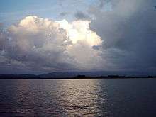
Notable landmarks are the Karnaphuli Hydroelectric Power Station, the only Hydro-electric power plant of Bangladesh. The Kaptai Dam, built for this purpose on the Karnaphuli River, created the Kaptai Lake, the largest man-made dam in Bangladesh.
Geography
Kaptai is located at 22°30′00″N 92°13′00″E / 22.5000°N 92.2167°E . It has 12992 households and total area 259 km².
Demographics
At the 2001 Bangladesh census, Kaptai had a population of 66,135. Males constituted 55.45% of the population, and females 44.55%. The population of those aged 18 and older was 32,352. The average literacy rate was 49.9% (7+ years).[2]
Points of interest
- Kaptai lake
- Karnaphuli Paper Mills
- Kaptai national park
- Navy camp picnic spot
- Joom picnic spot
- Waggachara Tea Estate
- Chitmaram buddhist temple
Administration
Kaptai has 5 Unions/Wards, 10 Mauzas/Mahallas, and 144 villages.[3]
See also
References
- ↑ Atikur Rahman (2012), "Kaptai Upazila", in Sirajul Islam and Ahmed A. Jamal, Banglapedia: National Encyclopedia of Bangladesh (Second ed.), Asiatic Society of Bangladesh
- ↑ "Population Census Wing, BBS.". Archived from the original on 2005-03-27. Retrieved November 10, 2006.
- ↑ http://www.bbs.gov.bd/RptZillaProfile.aspx Bangladesh Bureau of Statistics, geographic unit, 2001 census
External links
- Sifatul Quader Chowdhury (2012), "Karnafuli Hydropower Station", in Sirajul Islam and Ahmed A. Jamal, Banglapedia: National Encyclopedia of Bangladesh (Second ed.), Asiatic Society of Bangladesh
- Nuruddin Mahmood and M Abdul Hai (2012), "Kaptai Lake", in Sirajul Islam and Ahmed A. Jamal, Banglapedia: National Encyclopedia of Bangladesh (Second ed.), Asiatic Society of Bangladesh
| Upazila/Thana: | ||
|---|---|---|
