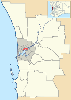
Keralup, Western Australia
| Keralup Perth, Western Australia | |||||||||||||
|---|---|---|---|---|---|---|---|---|---|---|---|---|---|
 Keralup | |||||||||||||
| Coordinates | 32°28′16″S 115°48′47″E / 32.471°S 115.813°ECoordinates: 32°28′16″S 115°48′47″E / 32.471°S 115.813°E | ||||||||||||
| Population | 0 (2011)[1] | ||||||||||||
| • Density | 0.00/km2 (0.0/sq mi) | ||||||||||||
| Established | 2007 | ||||||||||||
| Postcode(s) | 6182 | ||||||||||||
| Area | 4.0 km2 (1.5 sq mi) | ||||||||||||
| Location | 58 km (36 mi) S of Perth | ||||||||||||
| LGA(s) | |||||||||||||
| State electorate(s) | Warnbro and Murray-Wellington | ||||||||||||
| Federal Division(s) | Brand and Canning | ||||||||||||
| |||||||||||||
Keralup is a suburb straddling the southern boundary of the metropolitan area of Perth, Western Australia, on the eastern side of the Kwinana Freeway, and consists entirely of a government strategic landholding. The suburb will ultimately contain 90,000 people, with the majority of development being on the eastern side of the Serpentine River.[2]
The name was chosen from a newspaper poll; it was proposed by local Nyoongar leader, Trevor Walley, as it was the name of a pool in the Serpentine River in which he and his friends played as children.[3]
References
- ↑ Australian Bureau of Statistics (31 October 2012). "2011 Census QuickStats: Keralup". 2011 Census QuickStats. Retrieved 2012-10-31.
- ↑ http://www.rockingham.wa.gov.au/Business-and-development/Land-and-property/Future-town-planning/Keralup.aspx
- ↑ http://www.dhw.wa.gov.au/keralup/
This article is issued from Wikipedia - version of the 3/2/2014. The text is available under the Creative Commons Attribution/Share Alike but additional terms may apply for the media files.