Kerr Township, Champaign County, Illinois
| Kerr Township | |
|---|---|
| Township | |
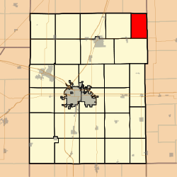 Location in Champaign County | |
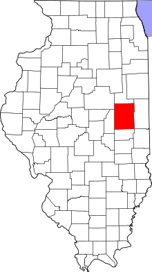 Champaign County's location in Illinois | |
| Coordinates: 40°21′35″N 87°57′48″W / 40.35972°N 87.96333°WCoordinates: 40°21′35″N 87°57′48″W / 40.35972°N 87.96333°W | |
| Country | United States |
| State | Illinois |
| County | Champaign |
| Established | November 8, 1859 |
| Area | |
| • Total | 22.25 sq mi (57.6 km2) |
| • Land | 22.11 sq mi (57.3 km2) |
| • Water | 0.14 sq mi (0.4 km2) 0.63% |
| Elevation | 705 ft (215 m) |
| Population (2010) | |
| • Total | 163 |
| • Density | 7.4/sq mi (2.9/km2) |
| Time zone | CST (UTC-6) |
| • Summer (DST) | CDT (UTC-5) |
| GNIS feature ID | 0429204 |
Kerr Township is a township in Champaign County, Illinois, USA. As of the 2010 census, its population was 163 and it contained 66 housing units.[1]
History
Kerr Township changed its name from Middlefork Township on April 30, 1860.
Geography
According to the 2010 census, the township has a total area of 22.25 square miles (57.6 km2), of which 22.11 square miles (57.3 km2) (or 99.37%) is land and 0.14 square miles (0.36 km2) (or 0.63%) is water.[1] The stream of Sugar Creek runs through this township.
Cemeteries
The township contains four cemeteries: Chenoweth, Patton, Peabody and Tomlinson.
Major highways
References
- "Kerr Township, Champaign County, Illinois". Geographic Names Information System. United States Geological Survey. Retrieved 2010-01-04.
- United States Census Bureau cartographic boundary files
- 1 2 "Population, Housing Units, Area, and Density: 2010 - County -- County Subdivision and Place -- 2010 Census Summary File 1". United States Census. Retrieved 2013-05-28.
External links
 |
Button Township, Ford County | Butler Township, Vermilion County | | |
| Harwood Township | |
Middlefork Township, Vermilion County | ||
| ||||
| | ||||
| Compromise Township | |
Municipalities and communities of Champaign County, Illinois, United States | ||
|---|---|---|
| Cities | ||
| Villages | ||
| Townships | ||
| CDPs | ||
| Other unincorporated communities | ||
| Footnotes | ‡This populated place also has portions in an adjacent county or counties | |
This article is issued from Wikipedia - version of the 3/26/2016. The text is available under the Creative Commons Attribution/Share Alike but additional terms may apply for the media files.