Kistenuten
| Kistenuten | |
|---|---|
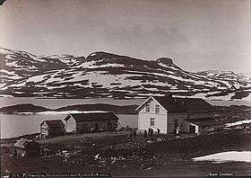 View of the mountain (c. 1885) | |
| Highest point | |
| Elevation | 1,648 m (5,407 ft) |
| Prominence | 325 m (1,066 ft) |
| Isolation | 9.9 km (6.2 mi) |
| Coordinates | 59°46′58″N 07°05′47″E / 59.78278°N 7.09639°ECoordinates: 59°46′58″N 07°05′47″E / 59.78278°N 7.09639°E |
| Geography | |
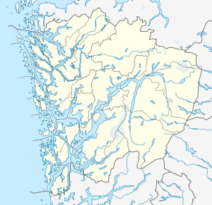 Kistenuten Location in Hordaland | |
| Location | Southern Norway |
| Parent range | Ryfylkeheiane |
Kistenuten is a 1,648-metre (5,407 ft) tall mountain in southern Norway. It is located in the Ryfylkeheiane mountains at the tripoint border of three different counties (and three municipalities): Suldal municipality in Rogaland county, Odda municipality in Hordaland county, and Vinje municipality in Telemark county. The mountain is the fourth tallest mountain in Telemark county, the second tallest in Rogaland county, but it is not even in the top 25 tallest mountains in Hordaland county.[1][2] The mountain Sandfloegga lies about 18 kilometres (11 mi) to the north in the Hardangervidda National Park.
References
- ↑ Lauritzen, Per Roger, ed. (2009). "Kistenuten". Norsk Fjelleksikon (in Norwegian). Arendal: Friluftsforlaget. p. 192. ISBN 9788291495477.
- ↑ Godal, Anne Marit (ed.). "Ryfylkeheiane". Store norske leksikon (in Norwegian). Norsk nettleksikon. Retrieved 15 May 2013.
This article is issued from Wikipedia - version of the 12/6/2015. The text is available under the Creative Commons Attribution/Share Alike but additional terms may apply for the media files.