Knox County, Maine
| Knox County, Maine | |
|---|---|
 Knox County Courthouse | |
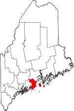 Location in the U.S. state of Maine | |
 Maine's location in the U.S. | |
| Founded | April 1, 1860 |
| Named for | Henry Knox |
| Seat | Rockland |
| Largest city | Rockland |
| Area | |
| • Total | 1,144 sq mi (2,963 km2) |
| • Land | 365 sq mi (945 km2) |
| • Water | 779 sq mi (2,018 km2), 68% |
| Population | |
| • (2010) | 39,736 |
| • Density | 109/sq mi (42/km²) |
| Congressional district | 1st |
| Time zone | Eastern: UTC-5/-4 |
| Website |
www |
Knox County is a county located in the state of Maine, in the United States. As of the 2010 census, the population was 39,736.[1] Its county seat is Rockland.[2] The county is named for American Revolutionary War general and Secretary of War Henry Knox,[3] who lived in the county from 1795 until his death in 1806. The county was established on April 1, 1860, and is the most recent county to be created in Maine. It was carved from parts of Waldo and Lincoln counties. The Union Fair, started in 1868, began as the efforts of the North Knox Agricultural and Horticultural Society.[4]
Geography
According to the U.S. Census Bureau, the county has a total area of 1,144 square miles (2,960 km2), of which 365 square miles (950 km2) is land and 779 square miles (2,020 km2) (68%) is water.[5] It is the second-smallest county in Maine by land area. It was originally part of the Waldo Patent.
Adjacent counties
- Lincoln County, Maine – west
- Waldo County, Maine – north
National protected areas
Demographics
| Historical population | |||
|---|---|---|---|
| Census | Pop. | %± | |
| 1860 | 32,716 | — | |
| 1870 | 30,823 | −5.8% | |
| 1880 | 32,863 | 6.6% | |
| 1890 | 31,473 | −4.2% | |
| 1900 | 30,406 | −3.4% | |
| 1910 | 28,981 | −4.7% | |
| 1920 | 26,245 | −9.4% | |
| 1930 | 27,693 | 5.5% | |
| 1940 | 27,191 | −1.8% | |
| 1950 | 28,121 | 3.4% | |
| 1960 | 28,575 | 1.6% | |
| 1970 | 29,013 | 1.5% | |
| 1980 | 32,941 | 13.5% | |
| 1990 | 36,310 | 10.2% | |
| 2000 | 39,618 | 9.1% | |
| 2010 | 39,736 | 0.3% | |
| Est. 2015 | 39,855 | [6] | 0.3% |
| U.S. Decennial Census[7] 1790–1960[8] 1900–1990[9] 1990–2000[10] 2010–2013[1] | |||
2000 census
As of the census[11] of 2000, there were 39,618 people, 16,608 households, and 10,728 families residing in the county. The population density was 108 people per square mile (42/km²). There were 21,612 housing units at an average density of 59 per square mile (23/km²). The racial makeup of the county was 98.28% White, 0.24% Black or African American, 0.22% Native American, 0.36% Asian, 0.01% Pacific Islander, 0.12% from other races, and 0.78% from two or more races. 0.57% of the population were Hispanic or Latino of any race. 25.4% were of English, 12.2% Irish, 11.7% United States or American, 7.5% German and 5.7% French ancestry according to Census 2000. 97.1% spoke English and 1.5% French as their first language.
There were 16,608 households out of which 28.30% had children under the age of 18 living with them, 52.20% were married couples living together, 9.00% had a female householder with no husband present, and 35.40% were non-families. 29.00% of all households were made up of individuals and 12.70% had someone living alone who was 65 years of age or older. The average household size was 2.31 and the average family size was 2.83.
In the county the population was spread out with 22.40% under the age of 18, 6.30% from 18 to 24, 27.40% from 25 to 44, 26.70% from 45 to 64, and 17.20% who were 65 years of age or older. The median age was 41 years. For every 100 females there were 95.20 males. For every 100 females age 18 and over, there were 93.00 males.
The median income for a household in the county was $36,774, and the median income for a family was $43,819. Males had a median income of $30,704 versus $22,382 for females. The per capita income for the county was $19,981. About 6.40% of families and 10.10% of the population were below the poverty line, including 11.90% of those under age 18 and 8.00% of those age 65 or over.
2010 census
As of the 2010 United States Census, there were 39,736 people, 17,258 households, and 10,662 families residing in the county.[12] The population density was 108.8 inhabitants per square mile (42.0/km2). There were 23,744 housing units at an average density of 65.0 per square mile (25.1/km2).[13] The racial makeup of the county was 97.1% white, 0.5% black or African American, 0.5% Asian, 0.4% American Indian, 0.2% from other races, and 1.4% from two or more races. Those of Hispanic or Latino origin made up 0.8% of the population.[12] In terms of ancestry, 31.3% were English, 19.0% were Irish, 12.8% were German, 6.9% were Scottish, and 5.9% were American.[14]
Of the 17,258 households, 25.4% had children under the age of 18 living with them, 48.2% were married couples living together, 9.4% had a female householder with no husband present, 38.2% were non-families, and 31.0% of all households were made up of individuals. The average household size was 2.22 and the average family size was 2.75. The median age was 46.2 years.[12]
The median income for a household in the county was $45,264 and the median income for a family was $55,830. Males had a median income of $40,712 versus $29,732 for females. The per capita income for the county was $25,291. About 7.9% of families and 12.5% of the population were below the poverty line, including 16.5% of those under age 18 and 9.8% of those age 65 or over.[15]
Politics
| Year | Democrat | Republican |
|---|---|---|
| 2012 | 60.1% 13,227 | 37.6% 8,262 |
| 2008 | 59.7% 13,728 | 38.4% 8,816 |
| 2004 | 54.6% 12,690 | 43.5% 10,103 |
| 2000 | 46.1% 9,453 | 43.7% 8,968 |
In 2012, Knox County voted 55% in favor of a measure to legalize same-sex marriage.[17]
Voter registration
| Voter Registration and Party Enrollment as of June 2014[18] | |||||
|---|---|---|---|---|---|
| Unenrolled | 9,889 | 35.08% | |||
| Democratic | 8,888 | 31.53% | |||
| Republican | 8,265 | 29.32% | |||
| Green Independent | 1,142 | 4.05% | |||
| Total | 28,184 | 100% | |||
Communities
Public Buildings
An addition to the Knox County Courthouse designed by Scott Simons Architects was completed 2005. It is connected to an annex built in 1977 that is adjacent to the historic, original building that was finished in 1874.[19]
See also
- National Register of Historic Places listings in Knox County, Maine
- Historical United States Census totals for Knox County, Maine
References
- 1 2 "State & County QuickFacts". United States Census Bureau. Retrieved August 19, 2013.
- ↑ "Find a County". National Association of Counties. Retrieved 2011-06-07.
- ↑ Gannett, Henry (1905). The Origin of Certain Place Names in the United States. Government Printing Office. p. 177.
- ↑ "The Birth of the Union Fair: Its History, Its Promise". Retrieved 16 October 2011.
- ↑ "2010 Census Gazetteer Files". United States Census Bureau. August 22, 2012. Retrieved September 7, 2014.
- ↑ "County Totals Dataset: Population, Population Change and Estimated Components of Population Change: April 1, 2010 to July 1, 2015". Retrieved July 2, 2016.
- ↑ "U.S. Decennial Census". United States Census Bureau. Retrieved September 7, 2014.
- ↑ "Historical Census Browser". University of Virginia Library. Retrieved September 7, 2014.
- ↑ "Population of Counties by Decennial Census: 1900 to 1990". United States Census Bureau. Retrieved September 7, 2014.
- ↑ "Census 2000 PHC-T-4. Ranking Tables for Counties: 1990 and 2000" (PDF). United States Census Bureau. Retrieved September 7, 2014.
- ↑ "American FactFinder". United States Census Bureau. Retrieved 2008-01-31.
- 1 2 3 "DP-1 Profile of General Population and Housing Characteristics: 2010 Demographic Profile Data". United States Census Bureau. Retrieved 2016-01-21.
- ↑ "Population, Housing Units, Area, and Density: 2010 - County". United States Census Bureau. Retrieved 2016-01-21.
- ↑ "DP02 SELECTED SOCIAL CHARACTERISTICS IN THE UNITED STATES – 2006-2010 American Community Survey 5-Year Estimates". United States Census Bureau. Retrieved 2016-01-21.
- ↑ "DP03 SELECTED ECONOMIC CHARACTERISTICS – 2006-2010 American Community Survey 5-Year Estimates". United States Census Bureau. Retrieved 2016-01-21.
- ↑ "Dave Leip's Atlas of U.S. Presidential Elections". Retrieved 2011-06-13.
- ↑
- ↑ "Registration and Party Enrollment Statistics as of June 10, 2014" (PDF). Maine Bureau of Corporations.
- ↑ "Knox County Courthouse". Maine Commercial Construction Company | Wright-Ryan Construction. Retrieved 2016-05-20.
External links
 |
Waldo County | | ||
| Lincoln County | |
Atlantic Ocean | ||
| ||||
| | ||||
| Atlantic Ocean |
Municipalities and communities of Knox County, Maine, United States | ||
|---|---|---|
| City | | |
| Towns | ||
| Plantation | ||
| Unorganized territory | ||
| CDPs | ||
| Other villages | ||
Augusta (capital) | |
| Topics |
|
| Society |
|
| Regions | |
| Counties | |
| Cities | |
| Largest towns | |
Coordinates: 44°02′N 69°02′W / 44.03°N 69.03°W