Kobuk, Alaska
| Kobuk Laugviik | |
|---|---|
| City | |
 Location in Northwest Arctic Borough and the state of Alaska. | |
| Coordinates: 66°55′3″N 156°54′25″W / 66.91750°N 156.90694°WCoordinates: 66°55′3″N 156°54′25″W / 66.91750°N 156.90694°W | |
| Country | United States |
| State | Alaska |
| Borough | Northwest Arctic |
| Incorporated | September 25, 1973[1] |
| Government | |
| • Mayor | Alex Sheldon[2] |
| • State senator | Donald Olson (D) |
| • State rep. | Benjamin Nageak (D) |
| Area | |
| • Total | 16.8 sq mi (43.6 km2) |
| • Land | 16.1 sq mi (41.7 km2) |
| • Water | 0.7 sq mi (1.9 km2) |
| Elevation | 148 ft (45 m) |
| Population (2010)[3] | |
| • Total | 151 |
| • Density | 9.0/sq mi (3.5/km2) |
| Time zone | Alaska (AKST) (UTC-9) |
| • Summer (DST) | AKDT (UTC-8) |
| ZIP code | 99751 |
| Area code | 907 |
| FIPS code | 02-40840 |
Kobuk (Laugviik in Iñupiaq) is a city in Northwest Arctic Borough, Alaska, United States. At the 2010 census the population was 151.
History
Kobuk was founded in 1899 as a supply point for miners north of Kobuk. A trading post, school, and mission were built and residents came to the settlement. In May 1973, a flood covered the entire village.
The economy of Kobuk is based on subsistence hunting for caribou and moose.
Geography and climate
Kobuk is located at 66°55′3″N 156°54′25″W / 66.91750°N 156.90694°W (66.917579, -156.906829).[4]
Kobuk is located on the bank of the Kobuk River, 10 km (6.2 mi) northeast of Shungnak. It is near Kobuk Valley National Park.
According to the United States Census Bureau, the city has a total area of 16.8 square miles (44 km2), of which, 16.1 square miles (42 km2) of it is land and 0.7 square miles (1.8 km2) of it (4.34%) is water.
| Climate data for Kobuk | |||||||||||||
|---|---|---|---|---|---|---|---|---|---|---|---|---|---|
| Month | Jan | Feb | Mar | Apr | May | Jun | Jul | Aug | Sep | Oct | Nov | Dec | Year |
| Average high °F (°C) | −3.3 (−19.6) |
1.8 (−16.8) |
13.3 (−10.4) |
28.0 (−2.2) |
50.6 (10.3) |
66.0 (18.9) |
69.4 (20.8) |
64.4 (18) |
52.0 (11.1) |
28.3 (−2.1) |
12.7 (−10.7) |
0.9 (−17.3) |
32.01 (0) |
| Average low °F (°C) | −26.7 (−32.6) |
−22.1 (−30.1) |
−12.6 (−24.8) |
4.1 (−15.5) |
27.9 (−2.3) |
42.1 (5.6) |
45.7 (7.6) |
42.9 (6.1) |
32.4 (0.2) |
11.4 (−11.4) |
−4.7 (−20.4) |
−19.1 (−28.4) |
10.11 (−12.17) |
| Average precipitation inches (mm) | 0.61 (15.5) |
0.35 (8.9) |
0.66 (16.8) |
0.61 (15.5) |
0.79 (20.1) |
1.75 (44.4) |
3.20 (81.3) |
3.41 (86.6) |
2.87 (72.9) |
0.81 (20.6) |
0.96 (24.4) |
0.65 (16.5) |
16.67 (423.5) |
| Average snowfall inches (cm) | 7.3 (18.5) |
4.9 (12.4) |
8.0 (20.3) |
4.7 (11.9) |
0.7 (1.8) |
0.1 (0.3) |
0.0 (0) |
0.0 (0) |
1.9 (4.8) |
6.9 (17.5) |
11.4 (29) |
8.0 (20.3) |
53.9 (136.8) |
| Source: http://www.wrcc.dri.edu/cgi-bin/cliMAIN.pl?ak4964 | |||||||||||||
Demographics
| Historical population | |||
|---|---|---|---|
| Census | Pop. | %± | |
| 1940 | 31 | — | |
| 1950 | 38 | 22.6% | |
| 1960 | 54 | 42.1% | |
| 1980 | 62 | — | |
| 1990 | 69 | 11.3% | |
| 2000 | 109 | 58.0% | |
| 2010 | 151 | 38.5% | |
| Est. 2015 | 158 | [5] | 4.6% |
As of the census[7] of 2000, there were 109 people, 26 households, and 23 families residing in the city. The population density was 6.8 people per square mile (2.6/km²). There were 45 housing units at an average density of 2.8 per square mile (1.1/km²). The racial makeup of the city was 4.59% White, 93.58% Native American, 0.92% Asian, 0.92% from other races. 4.59% of the population were Hispanic or Latino of any race.
There were 26 households out of which 61.5% had children under the age of 18 living with them, 46.2% were married couples living together, 30.8% had a female householder with no husband present, and 11.5% were non-families. 11.5% of all households were made up of individuals and none had someone living alone who was 65 years of age or older. The average household size was 4.19 and the average family size was 4.26.
In the city the age distribution of the population shows 52.3% under the age of 18, 9.2% from 18 to 24, 18.3% from 25 to 44, 17.4% from 45 to 64, and 2.8% who were 65 years of age or older. The median age was 17 years. For every 100 females there were 98.2 males. For every 100 females age 18 and over, there were 100.0 males.
The median income for a household in the city was $30,750, and the median income for a family was $20,313. Males had a median income of $71,250 versus $21,875 for females. The per capita income for the city was $9,844. There were 32.0% of families and 28.6% of the population living below the poverty line, including 28.2% of under eighteens and 57.1% of those over 64.
References
- ↑ "Directory of Borough and City Officials 1974". Alaska Local Government. Juneau: Alaska Department of Community and Regional Affairs. XIII (2): 48. January 1974.
- ↑ 2015 Alaska Municipal Officials Directory. Juneau: Alaska Municipal League. 2015. p. 89.
- ↑ "2010 City Population and Housing Occupancy Status". U.S. Census Bureau. Retrieved May 14, 2012.
- ↑ "US Gazetteer files: 2010, 2000, and 1990". United States Census Bureau. 2011-02-12. Retrieved 2011-04-23.
- ↑ "Annual Estimates of the Resident Population for Incorporated Places: April 1, 2010 to July 1, 2015". Retrieved July 2, 2016.
- ↑ "Census of Population and Housing". Census.gov. Retrieved June 4, 2015.
- ↑ "American FactFinder". United States Census Bureau. Retrieved 2008-01-31.
Municipalities and communities of Northwest Arctic Borough, Alaska, United States | ||
|---|---|---|
| Cities | 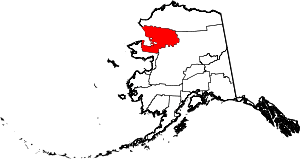 | |
| CDPs | ||
| Unincorporated communities | ||
| Ghost towns | ||