Koglo
| Koglo | |
|---|---|
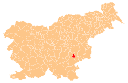
 Koglo Location in Slovenia | |
| Coordinates: 45°53′29.84″N 15°13′22.48″E / 45.8916222°N 15.2229111°ECoordinates: 45°53′29.84″N 15°13′22.48″E / 45.8916222°N 15.2229111°E | |
| Country |
|
| Traditional region | Lower Carniola |
| Statistical region | Southeast Slovenia |
| Municipality | Šmarješke Toplice |
| Area | |
| • Total | 1.23 km2 (0.47 sq mi) |
| Elevation | 403.6 m (1,324.1 ft) |
| Population (2002) | |
| • Total | 43 |
| [1] | |
Koglo (pronounced [ˈkoːɡlɔ]) is a settlement in the Municipality of Šmarješke Toplice in southeastern Slovenia. The area is part of the historical region of Lower Carniola. The municipality is now included in the Southeast Slovenia Statistical Region.[2]
History
Koglo was created as a separate settlement in 1996, when its territory was administratively separated from the villages of Radovlja, Sela pri Zburah, and Žaloviče.[3]
Church
The local church is dedicated to Saint Leonard and belongs to the Parish of Šmarjeta. It is a medieval church that was restyled in the Baroque in the 17th century, but retains a number of its original Gothic features.[4]
References
- ↑ Statistical Office of the Republic of Slovenia
- ↑ Šmarješke Toplice municipal site
- ↑ Statistical Office of the Republic of Slovenia: Koglo.
- ↑ "EŠD 2540". Registry of Immovable Cultural Heritage (in Slovenian). Ministry of Culture of the Republic of Slovenia. Retrieved 25 May 2011.
External links
| Settlements | Administrative centre: Šmarješke Toplice
|  | ||||||
|---|---|---|---|---|---|---|---|---|
| Landmarks |
| |||||||
This article is issued from Wikipedia - version of the 7/10/2015. The text is available under the Creative Commons Attribution/Share Alike but additional terms may apply for the media files.