Orešje, Šmarješke Toplice
| Orešje | |
|---|---|
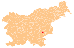
 Orešje Location in Slovenia | |
| Coordinates: 45°53′11.66″N 15°16′7.07″E / 45.8865722°N 15.2686306°ECoordinates: 45°53′11.66″N 15°16′7.07″E / 45.8865722°N 15.2686306°E | |
| Country |
|
| Traditional region | Lower Carniola |
| Statistical region | Southeast Slovenia |
| Municipality | Šmarješke Toplice |
| Area | |
| • Total | 1.73 km2 (0.67 sq mi) |
| Elevation | 269.2 m (883.2 ft) |
| Population (2002) | |
| • Total | 104 |
| [1] | |
Orešje (pronounced [ɔˈɾeːʃjɛ]) is a settlement east of Šmarjeta in the Municipality of Šmarješke Toplice in southeastern Slovenia. The area is part of the historical region of Lower Carniola. The municipality is now included in the Southeast Slovenia Statistical Region.[2]
References
- ↑ Statistical Office of the Republic of Slovenia Archived November 18, 2008, at the Wayback Machine.
- ↑ Šmarješke Toplice municipal site
External links
| Settlements | Administrative centre: Šmarješke Toplice
|  | ||||||
|---|---|---|---|---|---|---|---|---|
| Landmarks |
| |||||||
This article is issued from Wikipedia - version of the 11/14/2016. The text is available under the Creative Commons Attribution/Share Alike but additional terms may apply for the media files.