Kunice (Prague-East District)
| Kunice | |||
| Village | |||
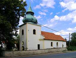 Saint Mary Magdalene Church | |||
|
|||
| Country | Czech Republic | ||
|---|---|---|---|
| Region | Central Bohemian | ||
| District | Prague-East | ||
| Elevation | 419 m (1,375 ft) | ||
| Coordinates | CZ 49°55′51″N 14°40′26″E / 49.93083°N 14.67389°ECoordinates: CZ 49°55′51″N 14°40′26″E / 49.93083°N 14.67389°E | ||
| Area | 10.39 km2 (4.01 sq mi) | ||
| Population | 1,032 (2010-01-01) | ||
| Density | 99/km2 (256/sq mi) | ||
| Timezone | CET (UTC+1) | ||
| - summer (DST) | CEST (UTC+2) | ||
| Postal code | 251 63 | ||
  Location in the Czech Republic | |||
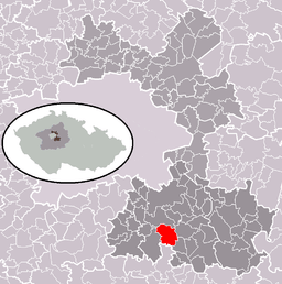 Location in Prague-East District | |||
| Wikimedia Commons: Kunice (Prague-East District) | |||
| Website: www.kunice.cz/ | |||


Kunice is a village in the Central Bohemian Region of the Czech Republic. It has around 1.000 inhabitants. Football club TJ Kunice plays in the village.
External links
- Village website (in Czech)
| Wikimedia Commons has media related to Kunice (Prague-East District). |
This article is issued from Wikipedia - version of the 4/7/2016. The text is available under the Creative Commons Attribution/Share Alike but additional terms may apply for the media files.