Všestary (Prague-East District)
| Všestary | |||
|---|---|---|---|
| Municipality | |||
|
A street in Všestary | |||
| |||
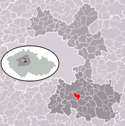 Location in Prague-East District | |||
 Všestary Location in the Czech Republic | |||
| Coordinates: 49°57′31″N 14°41′06″E / 49.95861°N 14.68500°ECoordinates: 49°57′31″N 14°41′06″E / 49.95861°N 14.68500°E | |||
| Country |
| ||
| Region | Central Bohemian | ||
| District | Prague-East | ||
| Area | |||
| • Total | 4.43 km2 (1.71 sq mi) | ||
| Elevation | 393 m (1,289 ft) | ||
| Population (2010-01-01) | |||
| • Total | 698 | ||
| • Density | 160/km2 (410/sq mi) | ||
| Postal code | 251 63 | ||
| Website | http://www.obec-vsestary.cz/ | ||


Všestary (Czech pronunciation: [ˈfʃɛstarɪ]) is a village and municipality in Prague-East District in the Central Bohemian Region of the Czech Republic.
The municipality covers an area of 4.43 square kilometres (2 sq mi) and as of 2010 it had a population of 698.
Všestary lies approximately 4.5 kilometres (3 mi) southeast of Říčany and 24 kilometres (15 mi) southeast of centre of Prague.
References
- This article was initially translated from the Czech Wikipedia.
| Wikimedia Commons has media related to Všestary (Prague-East District). |
This article is issued from Wikipedia - version of the 4/7/2016. The text is available under the Creative Commons Attribution/Share Alike but additional terms may apply for the media files.