La Mesilla, New Mexico
| La Mesilla, New Mexico | |
|---|---|
| Census-designated place | |
 La Mesilla, New Mexico | |
| Coordinates: 35°56′47″N 106°4′8″W / 35.94639°N 106.06889°WCoordinates: 35°56′47″N 106°4′8″W / 35.94639°N 106.06889°W | |
| Country | United States |
| State | New Mexico |
| County | Río Arriba |
| Area[1] | |
| • Total | 6.82 sq mi (17.67 km2) |
| • Land | 6.78 sq mi (17.57 km2) |
| • Water | 0.04 sq mi (0.1 km2) |
| Elevation | 5,640 ft (1,719 m) |
| Population (2010)[2] | |
| • Total | 1,772 |
| • Density | 393/sq mi (151.9/km2) |
| Time zone | Mountain (MST) (UTC-7) |
| • Summer (DST) | MDT (UTC-6) |
| GNIS feature ID | 2584131[3] |
La Mesilla is a census-designated place in Río Arriba County, New Mexico, United States. Its population was 1,772 as of the 2010 census.[2]
Geography
La Mesilla is located at coordinates 35°56′47″N 106°4′10″W / 35.94639°N 106.06944°W. According to the United States Census Bureau, La Mesilla has a total area of 17.67 square kilometers, of which 17.57 km² is land and (0.82%) 0.1 km² is water.[1]
Demographics
According to the 2010 census,[2] 1772 people were living in La Mesilla. The population density was 151.9 inhabitants per square kilometer. Of the 1772 inhabitants, La Mesilla was composed by 68.34% White, 0.34% were African American, 1.35% were Native American, 0.4% were Asian, 0% were Pacific Islanders, the 25.62% were of other races and 3.95% from two or more races. Of the total population 73.36% were Hispanic or Latino of any race[4]
References
- 1 2 "2010 Census Gazetteer Files". United States Census Bureau. Retrieved September 19, 2016.
- 1 2 3 "American FactFinder". United States Census Bureau. Retrieved September 19, 2016.
- ↑ "La Mesilla". Geographic Names Information System. United States Geological Survey.
- ↑ U.S. Board on Geographic Names
Municipalities and communities of Rio Arriba County, New Mexico, United States | ||
|---|---|---|
| City | 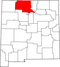 | |
| Village | ||
| CDPs |
| |
| Other unincorporated communities | ||
| Ghost towns and former settlements | ||
| Indian reservation | ||
| Footnotes | ‡This populated place also has portions in an adjacent county or counties | |