La Motte-en-Champsaur
| La Motte en Champsaur | ||
|---|---|---|
|
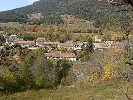
La Motte-en-Champsaur seen from the Infournas road | ||
| ||
 La Motte en Champsaur | ||
|
Location within Provence-A.-C.d'A. region 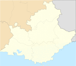 La Motte en Champsaur | ||
| Coordinates: 44°44′00″N 6°04′08″E / 44.7333°N 6.0689°ECoordinates: 44°44′00″N 6°04′08″E / 44.7333°N 6.0689°E | ||
| Country | France | |
| Region | Provence-Alpes-Côte d'Azur | |
| Department | Hautes-Alpes | |
| Arrondissement | Gap | |
| Canton | Saint-Bonnet-en-Champsaur | |
| Government | ||
| • Mayor (2014 2020 Intercommunalité = communauté de Communes du Champsaur.) | Bernard NICOLAS | |
| Area1 | 52.8 km2 (20.4 sq mi) | |
| Population (2008)2 | 192 | |
| • Density | 3.6/km2 (9.4/sq mi) | |
| Time zone | CET (UTC+1) | |
| • Summer (DST) | CEST (UTC+2) | |
| INSEE/Postal code | 05090 / 05500 | |
| Elevation |
1,014–3,164 m (3,327–10,381 ft) (avg. 1,095 m or 3,593 ft) | |
|
1 French Land Register data, which excludes lakes, ponds, glaciers > 1 km² (0.386 sq mi or 247 acres) and river estuaries. 2 Population without double counting: residents of multiple communes (e.g., students and military personnel) only counted once. | ||

La Motte-en-Champsaur is a commune in the Hautes-Alpes department in southeastern France.
Population
| Historical population | ||
|---|---|---|
| Year | Pop. | ±% |
| 1962 | 142 | — |
| 1968 | 182 | +28.2% |
| 1975 | 151 | −17.0% |
| 1982 | 167 | +10.6% |
| 1990 | 155 | −7.2% |
| 1999 | 177 | +14.2% |
| 2008 | 185 | +4.5% |
See also
References
| Wikimedia Commons has media related to La Motte-en-Champsaur. |
This article is issued from Wikipedia - version of the 1/30/2015. The text is available under the Creative Commons Attribution/Share Alike but additional terms may apply for the media files.